Podcast: Play in new window | Download | Embed Subscribe to Rewilding


This page tells the still-evolving story of the Rewilding the Heartland program, which started with a small group of citizen conservationists in Iowa, grew to include portions of surrounding states and a vision of Big River Connectivity, and became the grandest Wildlands Network Design effort yet, encompassing the entire Mississippi River Watershed.
Dave Foreman, Rewilding Institute founder and father of the rewilding concept, argues in his landmark book Rewilding North America, that four great continental wildways – Atlantic/Appalachian, Boreal/Tundra, Spine of the Continent/Rocky Mountain, and Pacific Crest & Coast – ought to be the foundations for conserving and restoring our continent’s great natural heritage. Dave has since looked at possible Great Plains and Gulf Coast Wildways. The Rewilding Institute (TRI) has heretofore mostly worked in the Spine of the Continent and Atlantic/Appalachian Wildways. We are delighted to be working now on Rewilding the Heartland--the Mississippi River Watershed.
Rewilding the Heartland can contribute greatly to the 30 x 30 and Half Earth efforts. (Be sure to check out the new Heartland Rewilding website for the most up-to-date events and resources on this project!)
It points caring people toward actions they can take to restore health to our continent’s grandest watershed; shows maps that highlight rewilding opportunities and delineate current and possible future reserves, especially along rivers; lists relevant podcasts and articles; and provides links to groups doing the good hard work on the ground, including wildlife advocacy organizations and land trusts.
” Creating a more biologically diverse, more enduring, and more beautiful Mississippi River Watershed ”
Rewilding the Heartland and Big River Connectivity are two newer, greener terms that hint at the central role the Mississippi River watershed should play in continental rewilding efforts.
~John Davis, Executive Director of The Rewilding Institute

Local leaders in Iowa have observed that Iowa is “Ground Zero” for needed ecological restoration. Iowa is 99.3% developed. [Read: "The Wildest Place In The World" by Mark Edwards.] Moreover, rewilding environmental historian John Miles has urged that we ought to practice rewilding at all scales and wherever we can.
Protecting continental cores and wildways is essential to life on Earth, especially those creatures who wander widely. Restoring local cores and wildways is essential to securing rare and endemic species, as well asto reconnecting people with wildlife in their neighborhoods.


"We ought to practice rewilding at all scales and wherever we can." ~environmental historian John Miles

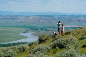
Loess Hills, Iowa
Ross Gipple created an elegant formula to do so: Retire from agriculture and Restore -- to at least semi-natural conditions -- the wetlands, floodplains, and slopes 9% or higher in gradient, and create a large core reserve spanning the Loess Hills.
This would allow Iowa to achieve about 30% protection.
Different states and provinces will contribute different amounts to the needed 50% minimum for each country: Montana and Maine, for instance, could be mostly wild in our lifetimes; Iowa and Illinois will likely continue to grow much more food for people than for wildlife, at least until we allow human numbers – in terms of both population and consumption – to relax back to sustainable levels.
Study areas: Loess Hills, The Driftless, Ozark Plateau
BeWild ReWild and Leland Searles developed data and maps for not only Iowa, but also for portions of surrounding states with similar ecological characteristics and connectivity. These included the Iowa River Corridor; the Loess Hills of northwestern Iowa and extending along the Missouri River Corridor into Missouri and Nebraska and bits of South Dakota and Kansas; the Driftless area overlapping Iowa, Illinois, Wisconsin, and Minnesota; and the Ozark Plateau centered in Missouri just to the south of Iowa and also overlapping Kansas, Oklahoma, and Arkansas.
The "Rewilding the Heartland" program is currently developing data and maps and plans for those three Initial Study Areas: The Loess Hills, The Driftless area, and the Ozark Plateau. Other areas will be added as funding and capacity become available.
Partisans Eastern and Western have spoken for years of the “Midwest” as “flyover country”. North America’s largest, the Mississippi River Watershed is indeed “flyover” country for millions of migratory birds, and is also stopover country for these same avian miracles, and is seasonal or year-round habitat for much of our continent’s native biota.

BeWild ReWild quickly identified the need for rewilding a much broader area, that of the entire Mississippi River Watershed, and envisioned the Heartland Rewilding project. That is almost all United States land between the Appalachian and Adirondack Mountains of the East and the Rocky Mountains of the West. They also arranged for Nitin Gadia, an expert mapper, to develop a preliminary rewilding map of the watershed.
How we treat waterways has everything to do with the biodiversity and connectivity of a region, as evidenced in this short film, "Cedar Creek."
"Cedar Creek" is a thought-provoking short film about one small but important creek in Jefferson County, Iowa and what happened to the water and the wildlife when the creek was altered. Written and directed by award-winning documentarian Dick DeAngelis and made possible by a Community Art Gathering grant from the BeWildReWild Fund.

"Rewilding the Heartland and Big River Connectivity are two newer phrases that hint at the central role the Mississippi River Watershed plays in continental rewilding efforts."
Executive Director of The Rewilding Institute
...perhaps a better metaphor than “breadbasket”, and certainly better than “cornbelt”. It includes all or parts of 32 states and two provinces, encompassing roughly 1.2 million square miles or one-third of the United States.
The large Ozark Plateau, when viewing the maps with a "species richness" layer, is plainly the "Wild Heart of the Heartland" in the Mississippi River Watershed!


Human actions have caused a decrease in wildness through wounding Nature.
1. killing
2. ecosystem degradation/loss
3. habitat fragmentation
4. natural process degradation/loss
5. exotic/invasive species invasion
6. poisoning
7. climate change.
Early maps showed public lands such as Forest Service, National Park, Bureau of Land Management and National Wildlife Refuge lands. Later maps also showed Wilderness and Proposed Wilderness lands, and Wild and Scenic Rivers. Still later maps added other information layers such as terrain, topography, ground cover and ecosystem type.


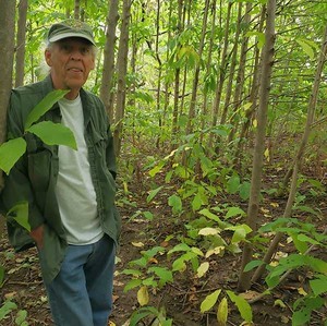
Effigy Mounds National Monument Iowa
Only Montana and Wyoming have significant large Protected Areas within the overall Heartland area. There are only modest protected areas in western North and South Dakota, the front range of the Colorado Rockies, the Southern Rockies of northeast New Mexico, northern Wisconsin, Arkansas and Tennessee. Most of the Heartland has very little protected area, and the existing few individual areas are not connected.
Maps developed using Geographic Information System (GIS) techniques and portraying multiple layers of information are particularly useful. [Read: "Mapping For Rewilding - A Healing Nature's Wounds Perspective" by Rewilding Institute Board Member Bob Howard]
Example Maps & Network Designs
We are now using multiple GIS data layers organized by wound type whenever that is possible. However, Nature is extremely complex and there is a paucity of data available to put into the maps. Sometimes available information for an individual wound type (or species or habitat marker or poison, etc.) must be used as a proxy for other missing information. We do not have--may never have--the data for some of the GIS layers that we know would be very useful.
Kurt Menke, a former professor teaching GIS Mapping, has put all the available data into a series of maps for the Heartland Rewilding Program. The map below shows the overall boundaries of the Rewilding the Heartland program, including the Mississippi River Watershed, the current Protected Areas, the Initial Study Areas, *Flyways, and potential Connectivity regions/corridors.
*We are still working on flyway data and hope to have an updated map including flyways soon!
Using human ecological footprint data, Kurt also shows in the map below the level of potential for rewilding in the Mississippi River Watershed. This is the first provisional effort to display the data for the entire area..
With lessons learned from West and East, we offer these preliminary suggestions on how to restore Big River Connectivity:

American Eel, sturgeon, trout, River Otter, Mink, Beaver, migratory birds, rare tall-grass species, Bison, prairie dogs, Swift Fox, Puma, and Gray Wolf


Bob Howard, TRI Board Member
Maps have played an important role in identifying, characterizing, and planning wilderness protection and wildlife habitat conservation for years. What is needed for rewilding and wilderness protection are maps that can be viewed and understood by politicians, agency personnel, and interested citizens.
Maps based on Geographic Information System (GIS) layers have proven particularly useful. Such GIS mapping efforts went into the published Sky Islands Wildlands Network, the New Mexico Highlands Wildlands Network, the Southern Rockies Wildlands Network, and many subsequent land conservation efforts. [READ MORE]
Podcast: Play in new window | Download | Embed Subscribe to Rewilding

Podcast: Play in new window | Download | Embed Subscribe to Rewilding

Podcast: Play in new window | Download | Embed Subscribe to Rewilding
Podcast: Play in new window | Download | Embed Subscribe to Rewilding

Podcast: Play in new window | Download | Embed Subscribe to Rewilding
Podcast: Play in new window | Download | Embed Subscribe to Rewilding
We will be adding landowner resources and other helpful links here as the project progresses.