
 Brian Miller")
Rio Mora Seasons
January 11, 2020
By Brian Miller
Introduction
Phenology is the study of patterns in nature that repeat themselves periodically through seasons. For example, when does a particular species of flower bloom, or when does a given species of migratory bird arrive in the spring to build nests and lay eggs. By noting the timing of concurrent events, an observer of nature can know that by seeing one event, he or she should be able to predict and search for another event happening at the same time. In some cases, this book expands on the phenology of a given species to describe interesting parts of its natural history. The book is written for the interested lay person who wants to get some mud on his or her shoes. The book provides scientific names at the first mention of a species. In some cases, common names can differ in different regions, so the scientific name will justify the use of a common name after the first mention.
The base area for this book is the Rio Mora National Wildlife Refuge, although it also reflects the sequence of events elsewhere on the high plains of northeastern New Mexico. Altitude and latitude affect phenology. For every 100-meter increase in altitude, the temperature decreases by one degree Celsius. Latitude is the distance of a given location from the Equator. When a location is farther from the Equator, it receives less solar energy. Because the Earth is round, the angle of sunlight hitting the Earth changes as you move away from the Equator. At the Equator, solar energy strikes the Earth at a nearly perpendicular angle, and the shorter distance sunlight travels through the atmosphere means that heat is concentrated. As you get nearer to the poles, the angle grows acute, and solar energy must travel a longer distance through the atmosphere to arrive. Thus, heat is lost as it travels through the atmosphere. The direction of a slope can also create microclimates. A south-facing slope will receive more solar energy than a north-facing slope.
The Rio Mora National Wildlife Refuge is located on the high plains near the foothills of the Southern Rockies. The Refuge is located between 6,700 feet and 7,000 feet. It is the center of a U.S. Fish and Wildlife Service Conservation area covering 952,000 acres of the Mora River watershed. The Mora River starts on Osha Mountain in the Sangre de Cristo range. It begins at 10,000 feet of altitude, then flows eastward to enter the Canadian River at approximately 4,500 feet of altitude. Various locations along the Mora River will affect phenology sequences, but the heart of this book is the Rio Mora National Wildlife Refuge which is midway between the start and finish of the Mora River.
Part 2: Landscape Around Rio Mora National Wildlife Refuge
Rio Mora NWR sits at 6,700 to 7,000 feet of altitude, in northern New Mexico. The main habitat types are shortgrass prairie, riparian, ephemeral natural catchments, and perennial seeps/springs/marsh wetlands, piñon/juniper/oak woodlands (Pinus edulis-Juniperus spp.-Quercus spp.), and ponderosa pine (Pinus ponderosa) forests. The Refuge includes the Mora River, which is a sub-basin in the Canadian Watershed. The main tributaries feeding the Mora River are the Sapello River and Coyote Creek. The Mora River starts in the Rincon Mountains north of Chacon (at about 10,000 ft.) and enters the Canadian River near the tri-county border of Mora, Harding, and San Miguel Counties. The river covers a distance of 116 miles.
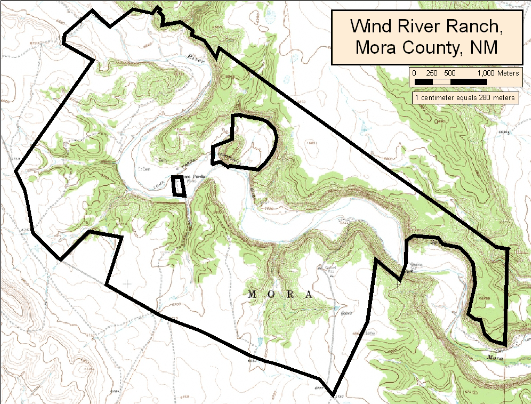
A topographical map of the Rio Mora National Wildlife Refuge taken from the Loma Parda quadrangle (thanks to Quivira Coalition).
Audubon has designated the Refuge (when it was the Wind River Ranch) as an Important Bird Area. Important Bird Areas are sites that provide essential breeding, migrating or wintering habitat for birds and/or they support one or more high-priority species, large concentrations of birds, exceptional habitat, and/or have substantial research value. Designation as an Important Bird Area confers no regulatory authority.
Habitats within the Mora River watershed provide important life cycle needs for a wide variety of neo-tropical migratory birds and many other riparian, grassland, woodland, aquatic, and wetland dependent species. The Migratory Bird Program in the USFWS Southwest Region has identified at least 18 species from the Birds of Conservation Concern list (U.S. Fish and Wildlife Service 2008) that utilize the area during migration, or for winter stopover habitat.
The Refuge lies on the high plains east of the Sangre de Cristo Mountains. This is the southern end of the Rocky Mountain chain, a discontinuous series of ranges. The entire Rocky Mountain chain extends from central New Mexico to northern Canada.
The elevation transition between the Great Plains and the Sangre de Cristo Mountains, the juxtaposition of two ecoregions, and the riparian habitats in this arid part of the West all enrich the species diversity of the area. The location of the Rio Mora National Wildlife Refuge in the heart of this transition provides remarkable species diversity. We have documented close to 200 bird species, close to 30 amphibian and reptile species, and close to 50 mammal species on the Refuge.
About 140 million years ago, during the Cretaceous, eastern New Mexico was flooded by a shallow sea. This sea left thick deposits of shales and sandstones. About 80 million years ago, the Laramide Orogeny began fault-lifting Pre-Cambrian rocks upward to start the New Mexican part of the Rocky Mountain chain; the upward faulting continued into the Cenozoic Era. Along the east edge of the faulting, sedimentary layers bent upward to form the present-day hogbacks.
Erosion from the mountains was heaviest during the Pleistocene Epoch of the Cenozoic Era because of continued uplift combined with Ice-Age precipitation. Dakota sandstone and Pierre shale still lie on the basin east of the mountains today. The dark, gray Pierre shale was deposited as mud on the floor of the shallow sea. The Dakota sandstone, however, is a beach and shore deposit, and like beach sand it is porous and permeable. Thus, the soil-covered sandstone serves as an aquifer throughout the east side of the Sangre de Cristo Mountains. Various layers of soil cover this sedimentary base, with topsoil averaging about four inches thick. Dominant soils are loam and clay.
Up until about 25 million years ago, there were palms as far north as Montana. During the Miocene, from 25 million years ago until 12 million years ago, a drier climate forced the neotropical vegetation south and neoarctic vegetation north, and the grasslands emerged in between. During the Pleistocene, there were 17 ice ages. Vegetation moved south ahead of ice, then moved north as the ice later melted—at least as a generalization of the time.
At the end of the last Ice Age, the Clovis Culture arrived in New Mexico. The Clovis points were exquisitely beautiful as art, and extremely deadly as weapons. Following human entry into North America, 70% of large animal species (averaging above 100 pounds full-grown) disappeared. A distant exception was the mammoth, which continued life on Wrangel Island, of what is now southeastern Alaska, until 4000 years ago. That is when humans arrived on the island, and mammoths then went extinct. Bison and the other animals we associate with the grasslands came about after the loss of the megafauna approximately 12,000 years ago. The specialized Clovis and Folsom cultures were then replaced by a more generalized approach to life in the Southwest. About 7,000 years ago, the Altithermal period produced a 2,000-year drought that depopulated the lowland areas.
Ancient Puebloans lived in complex, multi-storied buildings constructed of stone, adobe, and wood. The culture has existed for more than 5,000 years. People often talk about places like Santa Fe and Jamestown being old settlements, but the Pueblo communities are far older. Both the Acoma Pueblo and Taos Pueblo have been consistently occupied for nearly 1,000 years.
About 1,200 years ago, Navajos and Apache arrived in the Southwest from the north. The Rio Mora NWR was once part of Jicarilla Apache lands and Pueblo lands. The Mora River offered a travel route for Pueblos coming down to the plains and plains tribes going up to the Pueblo villages to trade or raid. In addition to northern Pueblos and Apache, other tribes like the Comanche, the Navajo, the Ute, and Kiowa also passed through Rio Mora NWR, particularly after the arrival of the horse.
When the Spanish arrived, they subjugated tribes, but the Spanish were thrown out of Santa Fe by the Pueblo Rebellion of 1680. Popé, who was from the Ohkay Owingeh, united the Pueblo tribes, and they attacked the Spanish with 2,500 warriors. The Spanish returned in 1692 to retake Santa Fe. The meadows where Las Vegas is today had been given to Luis C. de Baca as a Spanish Land grant in 1821, shortly before Mexico became independent of Spain (vegas means meadows in Spanish). The C. de Baca Land grant was used for grazing but was later abandoned. The Las Vegas Land Grant from Mexico founded the town of Las Vegas in 1835. The Rio Mora NWR was part of the Mora Land Grant from Mexico in 1835. By this time the Santa Fe Trail was bringing U.S. settlers into the area. In 1848, the Mexican-American war ended and the United States took control of New Mexico. Tribal Wars with continued with the U.S. government. The Apache Wars, Navajo Wars, and Comanche Wars were the most famous.
In the 1700s and 1800s, the grasslands of New Mexico were still very rich in quantity and quality. Journals from cavalry officers, freighters, and stockmen noted abundant grama grasses from north to south on the Great Plains of New Mexico. Soldiers and stockmen cut grama grasses for hay and claimed it was superior to the best clover or timothy (Phleum pratense) hay. Reports from the Diné lands on the west side of the Rocky Mountains noted knee-high grasses.
Grasslands today are very deteriorated and would be unrecognizable to someone from several hundred years ago. Following 1870, the bison (Bison bison) were replaced with cattle. Bison had once numbered around 30,000,000 and ranged across much of North America, but by the end of the 19th Century, only about 1,000 remained. The slaughter of bison was a deliberate strategy to subjugate warring tribes as well as meet market demands driven by the sale of hides in the eastern U.S.
In 1870, there were 137,000 cattle in New Mexico. The 1870s had been wet and grass was prolific. By 1880, there were 1,380,000 cattle in New Mexico, but the wet 1870s turned into a decade of severe drought during the 80s. Thus, came the greatest livestock die-off in western history. Before dying, however, livestock denuded the grasses. This caused arroyo erosion (that we still see today) and started juniper (Juniperus spp.) invasion of the grassland. Loss of vegetation allowed exotic plants to invade. Roads, fences, market hunting, and exotic species hastened the decline of wildlife. By 1900, wild ungulates were so reduced in numbers that they bordered on extinction. Game laws helped recover ungulates, except for bison, but persecution of carnivores continues today and that has removed the role of predators in top-down ecological processes.
These are some of the legacy effects we still feel today, and they are a focus of restoration at Rio Mora NWR. We are fortunate that in this part of northern New Mexico many landowners, agencies, and NGOs are committed to changing those legacy wounds.
Resources:
Download Brian’s presentation in PDF format
Spanish version
Cuando llegó el virus y la movilidad humana se detuvo, decidimos hacer un powerpoint sobre los métodos que usamos para reducir el daño heredado en el Refugio Nacional de Vida Silvestre Río Mora. Estos esfuerzos comenzaron en 2005 cuando la tierra todavía era un rancho privado propiedad de Eugene y Clare Thaw. El nombre del rancho era Wind River Ranch, y la Fundación Wind River Ranch lo dirigió como un área protegida para especies nativas solo hasta que Thaws donó la tierra a USFWS en 2012.
Bill Zeedyk fue pionero en las técnicas para revertir la erosión de los barrancos, proteger los humedales, revertir los efectos negativos de las carreteras en el movimiento natural del agua y restaurar la función ecológica de los ríos y arroyos. Bill ha aplicado estas técnicas en todo el suroeste y ha estado en el terreno en Rio Mora NWR desde 2005 para liderar nuestros esfuerzos de restauración. Además, nuestros esfuerzos para restaurar los pastizales incluyeron la reintroducción de los perros de las praderas y los bisontes. Los bisontes son propiedad del Pueblo de Pojoaque y tienen el doble propósito de restauración ecológica y cultural.
Si desea utilizar estas técnicas, le recomendamos leer los artículos escritos por Bill, que se enumeran al final del powerpoint. Aún mejor sería que Bill, o alguien familiarizado con sus técnicas, visitara su tierra.

Brian J. Miller received a PhD from the University of Wyoming in behavioral ecology and conservation of black-footed ferrets and was then awarded a Smithsonian Institution Fellowship at their Conservation and Research Center. Brian worked with the conservation of the endangered black-footed ferret for a decade, then lived in Mexico for five years beginning an ongoing research project on jaguars and pumas in the dry tropical forest of Jalisco, Mexico.
After seven years as a Coordinator of Conservation and Research at the Denver Zoological Foundation, Brian accepted a position to develop conservation and education programs at the Wind River Foundation. His main research interest concerns the role of highly interactive species (keystones) in regulating ecosystem processes, and how to improve protection for those species when designing reserves.
He has published 100 scientific articles, seven books, and has been on the board of five conservation organizations. He has helped start two protected areas, one of which is Rio Mora NWR. In 2009 he was given the Denver Zoo’s Annual Conservation Award. Brian is a member of the Rewilding Leadership Council.