
The Mogollon Wildlife Corridor: A Big Step Toward Half Earth and Beyond
August 18, 2021
By Kim Crumbo, The Rewilding Institute, Wildlands Coordinator
[Here is a PDF version of this paper: The Mogollon Wildlife Corridor A Big Step Toward Half Earth and Beyond]
Forward
Averting the Sixth Extinction
I still believe the arc of the moral universe bends toward justice, but nobody is going to do the hard bending, if not you and me.
-Susan Rice
A few years ago, in a book called The Sixth Extinction,[1] the writer Elizabeth Kolbert warned of a devastating sequel, with plant and animal species on land and sea already disappearing at a ferocious clip, their habitats destroyed or diminished by human activities. Recently, the Intergovernmental Science-Policy Platform on Biodiversity and Ecosystem Services (IPBES), released a report concluding that “Biodiversity” — a word encompassing all living flora and fauna — “is declining faster than at any time in human history.” They estimate that “around one million species already face extinction, many within decades,” unless the world takes transformative action to save natural systems. The at-risk population includes a half-million land-based species and one-third of marine mammals and corals. This extinction crisis, created by mankind, constitutes the greatest biodiversity loss of the past half billion years.[2] Averting this unfolding biotic and environmental catastrophe demands our decisive and effective action.[3]
Half Earth
In his recent book, Half-Earth, the eminent ecologists Edward O. Wilson offers an emergency solution to saving and stabilizing at least 80 percent of the planet’s diversity of life.[4] He presents a compelling case that sustaining the planet’s natural unfolding of evolutionary processes is essential for the survival, let alone flourishing, of all our planet’s living inhabitants—humans included. He implores understanding that only by setting aside half the planet in reserves, or more, can we save the living part of the environment and achieve the stabilization required for our own survival.[5] Wilson’s premise, based on extensive research including many other scientists, is that nature’s planetary share requires at least half the planet to sustain its complexity, ecological processes, and diversity of life.[6]
As an interim step toward Half-Earth, Eric Dinerstein, the lead author of a 2019 study, A Global Deal for Nature: Guiding Principles, Milestones, and Targets, calls on governments around the world to fully protect 30% of Earth’s surface and sustainably manage another 20% by 2030 if we’re to have a hope of saving ecosystems and limiting global warming.[7] While some worry that the message is still too aspirational to make a practical difference for some of the most important and threatened habitats on the planet,[8] Dinerstein says the work provides an initial map for what needs to be done, but a global movement is needed to convince governments and the private sector to act. I think we have the science now, he says. We need to rally humanity to step up.
Conserving and Restoring America the Beautiful
Climate change and loss of biodiversity are widely recognized as the foremost environmental challenges of our time[9]; and the conservation of high quality existing habitats should remain the primary focus of conservation efforts to maintain biodiversity.[10] President Biden’s Executive Order of January 20, 2021, placed the climate crisis at the center of United States policy.[11] He also instructed the Secretary of Interior and Secretary of Agriculture to take steps “to achieve the goal of conserving at least 30 percent of our lands and waters by 2030.”[12] In a recent policy announcement, the President again emphasized that the U.S. should aim to conserve “at least 30 percent of our lands and waters by 2030.”[13] This challenge is the first-ever national goal for the stewardship of nature in America.[14]
Protect Public Lands
America’s public lands play a major role in any North American Half-Earth strategy, especially in the context of climate disruption, and so we strongly advocate for the protection of public lands. In this endeavor we have two powerful pillars of support. For one, Americans support protecting the environment, but there are deep partisan divides on the issue. A 2016 poll indicated that about three-quarters of U.S. adults (74%) said “the country should do whatever it takes to protect the environment,” compared with 23% who said “the country has gone too far in its efforts to protect the environment.”[15]
Reliance on credible science remains our second pillar of support. The best available science comes from independent scientists with relevant expertise who are able to evaluate and synthesize the available science, and adhere to standards of peer-review and full conflict-of-interest disclosure.[16]
The Mogollon Wildlife Corridor: A Proposal for Full Protection of Public Lands in an Eleven Million-Acre Landscape[17]
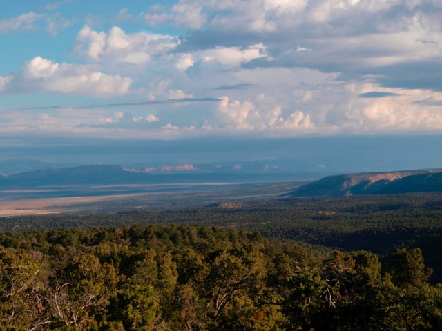
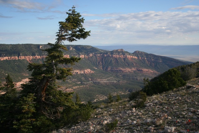
Ranging from low lying, arid realms of Grand Canyon’s inner canyon to piñon-juniper-oak woodlands and open grassland to alpine tundra mountain elevations rising above 11,000 feet,[18] the proposed 11 million-acre Mogollon Wildlife Corridor’s spectacular terrain exemplifies the Southwest’s rugged landscape and rich diversity of life. The Coconino, Kaibab, Apache-Sitgreaves and Gila National Forests, along with Grand Canyon National Park rim country, remain America’s largest contiguous expanse of Southwestern ponderosa pine, considered an endangered ecosystem type that comprises the Corridor’s biological heart.[19] The Corridor also provides core areas and wildlife linkages essential for recovery of the critically endangered Mexican wolf.

Mogollon Wildlife Conservation Area (Proposed)
Conservation Goals[20]
The overarching goal for the Mogollon Wildlife Corridor is to, through an array of conservation approaches, retain and restore the landscape’s various intact ecosystems—including all native species in natural patterns of abundance and distribution—ecological components critical to conserving the region’s biodiversity in a fast-changing world.[21] While protected areas remain the foundation of nature conservation, even in fragmented areas of land or freshwater, they alone would be insufficient.[22] Science demonstrates that active measures must also be taken to maintain or restore ecological connectivity among and between protected areas,[23] and that in order to achieve long- term biodiversity outcomes, retaining ecological connectivity is essential in a time of climate change.[24] With increasing human alteration of Earth, especially by rapid climate change, it is necessary to think and act at the larger spatial scales at which many species and processes actually operate.[25]
What is a Wildlife Corridor?
Ecological connectivity is the unimpeded movement of species and the flow of natural processes that sustain life on Earth.[26] This definition has been endorsed by the Convention on Migratory Species[27] and underlines the urgency of protecting connectivity and its various elements, including dispersal, seasonal migration, fluvial processes and the connectivity that is inherently present in large wild areas.[28] The 2012 USFS Planning Rule, particularly relevant to the four National Forest comprising most of the proposed Mogollon Wildlife Corridor, defines connectivity as:
Ecological conditions that exist at several spatial and temporal scales that provide landscape linkages that permit the exchange of flow, sediments, and nutrients; the daily and seasonal movements of animals within home ranges; the dispersal and genetic interchange between populations; and the long distance range shifts of species, such as in response to climate change.[29]
The following terms are often used similarly: ‘linkages’, ‘megalinkages’, ‘wildway’, ‘safe passages’, ‘ecological connectivity areas’, ‘ecological connectivity zones’, and ‘permeability areas’. While the term corridor suggests a single conduit, whereas the term linkage is commonly used to refer to a connectivity area with multiple strands (e.g., the proposed Mogollon Wildlife Corridor).[30] We use the commonly recognized term ‘corridor’ only to avoid confusion with the continental Western Wildway of which the Mogollon Plateau region is a major component.[31]
An ecological, biological, or wildlife corridor, or linkage, is a clearly defined geographical space that is governed and managed over the long term to maintain or restore effective ecological connectivity.[32] It is a swath of natural land, or stepping stones (e.g., “flyway”) of natural land, that is conserved to enhance the ability of plants and animals to move among larger habitat patches.[33] A wildlife corridor should be clearly delineated,[34] and have specific ecological objectives and be governed to achieve connectivity outcomes.[35] A wildlife corridor’s purpose is to maintain connectivity, especially in regions where natural habitat has been badly fragmented and yet extensive connectivity is required to retain that region’s natural elements and processes.[36] Ecological corridors are one of the best—and possibly only viable—management tools to maintain biodiversity at large scales and to allow shifts in species, and ecological processes, especially in the time of rapid climate change.[37]
The Mogollon Corridor’s topographic diversity as well as its distinctive locale at the intersection of four diverse eco-regions—the temperate Rocky Mountains and sub-tropical Sierra Madre Occidental on the north and south, and the drier Chihuahuan and Sonoran Deserts on the east and west—supports a wide array of plants and more than 500 species of vertebrates.[38] Delineation of the Mogollon Corridor is based on credible connectivity modeling[39], and shows that the area provides the nexus for wildlife movement to and from Sonora, Mexico, the U.S. Southern Rockies, and Utah’s High Plateaus.[40]
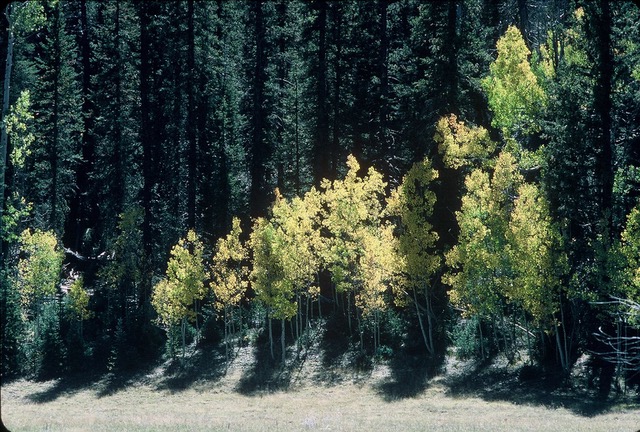
The Corridor’s biological core consists of America’s largest contiguous expanse of old growth Southwestern ponderosa pine forest. The pine forest, most common between 5,500 and 6,500 feet, gives way to spruce, fir, and aspen groves at higher elevations. Scientists[41] and conservationists[42] have determined that the Southwestern ponderosa pine forest found along the Mogollon Wildlife Corridor, including Grand Canyon National Park’s rim country and the North Kaibab Ranger District, constitutes one of America’s most endangered ecosystems.
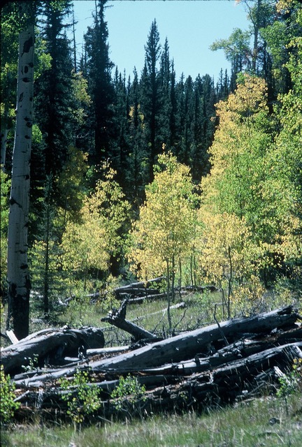
North Kaibab Aspen (c) Kim Crumbo
Scientists[43] also identified the public lands comprising the Mogollon Corridor (Grand Canyon to Gila Wilderness) as an ecologically significant region by pointing out the overlap between the 30% of areas with highest value for climate adaptation,[44] above-ground carbon,[45] and/or soil carbon levels.[46] Others identified the corridor as one of many areas that constitutes the most efficient and complementary candidates for broad-scale land conservation in the face of climate change.[47]
Federal Land and Wildlife Responsibilities
Federal land management agencies—including the two major agencies within the proposed Corridor: the Forest Service and National Park Service—have an obligation, and not just the discretion, to manage and conserve fish and other wildlife and their habitats on federal lands.[48] While individual states have broad trustee and police powers over wild animals within their jurisdictions, those powers exist only “in so far as [their] exercise may be not incompatible with, or restrained by, the rights conveyed to the federal government by the constitution.”[49] The states’ trust responsibilities for wildlife are subordinate to the federal government’s statutory and trust obligations over federal lands and their integral resources. In other words, the U.S. Constitution and subsequent federal law grants the federal government the authority to manage its own lands and resources even in the face of objections from the states.[50]
National Forests
A primary law governing the administration of national forests is National Forest Management Act (NFMA).[51] One of its most powerful provisions is its wildlife diversity mandate.[52] It requires that forest plans “provide for a diversity of plant and animal communities based on the suitability and capability of the specific land area in order to meet overall multiple-use objectives.”[53] The diversity provision was meant to require “Forest Service planners to treat the wildlife resource as a controlling, co-equal factor in forest management and, in particular, as a substantive limitation on timber production.”[54] If state wildlife management actions occur on national forest lands they must be considered in this statutory and regulatory context, and may be subject to preemption based on the USFS’s authority and obligations for wildlife diversity.[55] In other words, the Forest Service has the authority and responsibility to elevate protective status from GAP 3 to GAP 2 status by maintaining and restoring old growth ecosystems and establishing refugia for wildlife. Congressional legislation could make such designations permanent GAP 1 lands (see GAP Land Status discussion below).
National Parks
The National Park Service (NPS) has authority to manage wildlife on lands subject to its jurisdiction under the NPS Organic Act and other authorities.[56] The agency is required to “maintain as parts of natural ecosystems of parks all plants and animals native to park ecosystems…[by] preserving and restoring natural abundances, diversities, dynamics, distributions, habitats, and behaviors of native plant and animal populations and the communities and ecosystems in which they occur [and] restoring native plant and animal populations in parks when they have been extirpated by past human-caused actions…”[57]
The Park Service is also directed to “survey for, protect, and strive to recover all species native to national park system units that are listed under the [Endangered Species Act] to fully meet its obligations under the NPS Organic Act and the ESA to both proactively conserve listed species and prevent detrimental effects on these species.” To meet these obligations, “the Service will… reestablish extirpated populations as necessary to maintain the species and the habitats upon which they depend… [and] manage designated critical habitat, essential habitat, and recovery areas to maintain and enhance their value for the recovery of threatened and endangered species.”[58]
In addition, Park Service Policies state that NPS will cooperate and work with state and tribal governments, federal agencies, and other land managers to encourage the conservation of species populations and habitats “whenever possible.”[59] In other words, the NPS responsibility to recover the California condors, Mexican wolves, and other struggling species is not limited to activities solely within Park boundaries. Although the Policies are not judicially enforceable, courts have not hesitated to find that deviations from the Policies are arbitrary and capricious.[60]
It’s encouraging to point out the National Park Service Intermountain Region Director has asserted the agency’s authority to protect as an endangered species under Endangered Species Act Mexican wolves on National Park Service (NPS) lands including areas outside of the Mexican Wolf Experimental Population Area MWEPA[61]—e.g. Grand Canyon, Zion, Bryce, Mesa Verde, and Canyonlands national parks, all of which lie within the recovery area recommended by the Mexican Wolf Recovery Team Science and Planning Subgroup.[62]
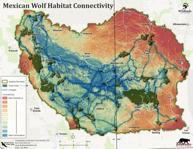
Mexican Wolf Habitat Connectivity Map
Mogollon 30×30 GAP Status
Designation and effective management of the proposed Mogollon Wildlife Corridor supports global—including President Biden’s[63] —calls to protect and conserve at least 30% of the Earth’s surface by 2030.[64] This is viewed as a milestone toward the larger end goal of half of the planet protected by 2050, if not sooner, if possible.[65]
Protect and Conserve
For consideration regarding what constitutes a protected area, Defenders of Wildlife offered this definition of “protect and conserve”:[66]
For the purposes of 30×30, “protect” or “conserve” means the establishment of enduring measures[67] that support secure and thriving biodiversity, contribute to climate adaptation, and provide ecosystem services, such that the intrinsic value, natural character, resources, and functions of the covered area are maintained or enhanced now and into the future, both individually and as part of an interconnected network of healthy lands and waters.[68]
GAP 1 (Wilderness: 1,042,753 acres or approximately 10% of the Mogollon Corridor)[69]
An area having permanent protection from conversion of natural land cover and a mandated management plan in operation to maintain a natural state within which disturbance events (of natural type, frequency, intensity, and legacy) are allowed to proceed without interference or are mimicked through management.[70] Wilderness meets GAP 1 criteria.[71]
With its emphasis on protecting and restoring all natural processes, wilderness (GAP 1) provides the highest potential level of protection for the full range of native species,[72] although activities permitted in many designated wilderness areas such as livestock grazing[73] and hunting carnivores results in significant degradation of natural evolutionary process.[74]
The most widely-publicized biodiversity-related commitment adopted by the Convention on Biological Diversity (CBD) involves area-based targets.[75] These include a 2010 commitment to conserve 17% of terrestrial areas in ecologically representative and connected networks under strict protection (e.g., GAP 1) or “other effective area-based conservation measures” (OECM).[76]
The Gila National Forest manages three wilderness areas (789,385 acres),[77] with 23,359 acres managed by the Apache-Sitgreaves National Forest,[78] all comprising a 812,744-acre GAP 1, “strictly protected,” core area within the eastern corridor. In the western corridor the Coconino National Forest manages seven wilderness areas comprising 182,530 acres.[79] The Kaibab National Forest oversees 117,509 acres in three widely dispersed wildernesses, two of which are contiguous with Grand Canyon National Park.[80]
The Corridor’s potential wilderness, based on agency and credible citizen wilderness proposals is approximately 2,850,500 acres. If enacted by Congress, this action alone would protect 26% of the proposed Mogollon Wildlife Corridor.[81]
- Coconino National Forest: 61,833 acres.[82]
- Kaibab National Forest: 70,746.[83]
- Apache-Sitgreaves National Forest: 714,938 acres.[84]
- Gila National Forest: 734,000 acres.[85]
- Grand Canyon National Park recommended/potential wilderness: 1.1 million acres.
- Vermilion Cliffs National Monument:[86] 169,000 acres.[87]
When added to the existing designated wilderness—930,253 acres—the potential contribution of approximately 3.6 million acres would boost wilderness GAP 1 (strictly protected) areas within the proposed Corridor to approximately 33%.

Sitgreaves National Forest Black Mesa District Proposed Wilderness and Quiet Areas
GAP 2 (1,910,432 acres or approximately 17% of Mogollon Wildlife Corridor)[88]
An area having permanent protection from conversion of natural land cover and a mandated management plan in operation to maintain a primarily natural state, but which may receive uses or management practices that degrade the quality of existing natural communities, including suppression of natural disturbance.[89] National Parks and Wilderness Study Areas qualify as GAP 2 lands.[90]
The National Park Service manages over 1,238,000 acres within the Corridor that qualify as GAP 2.[91] Congressional designation of the agency’s 1.1 million-acre wilderness recommendation would elevate most to Grand Canyon National Park to GAP 1 status. The Blue Range Primitive Area and Contiguous Lands consists of 378,983 acres that possess significant wilderness value.[92] As such, these lands appear to meet the requirements of GAP Status 2 Wilderness Study Areas.
GAP 3[93] (approximately 8,400,000 acres or approximately 73% of the Mogollon Wildlife Corridor)[94]
An area having permanent protection from conversion of natural land cover for the majority of the area, but subject to extractive uses of either a broad, low-intensity type (e.g., logging, livestock grazing, off-road vehicle recreation) or localized intense type (e.g., mining). It also confers protection to federally listed endangered and threatened species throughout the area.[95] GAP 3 lands in New Mexico’s portion of the Mogollon Wildlife Corridor include the Gila National Forest: 2,500,000;[96] and Arizona’s Coconino, Apache-Sitgreaves, and Kaibab National Forests: Approximately 5.9 million acres.[97]
Wildlife
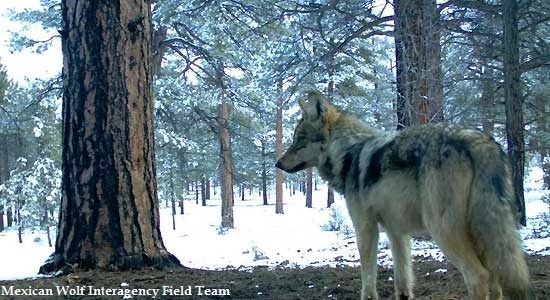
(c) Mexican Wolf Interagency Field Team
The Mogollon Wildlife Corridor’s forests, riparian areas and grasslands contain ecologically significant habitat for threatened, endangered and sensitive species including 45 bird species.[98] Virtually all of the Corridor’s approximately 30 fish species are either extinct or listed as threatened or endangered, or recommended as candidates of such listings. These species include the Gila chub, Little Colorado River spinedace, Gila topminnow, loach minnow, and Gila trout fish.[99] The Corridor provides habitat as well as for terrestrial native wildlife such as pronghorn antelope, Gunnison’s prairie dog, mountain lion, elk, deer, black bear, bighorn sheep, turkey, javalina, and porcupine.[100] Jaguar once inhabited the region north to Grand Canyon and, if allowed, could return.[101] At least 306 bird species spend at least a portion of their lives within the proposed Mogollon Wildlife Corridor.[102] The list of avian creatures includes Mexican spotted owls, bald eagles, goshawks, aplomado falcons, belted kingfishers, great blue herons, and southwestern willow flycatchers.[103]
Mexican spotted owls, listed as threatened by both the U.S. and Mexican governments, occupy forests and canyons of the southwestern states and northern and central Mexico. It was listed as a threatened species by the U.S. Fish and Wildlife Service (USFWS) in 1993,[104] based on historical and ongoing habitat alteration mostly due to timber management practices and on the future risk of stand-replacing wildfire, especially in previously logged areas.[105] Critical habitat was designated for this species in 2001.[106]
Northern goshawks (Accipter gentilis) depend heavily on old-growth forests for nesting habitat and have experienced significant declines in the United States due to logging and habitat fragmentation. The northern goshawk is a good indicator species of forest health because of its dependence on large old growth forest and vulnerability to disturbance. One of the major threats to goshawks is habitat fragmentation by timber harvesting. Timber harvesting and subsequent wildfires are the principal cause of loss of suitable nest trees and loss of nesting and foraging habitats.[107] Additional threats to goshawks include human disturbance, poaching, wildfire, livestock and wildlife browsing, as well as the more general problems of drought, prey reduction, and toxic chemicals.
Mexican Wolf (Canis lupus baileyi), a critically endangered species, depends on the Corridor’s core habitat and wildlife linkages identified by scientists as essential for its recovery.[108] Several habitat suitability assessments conducted over the last 20 years indicate that only three existing major core areas of suitable habitat are capable of supporting Mexican wolf populations of sufficient size to contribute to recovery. The three core areas of suitable habitat are: 1) the current Mexican Wolf Experimental Population Area (MWEPA); 2) the Grand Canyon and adjacent public lands in northern Arizona and southern Utah; and 3) two linked areas of public lands and private lands with conservation management in northern New Mexico and southern Colorado.[109] The proposed Mogollon Wildlife Corridor forms the MWEPA’s biologically productive northern region and provides an essential core Mexican wolf recovery area as well as crucial connectivity between the recovery areas identified by the USFWS Mexican Wolf Recovery Team Science and Planning Subgroup.[110]
The Kaibab Squirrel (Sciurus aberti kaibabensis), an endemic, rare and beautiful subspecies of tassel-eared squirrel and found only on the Kaibab Plateau’s 200,000-acre ponderosa pine forest,[111] has been characterized as “a classical example of the process of evolution through geographic isolation.”[112] The squirrel is now considered by the Nature Conservancy to be a potential species of concern,[113] and there remains credible concern regarding its survival as a subspecies.[114] Kaibab squirrels depend upon the structure of intact old-growth trees to facilitate their movements and provide shelter and food.[115]
River Headwaters Define the Region
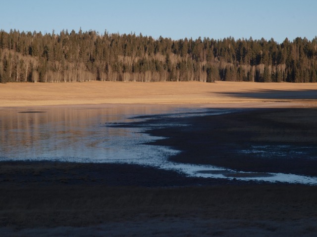
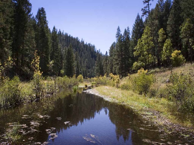
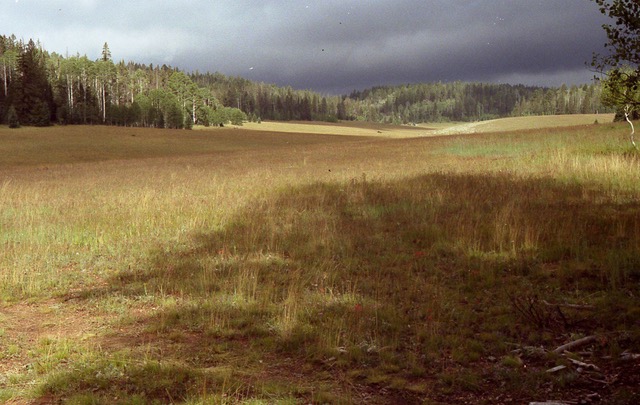
North Kaibab, wetland (c) Steve Bridgehouse
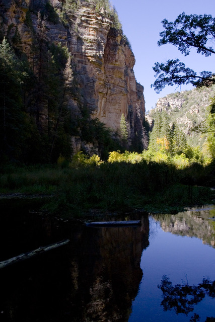
The headwater tributaries of the Little Colorado, Verde and Gila Rivers comprise the heart of the Mogollon Wildlife Corridor. Globally, 40% of all species live or breed in wetlands.[116] Out of the 36 fish species native to Arizona, one species is already extinct,[117] 34 have been identified as Species of Greatest Conservation Need, and 20 have been federally listed as endangered or threatened.[118] Endangered fish found within the proposed Mogollon Wildlife Corridor’s streams include spikedace (Meda fulgida)[119] and Apache trout (Oncorhynchus gilae apache).[120] The Gila trout (Oncorhynchus gilae gilae) had an historic range that included the headwaters of the Gila River drainage in New Mexico, the Gila River, and possibly the San Francisco Drainage,[121] and is classified as threatened under the ESA.[122]
In any landscape, rivers and streams are considered the epitome of connectivity critical to a landscape’s overall health.[123] Their long, linear shapes and arterial patterns make them unique. By physically and ecologically connecting habitats, riparian areas can significantly influence ecological processes and functions on a landscape level.[124] Southwestern riparian communities’ complex, multi-layered structure supports high species diversity, especially compared to arid uplands. They are anchors for biodiversity and connectivity in the Southwest.[125]
1) Gila River Headwaters
The Gila River and its headwater tributaries—the East, West, and Middle Forks— merge with the San Francisco and Blue Rivers to become the regions dominant river. On rare occasions—since man-made dams and diversions now expropriate most of the lower Gila’s water—floodwaters still flow along a 650-mile journey to the Colorado River near Yuma, Arizona. The upper Gila, San Francisco, the Blue, and their tributaries are largely undammed and free flowing, a rare circumstance in the West. The Gila River, however, is considered one of America’s most endangered.[126] The threat of damming or massive diversion higher on the Gila moved closer in 2004 when Congress approved the Arizona Water Settlements Act. The Act settled claims with several Indian tribes and affirmed New Mexico’s right to take about 14,000 acre-feet of water from the Gila and its tributary, the San Francisco River.[127] Fortunately after five years, $16 million, and missing a key planning deadline, a proposal to divert 14,000 a acre-feet of water from the Gila is for the time being dead due to lack of funding.[128] It’s time to designate the upper Gila River as a Wild and Scenic River.[129]
Gila Region Wilderness
In addition to its ecological values, the Gila bioregion is the considered the birthplace of America’s wilderness movement.[130] Established in 1924, the Gila Wilderness was the first administratively designated wilderness in the country, thanks to Aldo Leopold, then a forester on the Gila National Forest. Leopold is the American conservation icon whose experiences in the Gila bioregion shaped his eloquent plea for a new land ethic to guide conservation. Named in his honor, the Aldo Leopold Wilderness lies adjacent to the Gila Wilderness.
Today nearly one million acres of the Gila headwaters are currently protected as wilderness with at least another 2.2 million acres of land still eligible and in need of protection.[131] Three wilderness areas (789,385 acres) in the Gila National Forest—the Gila,[132] Aldo Leopold,[133] and Blue Range Wilderness areas[134]—and three wildernesses (23,359 acres managed by the Apache-Sitgreaves National Forest in Arizona—the Bear Wallow,[135] Mt. Baldy,[136] and Escudilla[137])—comprise a 812,744-acre GAP 1, “strictly protected” core area within the eastern corridor.
The Blue Range Primitive Area and Contiguous Lands consists of 378,983 acres that possess significant wilderness value.[138] As such, these lands appear to meet the requirements of GAP Status 2 Wilderness Study Areas: “An area having permanent protection from conversion of natural land cover and a mandated management plan in operation to maintain a primarily natural state, but which may receive uses or management practices that degrade the quality of existing natural communities, including suppression of natural disturbance.”[139]
In addition, approximately 450,000 acres of wilderness quality Inventoried Roadless Areas (IRAs) are located within the Blue Range region managed by the Apache-Sitgreaves National Forest.[140] Although administratively designated IRAs provide essential ecological protection of wildlife habitat, the Forest Service historically has sacrificed roadless areas and wildlife protection in favor of resource extraction and motorized recreation.[141] Indeed, the passage of the 1964 Wilderness Act was Congress’s response to federal land management agencies’ failure to protect these values.[142] Because IRAs are an administrative designation of the U.S. Forest Service and not legislatively established by the U.S. Congress, they are not considered part of the U.S. system of protected areas (i.e., units classified with a Gap Analysis Program [GAP] status of 1 or 2) in protected areas databases.[143] Protected areas classified as GAP 1 or 2 are governed by mandates to maintain biodiversity, prohibit land cover conversion, and minimize other human stressors. Road building and commercial timber harvesting are generally prohibited in IRAs, but livestock grazing, motorized recreation, and some mining are permitted. IRAs may provide similar levels of protection to many GAP 1 and 2 areas, but unlike Congressionally designated Wilderness Study Areas (WSAs) their administrative status leaves them vulnerable to efforts to repeal the Roadless Rule completely, as occurred recently in Alaska and Utah.[144]
Passage of the “Roadless Area Conservation Act of 2021” would correct that major flaw by prohibiting road construction, road reconstruction, or logging in an IRA,[145] and elevate approximately 58.5 million acres (one-third of all National Forests, or 2% of the continental land base)[146] from GAP 3 to at least GAP 2.[147] It would permanently protect approximately 542,000 acres within the proposed Mogollon Wildlife Corridor.[148]
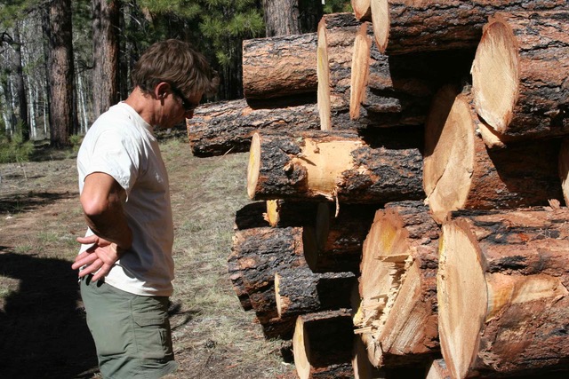
North Kaibab, TRI Executive Director John Davis with logs (c) Kim Crumbo
2) Upper Little Colorado River—White Mountains to San Francisco Peaks
The Apache-Sitgreaves National Forest (ASNF) and its riparian regions include the Little Colorado River and Chevelon, Willow, Leonard, Nutrioso, and Silver creeks. Coupled with the Coconino National Forest East Clear Creek headwaters, this watershed offers some of the finest and most diverse, as well as threatened, natural and cultural resources in the United States. These perennial streams, located on the southern edge of the Mogollon Plateau, remain incredibly rich, biologically diverse refugia for imperiled and biologically significant species described above. The Forest Service determined that approximately 212 miles of rivers in the Apache-Sitgreaves National Forest qualified as “Eligible” for Wild and Scenic Rivers designation.[149]
The ASNF Black Mesa Ranger District riparian areas (Willow Creek and Chevelon, Leonard, and West Chevelon canyons) provide relatively intact, biologically significant core and wildlife movement corridors through a landscape generally fragmented by roads and logging impacts. In addition, the 200,000-acre Chevelon Canyon-Willow Creek watershed (including the approximately 9,000-acre Chevelon roadless area) likewise supports diverse habitats of mixed conifer forests to pinyon-juniper woodlands, and riparian forests of willow, cottonwood, and box elder trees. The Forest Service determined that 26 miles of Chevelon Canyon was “Suitable” for Wild and Scenic Rivers designation.[150]
The East Clear Creek watershed, a principal tributary to the Little Colorado River, encompasses approximately 246,950 acres along the Mogollon Rim in north-central Arizona. The Mogollon Rim is the impressive escarpment explicitly announcing the southern edge of the Colorado Plateau. Approximately 125,900 acres of East Clear Creek headwaters lie within the Coconino Forest, while the Apache-Sitgreaves administers approximately 121,050 acres.[151] The Forest Service determined that 52 miles of the Clear Creek watershed[152] were “Eligible” for Wild and Scenic Rivers designation.[153] The East Clear Creek Watershed consists of a diversity of habitats including mixed conifer and old growth ponderosa pine, maple draws, and riparian areas and proposed Wild and Scenic Rivers. Wildlife, such as the endangered Mexican spotted owl and threatened Little Colorado River spinedace, northern goshawks, black bear, mountain lions, elk, mule deer, Mexican wolves, and a diversity of neotropical and resident birds, inhabit the forest.[154]
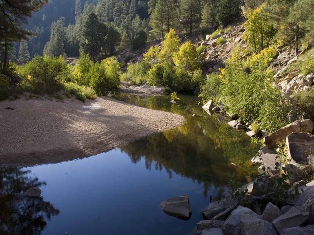
East Clear Creek (c) Zachary Crumbo
Anderson Mesa is a large (233,500 acres) region south of Flagstaff containing grasslands and ephemeral wetlands supporting a variety of wildlife such as pronghorn, elk, deer, mountain lions, Gunnison’s prairie dogs, Mexican spotted owls, goshawks, Abert squirrels, and waterfowl.[155] Padre Canyon roadless area (9,900-acres) lies in the region’s northeastern corner.
3) Eastern Upper Verde River Watershed
The approximately 209,500-acre Upper Eastern Verde River watershed includes six designated wildernesses (159,369 acres)[156] and five citizen proposed wilderness areas (50,098 acres).[157] The Forest Service determined that over 75 miles of the Upper Eastern Verde River[158] were “Eligible” for Wild and Scenic Rivers designation.[159]
4) Greater Grand Canyon—San Francisco Peaks to Grand Staircase National Monument.
San Francisco Peaks
With six individual peaks over 11,400 feet, the highest Humphreys Peak at 12,600 feet elevation, these mountains are the highest in Arizona and are composed of life zones ranging from ponderosa pine forest to alpine tundra.
San Francisco Peaks-Grand Canyon Mule Deer Migration Corridors (56 miles; 146,200 acres)
The Grand Canyon-San Francisco Peaks mule deer herd[160] makes an extraordinary, 50-mile annual migration between Flagstaff, Arizona and the Grand Canyon.[161] Heavy traffic on U.S. Highway 180 and State Route 64, in large part from tourists visiting the Grand Canyon, constitute the primary threat to mule deer and other wildlife species.[162]
South Rim Headwaters (325,425 acres) consists of the Kaibab National Forest Tusayan Ranger District south of and adjacent to Grand Canyon National Park. The District’s ponderosa pine and woodlands are integral to the Grand Canyon National Park’s South Rim, providing habitat for numerous wildlife species that often utilize both park and National Forest. Hualapai, Navajo, Hopi and Zuni people consider the area part of their extensive traditional territories.[163]
The area encompasses not only the Cataract/Havasupai Creek headwaters, but also other western drainages of the Little Colorado River as well as the source for Grand Canyon springs of the Esplanade and the Tonto Platforms beneath the South Rim.[164] The Hualapai and Havasupai consider all springs in the South Rim Headwaters and surrounding areas to be sacred, and the health and vitality of these springs is vital to the well-being of the people and all living beings.[165]
American Indians in the Southwest have an intimate relationship with their traditional territories, especially that of the Grand Canyon area including the South Rim Headwaters.[166] Red Butte, called Wii Giidwissa by the Havasupai,[167] is the area’s most conspicuous landform and is considered a sacred site for the Havasupai, Hualapai, Navajo, Hopi, and Zuni.[168] The Federal government has determined that Red Butte is eligible for listing in the National Register for Historic Places (NRHP) as a Traditional Cultural Property (TCP) for its importance to American Indian beliefs and ceremonialism.[169]
1) Navajo Cultural Landscape
The South Rim Headwaters lies within the Navajo Nation’s traditional claim area.[170] Within that area lies the Coconino Plateau cultural landscape known as Dzil Libáí or Grey Mountain.[171] The area was used mainly in the nineteenth century and served as a battlefield for conflicts between the Navajo and Mexicans.[172] The number of archaeological sites of the Historic period attributed to the Navajo indicates that they were regularly using the area. Most of these sites, scattered throughout the parcel, are the remains of sweat lodges and other shelters. These may have been temporary camps associated with hunting, other activities, or periodic travel to the Grand Canyon from the homeland. In addition, a Navajo ceremonial site is located on the Coconino Plateau, but its exact location is unknown.[173]
2) Hopi Tradition Use Area
The Hopi traditional use area or claim area covers the entire state of Arizona, which obviously includes the South Rim Headwaters.[174] Ethnographic evidence associated with cultural activities includes the Salt Pilgrimage to the Hopi Salt Mine in the Grand Canyon and a pilgrimage or hom’vikya associated with Hopitutskwa, the traditional demarcation of Hopi land that is closely associated with ritual activities on Second Mesa.[175] There are also several trails traditionally used by the Hopi during trading expeditions to the Havasupai and for other regional travel.[176]
3) Hualapai Traditional Territory
The Hualapai have long used and continue to use the South Rim Headwaters for settlement, hunting and gathering, gardening, trade, and travel.[177] In oral histories, Hualapai elders describe birth places as well as gatherings near Red Butte with the Hopi, Havasupai, and other tribes. Trails were important in maintaining social, kinship, and trade relations with other tribes. Items traded by the Hualapai to other groups included tanned deer hides and red paint (hematite). Hualapai place names east of the South Parcel reflect the close relationships between the Hualapai and the western area of Hopi settlements around present-day Moenkopi.
4) Trails
A network of trails crosses the South Rim Headwaters, connecting the Hopi and Zuni with the Havasupai and Hualapai. These trails generally run east-west and extend well beyond the boundaries of the parcel. Some trails run all the way from the Rio Grande Pueblos to the Pacific Ocean. Many of these trails can be seen on early General Land Office maps from the end of the 19th century. The best known trails are those that run from Hopi Mesa to the Grand Canyon and the territory of the Havasupai. At least one trail leads past Red Butte on its way to the Grand Canyon.[178] Two Navajo trails used to access the canyon and Havasupai territory are found in the area.[179] These trails not only represent long-distance trade, but also long-standing and important social and kinship relations between the Hualapai, Hopi, and other tribes.[180]
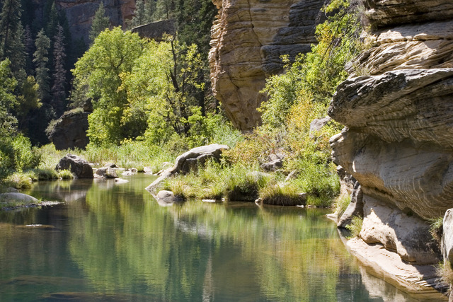
West Clear Creek (c) Zachary Crumbo
5) Wildlife Corridors
The Headwaters and Grand Canyon’s South Rim are linked to the more southernly forests by the 56-mile San Francisco Peaks-Grand Canyon Mule Deer Migration Corridor discussed elsewhere.[181]
Suggested Designations and Management
1) The Forest Service Administrative Process: Develop and incorporate into Kaibab National Forest Plan effective watershed, wildlife, and cultural conservation management objectives that assure that the South Rim Watershed’s populations of critical native species (e.g., California condors, black bears, mule deer, pronghorn, coyotes, wolves, etc.) are protected or restored. The Forest Plan should be amended to reflect desired outcomes including explicit goals, objectives, standards, and guidelines that provide credible protection of core habitats (e.g., old growth ponderosa pine, the 8,510-acre Coconino Rim Inventoried Roadless Area, Red Butte proposed Traditional Cultural Property), ecologically effective populations of keystone species (e.g., goshawks, Abert’s squirrel, and cougars), and wildlife movement corridors across the landscape.
2) Presidential Proclamation or Congressional Designation of a Wildlife Conservation Area or National Monument: While the forest plan approach presented above is consistent with applicable Federal laws and policy including the National Forest Management Act (NFMA) and the Federal Land Policy and Management Act (FLPMA), permanent protection of the natural and cultural values will undoubtedly require action from the President and/or Congress.
Co-management
Presidential proclamation, Congressional legislation, or a Forest Plan amendment could incorporate co-management provisions currently envisioned for the Bears Ears National Monument. Co-management with Native tribes is being reviewed.
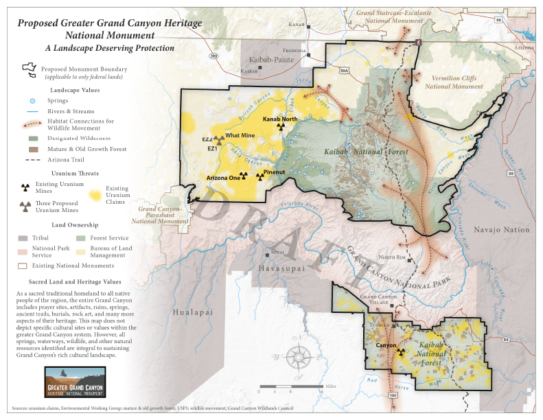
Proposed Greater Grand Canyon Heritage National Monument (Map)
The Kaibab (Kaivavitsi)[182] Ancient Forest: Refugia for Wildlife
Climate change and loss of biodiversity are widely recognized as the foremost environmental challenges of our time[183]; and the conservation of high quality existing habitats should remain the primary focus of conservation efforts to maintain biodiversity.[184] Globally, forests are home to 80% of the world’s terrestrial biodiversity.[185] Forests, especially intact forests, help stabilize the climate.[186] They regulate ecosystems, protect biodiversity, play an integral part in the carbon cycle, support livelihoods, and can help drive sustainable growth.[187]
Today, less than 20% of the world’s forests remain intact (i.e., largely free from logging and other forms of extraction and development) and are largely tropical forests or boreal forests in Canada and Russia.[188] In the U.S.—a global pioneer in national parks and wildlife preserves—the percentage of intact forest in the contiguous 48 states is only an estimated 6–7% of total forest area,[189] with a higher proportion in the West and a lower proportion in the East.[190] While international emphasis remains on preventing loss of tropical forests, intact and/or older U.S. forests have the potential for rapid atmospheric CO2 removal rates and biological carbon sequestration by forests[191] adequate enough to remove sufficient atmospheric CO2 and reduce national annual net emissions by approximately 11%.[192]
The Kaibab Plateau, the mountain through which the Colorado River carves the Grand Canyon, rises over 9,000 feet above sea level with its diverse stands of aspen, ancient pine and fir forests, woodlands, grasslands, and montane meadows. The Paiutes call it Kai Awvahv, the “mountain lying down,” or Kaivavitse,[193] and its people Kai’vahv Eetseng.[194] Clarence Dutton, a seasoned explorer and geologist, receptive to its intrinsic and aesthetic value, described the mountain in 1880 as “the most enchanting region it has ever been our privilege to visit.”[195]
North Kaibab (c) Steve Bridgehouse
Endangered Ecosystem
Scientists[196] and conservationists[197] have determined that old growth southwestern ponderosa pine forests found in Grand Canyon National Park and the North Kaibab Ranger District, constitutes one of America’s most endangered ecosystems. They report that old-growth ponderosa pine has suffered an estimated 85-98% area loss due to destruction and conversion to other uses and the threat continues to this day.[198]
The forest north of and adjacent to Grand Canyon National Park, is managed by the U.S. Forest Service’s North Kaibab Ranger District[199] and presents a rare example of a diminished but fundamentally intact mature forest outside of protected areas. Old-growth forests, by definition, have old trees but the presence of old trees is just the beginning of a description of the composition of an old-growth forest.[200] Growing relatively intact, but historically logged, existing forests, such as the North Kaibab, to their ecological potential—termed proforestation—is an effective, immediate, and low-cost approach that could be mobilized across suitable forests of all types.[201] Proforestation serves the “greatest public good,” the so-called Forest Service moral compass,[202] by maximizing co-benefits such as nature-based biological carbon sequestration and unparalleled ecosystem services such as biodiversity enhancement, water and air purification, flood and erosion control, public health benefits, low impact recreation, and scenic beauty.[203]
North Kaibab Forest Wildlife
1) The Kaibab Squirrel (Sciurus aberti kaibabensis), an endemic, rare and beautiful subspecies of tassel-eared squirrel and found only on the Kaibab Plateau’s 200,000-acre ponderosa pine forest,[204] has been characterized as “a classical example of the process of evolution through geographic isolation.”[205] The squirrel needs the structure of intact old-growth trees to facilitate their movements and provide food.[206] Recognizing this relationship and that the plateau’s forest “is one of the largest and best examples of a climax [old growth] community,” the Secretary of Interior in 1965 designated the plateau’s ponderosa pine forests within Grand Canyon National Park and the Kaibab National Forest as the 304,594-acre Kaibab Squirrel National Natural Landmark.[207] Grand Canyon National Park shares a common boundary with the North Kaibab Ranger District and comprises approximately ten percent of the Kaibab squirrel’s range.[208] Unfortunately, current protection of the National Natural Landmark’s values outside the Park is voluntary and has not assured the species’ continued survival. Presidential or Congressional designation of refugia mandating protection of this imperiled creature and its endangered habitat could.
As early as 1924, there was concern that the Kaibab squirrel might be in peril of extinction,[209] a continuing and growing concern given the uncertainty of southwestern forests due to climate disruption. The Kaibab squirrel is now considered by the The Nature Conservancy to be a potential species of concern,[210] and there remains credible concern regarding its survival. There also remains the imperative of conducting population surveys and continuing monitoring of the Kaibab squirrel, including loss of habitat due to high intensity fires, timber harvest and tree thinning, and to the dismay of many, hunting.[211] Consequently, some scientists and many conservation groups insist hunting of this unique and charismatic species should cease, especially in the absence of accurate population numbers.[212] In fact, the internationally respected American Society of Mammologists remains opposed to hunting the Kaibab squirrel in the absence of long-term, credible science that unquestioningly demonstrates that “hunting will not jeopardize in any way the survival of this squirrel.”[213]
North Kaibab, mixed conifer (c) Kim Crumbo
2) Grand Canyon Condors
In 1996, the U.S. Fish and Wildlife Service began releasing California condors in northern Arizona.[214] During spring through fall, condors now concentrate in Zion National Park and portions of Dixie National Forest in southern Utah. As winter snows make carrion more scarce, most of the birds return to Grand Canyon National Park, the North Kaibab Ranger District, and Vermilion Cliffs National Monument.[215]
While condors can live over 60 years, they reproduce slowly. The bird reaches sexual maturity at 5-7 years of age,[216] and the female lays only one egg every two years. As early as 6 weeks after hatching, California condor chicks leave the nest cavity but remain in the vicinity of the nest where they are fed by their parents.[217] The chick takes its first flight at about 5.5 to 6 months of age but does not become fully independent of its parents until the following year.[218] The unfortunate reality is that nearly a quarter of a century after the initial releases, only 186 condors traverse the vast skies above Zion and Grand Canyon National Parks.[219] That current total includes 3 wild-born fledglings and 10 captive birds recently released to the wild.[220] Because population growth remains slow, the total number of wild California condors is still relatively small and the species requires intensive management for survival.[221]
While we are still awaiting completion of partial 2019-2020 condor population count,[222] in 2020 only 82 traversed the Grand Canyon ecoregion.[223] Blood tests reported in the 2019 blood lead testing results showed that 77% of the Grand Canyon-Zion condor population suffered significant levels of lead,[224] with serious levels[225] reported in more than a quarter of the birds tested. The long-term prognosis for this critically endangered species is dire. Recovery of a secure population of the Grand Canyon Ecoregion’s critically endangered condors, along with countless other scavenging animals, demands at the very least the elimination of toxic lead ammunition from the recovery area as a management imperative.[226]
The Forest as Refugium
By definition, refugia are habitats that wildlife retreat to, persist in, and can potentially expand from under changing environmental conditions.[227] U.S. Federal land management agencies have sovereign powers over its lands and resources as well as an obligation, and not just the discretion, to manage and conserve fish and wildlife on federal lands,[228] including establishing refugia (no-hunting zones) for ecologically valuable and rare endemic species such as the Kaibab squirrel as well as lead-ammunition prohibitions where hunting of some species is permitted (e.g., condor recovery zones).[229]
The Forest Service has the authority and responsibility to protect and restore ecological integrity, including native species, to the North Kaibab forest.[230] U.S. Department of Agriculture (USDA) regulations require the Forest Service (and other USDA agencies) to “avoid actions which may cause a species to become threatened or endangered”[231] The Forest Service’s 2012 Planning Rule states that for at-risk species—referred to as species of conservation concern (“SCC”)—forest plan components must provide the “ecological conditions to maintain a viable population of each species of conservation concern in the plan area.”[232] The Rule defines “viable population” as a “population of a species that continues to persist over the long term with sufficient distribution to be resilient and adaptable to stressors and likely future environments,”[233] for example, obvious stressors such as climate change. The Rule also establishes population levels for at-risk species as a goal, which is to be achieved by providing ecological conditions and regulating human uses.[234]
Should the Kaibab National Forest continue to abdicate its management responsibility to protect the Kaibab squirrel from the gratuitous threat of sport hunting and the avoidable threat to condors and other native wildlife scavengers from poisoning through ingesting spent lead ammunition fragments, Presidential proclamation or permanent Congressional designation of forest refugia would be consistent with federal law and policy.[235] It would direct the agency to initiate a precautionary approach to protect remaining old growth and restore characteristic biotic and abiotic processes, including natural fire and all native species, especially ecologically effective populations of strongly interactive species, to assure naturally evolving patch dynamics along with minimizing road density.[236] All these actions leading to the restoration of wild forest structure, function, composition, and native species diversity is consistent with existing law, regulations, and the Presidents national priorities.
North Kaibab view (c) Kim Crumbo
Next Steps
The most critical step in establishing a viable wildlife corridor is defining its geographic location and articulating and implementing goals and objectives for ecological connectivity.[237] Connectivity can be established or maintained for any one or a combination of the following purposes, all of which depend on movements between habitat patches: (1) genetic exchange; (2) movement of individuals to meet life-cycle needs, including migration; (3) provision of habitat for daily to multi-generational movement; (4) maintenance of ecological processes; (5) movement and adaptation responses to global change, including climate change; (6) or recovery and recolonization after disturbance.
Establish Goals
A wildlife corridor should have clear and measurable ecological objectives meeting at least one of the above (Next Steps) purposes.[238] The overarching goal for the Mogollon Wildlife Corridor is to retain and/or restore the landscape’s various intact ecosystems—including all native species in natural patterns of abundance and distribution—ecological components critical to conserve the region’s biodiversity in a fast-changing world.[239]
General Goals[240]
- Make wildlife corridors, also known as ecological corridors, wildways, or habitat links, as wide and wild as possible. Although the size of a wildlife corridor will vary, it should be large enough to achieve its specific ecological connectivity objectives over the long term.[241] Wildlife corridors should be designated so they contain sufficient ecologically effective habitat to facilitate wildlife movement for daily, seasonal, and long-term needs in a safe manner.[242]
- Allow for latitudinal and elevational range shifts in response to climate change.[243]
- Maintain ecological integrity of all wildlife habitat types and migration routes.[244]
- Evaluate current and proposed activities, including recreational use, for their potential to adversely affect relevant wildlife values in the corridor. Do not permit any activities that interfere with adequate protection of those values.[245] Eliminate or minimize mechanical intrusions within the corridor.
- Manage area to protect migration and movement routes for mule deer, elk, pronghorn, and other wide-ranging wildlife, and especially keystone species[246] such as wolves, cougars, and other carnivores.[247] This includes identification and mitigation of barriers such as highways, canals, fencing, and man-made dams.[248]
- Ensure that protective fencing prevents wildlife from accessing the road/railway or canal interior while simultaneously funneling wildlife to a safe crossing structure. In addition to protective fencing along roads, rails, and canals, ensure that all fencing within the ecological corridor is wildlife friendly and clearly marked with non-threatening or deterring markers.[249]
- Close the area to renewable and other energy developments, including ostensibly renewable forms. For example, flyway corridors require consideration of their vertical dimension with an emphasis on threats such the placement of wind turbines that intercept and kill migrating avifauna.[250]
- Protect riparian and aquatic habitat for native species (fish, beaver, river otter, mink, invertebrates, etc.).[251]
- Activities currently authorized by the agency within any corridor shall coexist with wildlife movement, migration, and dispersal. Changes to current activities and infrastructure may be required if found incompatible with the corridor’s wildlife values.
- Disallow hunting or trapping of large carnivores and other strongly interactive[252] or sensitive species within wildlife corridors. Evaluate big game hunting levels, stocking of nonnative fish, furbearer trapping, and other wildlife management practices for compatibility with the corridor’s wildlife values and goals.
- For private lands within wildlife corridors, provide strong economic incentives for wildlife-friendly practices; and have funds ready for conservation acquisition by land trust or government agency, should the owners decide to sell.
Retain Public Ownership
- Retain public land in federal ownership allowing for the protective management of crucial habitat and movement corridors for mule deer, elk, pronghorn, other wide-ranging wildlife, and especially top carnivores, like wolf and cougar, and ecosystem enhancers, like beaver and prairie dogs.
- Encourage the acquisition of non-federal lands within the corridor through purchase from willing sellers, exchange (but never trading away other ecologically critical lands), transfer, or donation. Acquired lands should be managed consistent with the corridor’s standards and guidelines.
- Again, where possible, augment wildlife values through purchase from willing sellers, exchange, transfer, or donation of additional acreage of crucial wildlife habitat for their migration, movement, and dispersal.[253]
- Establish and implement in a timely manner mitigation measures for roads, fencing, and other fragmenting structures to allow the safe movement of wildlife. Busy roads (e.g., Interstate 40, U.S. 89, SR 269) should have safe wildlife overpasses and underpasses where wild animals want to cross.
West Clear Creek (c) Zachary Crumbo
Minimize and Mitigate Roads, Canals, and Railroads
Road mortality (road kill) occurs when animals die from collisions with vehicles. These collisions kill between 89 million and 340 million birds annually on US roads,[254] and may contribute to global declines of insect populations.[255] Canals are typically a nearly-complete barrier to wildlife movement because they are often bordered by tall chain-link fences, often have nearly vertical concrete sides, and are filled with deep, swiftly-moving water blocking almost all reptiles, non-flying mammals, and non-flying invertebrates.[256]
- Avoid building roads, canals, or railroad tracks in linkages and avoid having these infrastructures bisect linkages.[257]
- Provide a variety of safe crossing structures over or under roads, railways, and canals, and whenever possible maintain the structures to contain natural vegetation while still remaining free of debris. Maintain high-quality natural areas on either end of crossing structures.[258]
- When roads are unavoidable, use speed abatements to slow traffic speed within and adjacent to corridors.[259]
- Manage motorized vehicular use as “Limited to Designated Roads and Trails.”
- Establish road and motorized trail density standards within the management area to conform to the best scientific recommendations, generally less than one-half mile per square mile.[260] Ensure that there will be no net increases in road densities above a scientifically credible threshold to maintain the security of core habitat areas.[261]
- Close existing designated roads or trails if conflicts with wildlife cannot be mitigated.[262]
- Establish and implement in a timely manner safe wildlife crossings and mitigation standards for existing roads and primitive roads or highways crossing public land to facilitate movement of wildlife and reduce mortality of wildlife from vehicle collisions.[263]
- Ban new permanent roads within the corridor in order to maintain unfragmented habitat for wildlife migration and dispersal.[264]
Prohibit Mining
- Subject to valid existing rights, prohibit mining, oil and gas exploration and development within corridor management areas.[265]
- Close the corridor to fluid mineral leasing and to mineral materials sales.[266]
- Close the corridor to all locatable and leasable minerals exploration and development (including geothermal and sodium) and mineral material disposals.
- Withdraw the corridor from location and entry under the Mining Law, subject to valid existing rights.
- Close to recreational placer mining outside of active mining claims.
- Prohibit surface occupancy and surface-disturbing activities.
North Kaibab meadow (c) Kim Crumbo
Phase Out Livestock Grazing
- Mitigate ecological impacts due to livestock grazing. Domestic cattle and sheep grazing has been the leading cause of watershed, stream, and grassland degradation.[267] Wildlife corridors should incorporate grazing guidelines that state that livestock grazing may be permitted only where, and in such a manner, that it serves positive ecological roles.[268] Otherwise, significantly reduce or eliminate livestock grazing within or adjacent to the linkage.[269]
- Encourage coexistence and ranching husbandry practices to reduce livestock depredations, and consider payment programs to compensate ranchers for livestock losses from wildlife.[270]
- Facilitate permanent voluntary retirement of grazing permits. This option offers an effective resolution of habitat integrity-livestock conflicts and end to gratuitous lethal control of carnivores.[271]
- Minimize fencing for livestock and make all fences wildlife friendly.[272] Evaluate any proposed changes in grazing fencing guidelines for wildlife—such as timing and intensity of use—for impacts on relevant wildlife values. Implement those changes that benefit wildlife.[273]
Vegetation Treatments
- Only allow vegetation treatments determined beneficial by the best available science relevant to ecosystem values.
- Allow recovery of diverse, mixed-age forests would be more natural. Prohibit even-aged silvicultural management and timber harvesting within the special corridor management areas.[274]
- Discourage the spread of invasive species by removing unneeded roads and power-lines and allowing natural wildfires to burn where safe.
Enforce Existing Regulations
Insist on aggressive enforcement of existing regulations.[275] Within the United States, the Clean Water Act of 1972, as amended in 2009, restricts dumping of soil, agricultural waste, and trash in streams and restricts the intensity of farming, mining, and building along streams and on floodplains.[276] Adequate enforcement of these existing policies would go a long way toward improving riparian zone and stream habitat quality along corridors in the United States.[277]
Designation Options
There are a variety of actions to protect the ecological and other values of the proposed Mogollon Wildlife Corridor, either in total (10.7 million acres) or in strategically implemented components of an ecologically effective wildlife core and linkage area.
1) Presidential Proclamation or Congressional Designation (increase level of protection for national forest and BLM-administered lands from GAP 3 to GAP 2)
National monuments can either be established by Congress through legislation or by the president of the United States through the use of the Antiquities Act. National monuments can be managed by any of the several federal land management agencies, including the National Park Service, U.S. Forest Service, U.S. Fish and Wildlife Service, or the Bureau of Land Management.[278]
The President has the authority under the Antiquities Act to designate a national monument subject to “the limits of which in all cases shall be confined to the smallest area compatible with the proper care and management of the objects to be protected.”[279] The case should be made that, in order to maintain the Earth’s atmosphere at safe limits to protect specific “objects”—the Earth’s diversity of life,[280] humans included—we need to fast-track the protection and restoration of at least 50% of natural habitats by 2030.[281] Congress has no size constraints.
2) Designate a Wildlife Conservation Area (increase level of protection from GAP 3 to GAP 2) through Congressional legislation or Presidential proclamation. Presidents still have the authority to create game preserves such as the original Grand Canyon Game Preserve proclamation established for “the protection of game animals, and shall be recognized as a breeding place.”[282]
3) Establish an Ancient Forest/Old Growth Preserve (increase level of protection from GAP 3 to GAP 2) through Congressional legislation or Presidential proclamation mandating the preservation and restoration of the full array of biotic and abiotic processes creating old growth stands to assure protection of the forest’s diversity of life. Congressional designation could direct the agencies to initiate a precautionary approach to restore degraded habitats consistent with preserving native biodiversity. This concept includes restoring natural fire to assure naturally evolving patch dynamics and restoring the full compliment of wild forest structure, function, and composition.
4) Wilderness Designation (increase level of protection from GAP 3 to GAP 1) Congressional Designations of Wilderness, Wilderness Study Areas, Wild and Scenic Rivers, etc., offers the potential of protecting approximately 30% of the Mogollon Corridor.
5) Designate as Wild and Scenic Rivers all Rivers found “Suitable;” Chevelon Canyon and Gila River. Complete Suitability studies for river segments found “Eligible” by the agencies (approximately 440 miles in 29 units on the Apache-Sitgreaves, Coconino, and Kaibab national forests).[283]
East Clear Creek (c) Zachary Crumbo
6) Agency Administrative Process
Develop and incorporate into the Kaibab, Coconino, Apache-Sitgreaves, and Gila forest plans effective wildlife conservation management objectives that assure ecologically effective populations of critical native species by protecting core habitats and facilitating wildlife movements across the landscape. The forest plans could be amended to reflect desired outcomes including explicit goals, objectives, standards and guidelines that:
- Manage the National Forests for Conservation Purposes, not Commodity Production: Research indicates that forest carbon is maximized where there are the highest levels of forest protection and the least amount of logging—ideally, no logging at all.[284] Even careful commercial forestry operations in high conservation value forests impose substantial costs to other forest ecosystem services such as biodiversity conservation, watershed maintenance, increased fire risk, and recreation.[285] Logging also increases fire risks. For these reasons, scientists and other conservationists recommend that mature forests and other forest areas with recognized high conservation value should be fully protected and not managed for timber or biomass production.[286]
- Mandate Interagency Ecosystem Cooperation: As one biologist has noted, “the future persistence of many mammal populations within western North American parks, as well as the probability of extinct populations recolonizing the parks, is highly dependent upon human activities and land-use practices adjacent to the parks.”[287] Explicit, enforceable management objectives presented in the revised forest plan could utilize the current authority of the Chief of the Forest Service to enter into cooperative agreements with the State wildlife departments.[288] Current language consists of an ambiguous encouragement to protect and maintain “desirable” populations of wildlife. A renewed management direction could require the Forest Service, BLM, and NPS to cooperate with the States to protect all native species in natural patterns of abundance and distribution. This would establish clear direction for the federal agencies to actively cooperate to achieve conservation goals on the ecosystem level.
- Restore a “natural fire regime” by supporting NPS and Forest Service natural fire use policy. Implement management strategies appropriate for protecting and restoring southwestern ponderosa and mixed conifer forest through the best available scientific information.
- Administratively designate all suitable USFS roadless areas as “recommended wilderness.”[289]
- Administratively designate Wildlife Habitat Areas: In 2008, conservationists proposed a 380,000-acre Mogollon Wildlife Conservation Area consisting of existing and proposed wilderness areas linked by existing and proposed Wildlife Habitat Areas.[290] Designation of “wildlife habitat areas” is based on existing management strategies apparently successfully implemented by the Arizona Game and Fish Department (AGFD) and the Forest Service.[291] By 1985, the AGFD recognized that “high open road density and high OHV accessibility limit effective use of habitat by wildlife.”[292] In order to provide “quiet” wildlife habitat, particularly for elk, deer, and turkey, “unaffected by motor vehicle traffic,” the AGFD and Forest Service initiated a cooperative program designating five “Wildlife Habitat Areas” (WHAs) on the Apache-Sitgreaves National Forests.[293] The agencies’ goal for establishing the Wildlife Habitat Area program is “to improve wildlife habitat.”
Bureau of Land Management
The Bureau of Land Management (BLM) has broad authority to administratively designate wildlife corridors as priority biological areas[294] (similar to the Sonoran Desert designations)[295] for mitigation of existing and potential wildlife habitat fragmentation. The BLM manages lands north of Grand Canyon that are essential for wildlife migration and movement between Grand Canyon National Park and Grand Staircase-Escalante National Monument. Under the Federal Lands Policy and Management Act (FLPMA), the BLM is charged with identifying, inventorying, and protecting important natural resources, such as wilderness and wildlife corridors, on the public lands. FLPMA requires that the BLM identify and inventory the public lands for resources and important values, giving priority to designation of areas of critical environmental concern, and manage the lands pursuant to resource management plans (RMPs) that are based on this inventory.[296] FLPMA directs the BLM to manage the public lands in a manner “that will protect the quality of scientific, scenic, historical, ecological, environmental, air and atmospheric, water resource, and archaeological values.”[297] Furthermore, the BLM is expected to preserve “certain lands in their natural condition; that will provide food and habitat for fish and wildlife.”[298] As mentioned above, BLM-administered Sonoran Desert National Monument already provides designated wildlife corridors.[299]
Summary
We believe that the steps offered above will protect and restore the proposed Mogollon Wildlife Corridor’s ecological integrity, and will significantly enhance Arizona’s and New Mexico’s contribution to the 30×30 initiative to ensure that the Western Wildway’s globally significant plant and animal populations endure for the sake of the Earth’s diversity of life, humans included.
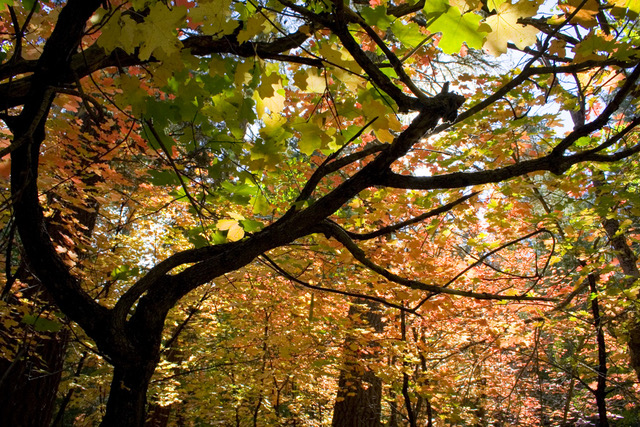
Fall Colors in the East Clear Creek Watershed (c) Zachary Crumbo
References
Allred, Sylvester. 2010. The Natural History of the Tassel-eared Squirrel. Albuquerque: University of New Mexico Press. 226 pages. https://unmpress.com/books/natural-history-tassel-eared-squirrels/9780826346551
American Rivers 2008. America’s Most Endangered Rivers TM 2008 Edition.
AWC [Arizona Wilderness Coalition]. 2002. Grand Canyon-Parashant and Vermilion Cliffs National Monuments: Wilderness Proposal. July 31, 2002. Document on file at Wild Arizona, Flagstaff, Arizona.
AWC [Arizona Wilderness Coalition]. 2003. Wilderness Proposal for the Non-Monument Portion of the Arizona Strip. April 29. 2003. Document on file at Wild Arizona, Flagstaff, Arizona.
AWC [Arizona Wilderness Coalition, Center for Biological Diversity, Grand Canyon Wildlands Council, Sierra Club—Grand Canyon Chapter, and The Wilderness Society]. 2006. Comments on the 2005 Draft Resource Management Plan/Draft Environmental Impact Statement for the Arizona Strip Field Office, the Vermilion Cliffs National Monument, and the BLM Portion of Grand Canyon-Parashant National Monument, and the Draft General Management Plan/Draft EIS for the NPS Portion of the Grand Canyon-Parashant National Monument. March 16, 2006. Document on file at the Arizona Strip Field Office, St. George, Utah.
AWC [Arizona Wilderness Coalition]. 2007a. Boulder Canyon Wilderness Proposal. March 2007. Copy on File at Wild Arizona, Flagstaff, AZ. https://www.wildarizona.org/.
AWC [Arizona Wilderness Coalition]. 2007b. Cimarron Hills. March 2007. Copy on File at Wild Arizona, Flagstaff, AZ. https://www.wildarizona.org/.
AWC [Arizona Wilderness Coalition]. 2007c. Hackberry. March 2007. Copy on File at Wild Arizona, Flagstaff, AZ. https://www.wildarizona.org/.
AWC [Arizona Wilderness Coalition]. 2007d. Walker Mountain. March 2007. Copy on File at Wild Arizona, Flagstaff, AZ. https://www.wildarizona.org/.
Austin, D., E. Dean, and J. Gaines. 2005. Yanawant: Paiute and Landscapes on the Arizona Strip, Vol. 2: The Arizona Strip and Places Names Study. Tucson: Bureau of Applied Research in Anthropology.
Baillie, J., and Y.-P. Zhang. 2018. Space for Nature. Science, 361(6407): 1051. DOI: 10.1126/science.aau1397
Barnes, Joel C. 2005. Protecting Wild Waters in A Dry World: The Role of Wild and Scenic Rivers in the Conservation of Aridland River Systems and Watersheds of the American Southwest. Dissertation. Union Institute & University, Cincinnati, Ohio.
Barnosky, A. D., Nicholas Matzke, Susumu Tomiya, Guinevere O.U. Wogan, Brian Swartz, Tiago B. Quental, Charles Marshall, Jenny L. McGuire, Emily L. Lindsey, Kaitlin C. Maguire, Ben Mersey, and Elizabeth A. Ferrer. 2011. Has the Earth’s Sixth Mass Extinction Already Arrived? Nature 471, 51–57. https://doi.org/10.1038/nature09678
Beier, Paul, and Joyce Maschinski. 2003. Threatened and Endangered, and Sensitive Species. Pages 306-327. In Friederici, Peter. 2003. Ecological Restoration of Southwestern Ponderosa Pine Forests. Washington, D.C.: Island Press. 561 pages.
Beier, Paul, Dan Majka, Shawn Newell, Emily Garding. 2008. Best Management Practices for Wildlife Corridors. https://scholar.google.com/scholar?q=Best+Management+Practices+for+Wildlife+Corridors&hl=en&as_sdt=0&as_vis=1&oi=scholart&sa=X&ved=0ahUKEwji57fKhujaAhVF2IMKHb6hCVQQgQMIJTAA
Belote, R. Travis, Matthews S. Dietz, Brad H. McRae, David M. Theobald, Meredith L. McClure, G. Hugh Irwin, Peter S. McKinley, Josh A. Gage, and Gregory H. Aplet. Identifying Corridors Among Large Protected Areas In the United States. 2016. Identifying Corridors among Large Protected Areas in the United States. PLoS ONE 11(4): e0154223. doi:10.1371/journal.pone.0154223. http://journals.plos.org/plosone/article?id=10.1371%2Fjournal.pone.0154223
Belsky, A.J., and D.M. Blumenthal. 1997. Effects of Livestock Grazing on Stand Dynamics and Soils in Upland Forests of the Interior West. Conservation Biology 11:315-327.
Belsky, J.J., A. Matzke, and S. Uselman. 1999. Survey of Livestock Influences on Stream and Riparian Ecosystems in the Western United States. Journal of Soil and Water Conservation. First Quarter: 419-431.
Beschta, R.L., and W.J. Ripple. 2018. Can Large Carnivores Change Streams via a Trophic Cascade? Ecohydrology 12(1):e2048. DOI:10.1002/eco.2048. https://onlinelibrary.wiley.com/doi/pdf/10.1002/eco.2048.
Binkley, D., T. Sisk, C. Chambers, J. Springer, and W. Block. 2007. The Role of Old-Growth Forests in Frequent-fire Landscapes. Ecology and Society 12(2): 18. [online] URL: http://www.ecologyandsociety.org/vol12/iss2/art18/
Bird, Bryan, and John Horning. 2009. The Greater Gila Bioregion: America’s First Wilderness. A Vision for the Next One Hundred Years. March 2, 2009. http://www.wildearthguardians.org/support_docs/gila-vision-report-03-09.pdf
BISON-M. 2008. Biota Information System of New Mexico. http://www.bison-m.org. (Accessed July 17, 2016).
BLM [Bureau of Land Management]. 2006. Record of Decision and Approved Dillon Resource Management Plan. February 2006.
BLM [Bureau of Land Management]. 2011. Northern Arizona Proposed Withdrawal Final Environmental Impact Statement. Vol. 1. October 2011. Access at https://www.grandcanyontrust.org/sites/default/files/resources/gc_FEIS_Northern_Arizona_Proposed_Withdrawal.pdf.
BLM [Bureau of Land Management]. 2012. Lower Sonoran Record of Decision and Approved Resource Management Plan. https://eplanning.blm.gov/epl-front-office/projects/lup/11856/40127/42156/01-LSDA_ROD-ARMP_FINAL_2012-09-19_web-with-Links_sans-map-pages.pdf
BLM [Bureau of Land Management]. 2015. Draft Resource Management Plans: Beaver Dam Wash National Conservation Area, Red cliffs National Conservation Area; and Draft Amendment to the St. George Field Office Resource Management Plan; and Draft Environmental Impact Statement. Chapter 4—Environmental Consequences. http://www.blm.gov/style/medialib/blm/ut/st__george_fo/planning/rmp-eis_5-8.Par.98394.File.dat/5-Chapter4-Environmental%20Consequences.pdf
Butchart, S. H., Di Marco, M., & Watson, J. E. 2016. Formulating Smart Commitments on Biodiversity: Lessons from the Aichi Targets. Conservation Letters, 9, 457– 468.
Carter, John, Emanuel Vasquez, and Allison Jones. 2020. Spatial Analysis of Livestock Grazing and Forest Service Management in the High Uintas Wilderness, Utah. Journal of Geographic Information System, 12, 45-69. https://doi.org/10.4236/jgis.2020.122003
Center for Biological Diversity, Grand Canyon Wildlands Council, and Sierra Club [CBD et al.]. No Date Given. Conserving the Grand Canyon Watershed: A Proposal for National Monument Designation. Copy on file at Wild Arizona.
CBD et al. [Center for Biological Diversity, Upper Gila Watershed Alliance, Defenders of Wildlife, WildEarth Guardians, New Mexico Wild, The Wilderness Society, The Rewilding Institute, Heart of the Gila, Wild Arizona, American Whitewater, White Mountain Conservation League, Sierra Club, Audubon New Mexico, Southwest New Mexico Audubon, New Mexico Wildlife Federation, Western Environmental Law Center, Southwest Environmental Center, New Mexico Horse Council, New Mexico Sportsmen, Gila Resources Information Project, Gila Conservation Coalition, and Great Old Broads for Wilderness]. 2020. Comment Letter sent April 16, 2020, to Gila Forest Supervisor and Plan Revision Team. 307 pages. Submitted by email to: je*************@**da.gov. Copy on File at Wild Arizona, Flagstaff, AZ. https://www.wildarizona.org/.
CMS [Convention on the Conservation of Migratory Species of Wild Animals. 2020. Improving Ways of Addressing Connectivity in the Conservation of Migratory Species, Resolution 12.26 (REV.COP13), Gandhinagar, India (17-22 February 2020). UNEP/CMS/COP13/ CRP 26.4.4. https://www.cms.int/sites/default/files/document/cms_cop13_crp26.4.4_addressing-connectivity-in-conservation-of-migratory-species_e_0.docx.
Carroll, Carlos, Richard J. Fredrickson, and Robert C. Lacy. 2014. Developing Metapopulation Connectivity Criteria from Genetic and Habitat Data to Recover the Endangered Mexican Wolf. Conservation Biology DOI:10.1111/cobi.12156.
Carroll, Carlos, and Justina C. Ray. 2021. Maximizing the Effectiveness of National Commitments to Protected Area Expansion for Conserving Biodiversity and Ecosystem Carbon Under Climate Change. Global Change Biology. doi: 10.1111/GCB.15645
Colorado Office of Archaeology and Historic Preservation, and U.S. National Park Service. 2011. Cultural Landscapes in the Western United States. https://www.historycolorado.org/sites/default/files/media/document/2017/NRSR_CLWUS_TCP.pdf.
Colton, H.S. 1964. Principal Hopi trails. Plateau 36(3):91–94.
Concerned Scientists. 2004. A letter sent October 19, 2004, by 127 concerned scientists to the Content Analysis Team, USDA Forest Service <ww***********************@****ed.us>.
Concerned Scientists. 2016. Implement the Endangered Species Act Using the Best Available Science. Letter to Secretary Sally Jewell and Secretary Penny Prizker. May 20, 2016. Signed by 968 scientists. https://wolvesofdouglascountywisconsin.com/2016/05/21/968-concerned-scientists-send-letter-implement-the-endangered-species-act-using-the-best-available-science/.
CBD [Convention on Biological Diversity]. (2010). Strategic plan for biodiversity 2011–2020 and the Aichi targets. Report of the Tenth Meeting of the Conference of the Parties to the Convention on Biological Diversity. www.cbd.int.
Convention on Biological Diversity [CBD]. 2020. Zero draft of the Post- 2020 Global Biodiversity Framework. https://www.cbd.int/doc/c/efb0/1f84/a892b98d2982a829962b6371/wg2020-02- 03-en.pdf.
Crist, Michele R. and Bo Wilmer. 2002. Roadless Areas: The Missing Link in Conservation. Washington, D.C.: The Wilderness Society.
Crist, MR, B. Wilmer, and GH Aplet. 2005. Assessing the Value of Roadless Areas in a Conservation Reserve Strategy: Biodiversity and Landscape Connectivity in the Northern Rockies. Journal of Applied Ecology 42: 181–191. doi: 10.1111/j.1365-2664.2005.00996.x
Crumbo, Kim. 2021. America’s Red Rock Wilderness Act: Moving America Closer to 30×30 and Enhancing Wildlife Connectivity. January 2021. https://suwa.org/wp-content/uploads/30×30-Report-FINAL-1.20.2021-WEB.pdf.
Davidson, Diane W., William D. Newmark, Jack W. Sites, Jr., Dennis K. Shiozawa, Eric A. Rickart, Kimball T. Harper, and Robert B. Keiter. 1996. Selecting Wilderness Areas to Conserve Utah’s Biological Diversity. Great Basin Naturalist 56(2):95-118.
Defenders of Wildlife, A Definition of “Protect” or ”Conserve” Under 30×30, Version 11.1, April 2021, https://defenders-cci.org/files/30x30_conserve_definition.pdf.
DellaSala, D.A., and E. Forst. 2001. An Ecologically Based Strategy for Fire and Fuels Management in National Forest Roadless Areas. Fire Management Today 61(2);12-23.
de Granade, R., and L.E. Stevens. 2020. Desert Oases: Aridland Springs as Diverse Biocultural Ecosystems. In Goldstein, Michael and DellaSalla, Dominick A. (eds). 2020. Encyclopedia of the World’s Biomes; Elsevier: Cambridge, UK, https://www.sciencedirect.com/referencework/9780128160978/encyclopedia-of-the-worlds-biomes.
Dinerstein, E., E.C. Vynne, E. Sala, A.R. Joshi, S. Fernando, T.E. Lovejoy, J. Mayorga. D. Olson, G.P. Asner, J.E.M. Baillie, N.D. Burgess, R.F. Noss, Y.P. Zhang, A. Baccini, T. Birch, N. Hahn, L.N. Joppa, and E. Wikramanayake. 2019. A Global Deal for Nature: Guiding Principles, Milestones, and Targets. Science Advances 5 (4) eaaw2869. DOI: 10.1126/sciadv.aaw2869. Available at https://advances.sciencemag.org/content/5/4/eaaw2869.
Dinerstein E, D.Olson, A. Joshi, C. Vynne, N.D. Burgess, E. Wikramanayake, N. Hahn, S. Palminteri, P. Hedao, R. Noss, M. Hansen, H. Locke, E. C. Ellis, B. Jones, C.V. Barber, R. Hayes, C. Kormos, V. Martin, E. Crist, W. Sechrest, L. Price, J.E.M. Baillie, D. Weeden, K. Suckling, C. Davis, N. Sizer, R. Moore, D. Thau, T. Birch, P. Potapov, S. Turubanova, A. Tyukavina, N. de Souza, L. Pintea, J.C. Brito, O.A. Llewellyn, A.G. Miller, A. Patzelt, S.A. Ghazanfar, J. Timberlake, H. Klöser, Y. Shennan-Farpón, R. Kindt, J.B. Lillesø, P. van Breugel, L. Graudal, M. Voge, K.F. Al-Shammari, and M. Saleem. 2017. An Ecoregion-Based Approach to Protecting Half the Terrestrial Realm. Bioscience. 2017 Jun 1;67(6):534-545. doi: 10.1093/biosci/bix014. Epub 2017 Apr 5. PMID: 28608869; PMCID: PMC5451287.
Dlamini, P., P. Chivenge, A. Manson, and V. Chaplot. 2014. Land degradation impact on soil organic carbon and nitrogen stocks of sub-tropical humid grasslands in South Africa. Geoderma 235–236: 372– 381.
Dobson, Andy, Katherine Ralls, Mercedes Foster, Michael E. Soulé, Daniel Simberloff, Dan Doak, James A. Estes, L. Scott Mills, David Mattson, Rodolfo Dirzo, Hector Ariita, Sadie Ryan, Elliott A . Norse, Reed F. Noss, and David Jones. 1999. Corridors: Reconnecting Fragmented Landscapes. Pp. 129- 170 in M.E. Soulé and J. Terborgh (eds.) Continental Conservation, Washington, D.C. Island Press.
Dutton, Clarence, Edward. 1882. Tertiary History of the Grand Canyon District; with atlas. U.S. Geological Survey Monograph 2, 264 pp.; Atlas, 23 sheets.
Eisenberg, Christina. 2010. The Wolf’s Tooth: Keystone Predators, Trophic Cascades, and Biodiversity. Washington, Covelo, and London: Island Press. 253 pages.
ECCC [Environment and Climate Change Canada]. 2020d. Canadian Environmental Sustainability Indicators: Canada’s Conserved Areas. Retrieved from https://www.canada.ca/content/dam/eccc/documents/pdf/cesindicators/canada-conserved-areas/2020/conserved-areas.pdf.
Fairley, Helen C. 2004. Changing River: Time, Culture, and the Transformation of Landscape in the Grand Canyon. Technical Series No. 79. Tucson: Statistical Research, Inc.
Fairley, Helen C., Peter W. Bungart, Christopher M. Coder, Jim Huffman, Terry L. Samples, and Janet Balsom. 1994. The Grand Canyon River Corridor Survey Project: Archaeological Survey along the Colorado River between Glen Canyon Dam and Separation Canyon. National Park Service, Grand Canyon.
Feng, Y., Q. Liu, T. Tokola, H. Liu, and X. Wang. 2009. Assessment of grassland degradation in Guinan County, Qinghai Province, China, in the past 30 years. Land Degradation & Development 20: 55– 68.
Fields, Kenyon, David M. Theobald, and Michael Soulé. 2010. Modeling Potential Broadscale Wildlife Movement Pathways Within the Continental United States. Whitepaper, July 2, 2010. Wildlands Network and Colorado State University. https://rewilding.org/rewildit/images/Wild-LifeLines_Wildlands-Network_White-Paper_low-res-copy.pdf
Finch, D.M. 1992. Threatened, Endangered, and Vulnerable Species of Terrestrial Vertebrates in the Rocky Mountain Region. USDA Forest Service General Technical Report RM-215.
Fleischner, Thomas L. 1994. Ecological Costs of Grazing in Western North America. Conservation Biology 8(3):629-644.
Foden, W.B. and Young, B.E. (eds.). 2016. IUCN SSC Guidelines for Assessing Species’ Vulnerability to Climate Change. Version 1.0. Occasional Paper of the IUCN Species Survival Commission, no. 59. Cambridge, UK and Gland, Switzerland: IUCN Species Survival Commission. https://doi.org/10.2305/IUCN.CH.2016.SSC-OP.59.en.
Forest Service. 1987. Coconino National Forest Land and Resource Management Plan. Washington, D.C.: Government Printing Office.
Forest Service. 1993. Preliminary Analysis for eligibility and Classification for Wild/Scenic/Recreational River Designation: National Forests of Arizona. Albuquerque: Department of Agriculture, Forest Service. https://www.fs.usda.gov/Internet/FSE_DOCUMENTS/fseprd480531.pdf.
Forest Service. 2000. Forest Service Roadless Area Conservation: Final Environmental Impact Statement. Vol. I. Washington, D.C.: Government Printing Office.
Forest Service. 2001. East Clear Creek Road Analysis. Mogollon Rim District. Coconino National Forest. Happy Jack, AZ.
Forest Service. 2002. Environmental Assessment: East Clear Creek Watershed Health Project. Flagstaff, AZ: Coconino National Forest.
Forest Service. 2004. Final Report: Anderson Mesa Landscape Scale Assessment. Flagstaff, AZ: Coconino National Forest.
Forest Service. 2013. Potential Wilderness Evaluation Report for the Forest Plan Revision FEIS. Williams, AZ: Kaibab National Forest. http://www.fs.usda.gov/Internet/FSE_DOCUMENTS/stelprdb5446476.pdf
Forest Service. 2014. Wilderness Resources and Inventoried Roadless Areas Specialist Report, October 2014. Forest Plan Revision. http://www.fs.usda.gov/Internet/FSE_DOCUMENTS/stelprd3851906.pdf. Accessed December 17, 2015.
Forest Service. 2014. Final Environmental Impact Statement for the Kaibab National Forest Plan and Resource Management Plan. February 2014. http://www.fs.usda.gov/Internet/FSE_DOCUMENTS/stelprd3791591.pdf
Forest Service. 2015a. Apache-Sitgreaves National Forest Land Management Plan Programmatic Final Environmental Impact Statement. Vol. I: https://fs.usda.gov/Internet/FSE_DOCUMENTS/stelprd3851836.pdf Accessed December 17, 2015.
Forest Service, U.S. Fish and Wildlife Service, Arizona Game and Fish Department, Arizona Agricultural Extension Service, and Range Allotment Permittee. 1999. East Clear Creek Watershed Recovery Strategy for the Little Colorado Spinedace and Other Riparian Species. Copy on file at the U.S. Forest Service, Coconino National Forest Office, Flagstaff, AZ.
Foreman, Dave. 2004. Rewilding North America: A Vision for Conservation in the 21st Century. Washington, Covelo, London: Island Press. 295 pages.
Foreman, D., K. Daly, R. Noss, M. Clark, K. Menke, D.R. Parsons, and R. Howard. 2003. New Mexico Highlands Wildland Network Vision: Connecting the Sky Islands to the Southern Rockies. Richmond, Virginia: The Wildlands Project. https://wildlandsnetwork.org/wp-content/uploads/2017/02/NM-Highlands-WND.pdf
Fox, R.A. 1989. Mule Deer (Odocoileus hemionus) Home Range and Habitat Use in an Energy-Impacted Area of the North Dakota Badlands. Masters Thesis, University of North Dakota. Grand Forks, ND.
Frome, Michael. 1997. Battle for the Wilderness. Revised. Salt Lake City: University of Utah Press. 278 pages.
Golden Kroner, R. E., S. Qin, C.N. Cook, R. Krithivasan, S.M. Pack, O.D. Bonilla, Kerry Anne Cort-Kansinally, Bruno Coutinho, Mingmin Feng, Maria Isabel Martinez Garcia, Yifan He, Chris J. Kennedy, Clotilde Lebreton, Juan Carlos Ledezma, Thomas E. Lovejoy, David A. Luther, Yohan Parmanand, Cesar Augusto Ruiz-Agudelo, Edgard Yerena, Vilisa Moron Zambrano, and Michael B. Mascia, M. B. 2019. The Uncertain Future of Protected Lands and Waters. Science, 364, 881–886. DOI: 10.1126/science.aau5525
Grand Canyon Wildlands Council. 2008. Mogollon Wildlife Conservation Area, Coconino and Apache-Sitgreaves National Forests: A Proposal. July 2008. 38 Pages. Copy on file at Wild Arizona, Flagstaff, AZ. https://www.wildarizona.org/.
GCWC and CBD [Grand Canyon Wildlands Council and Center for Biological Diversity]. 2007. East Clear Creek Wilderness Complex Proposal. 41 pages. Copy on File at Wild Arizona, Flagstaff, AZ. https://www.wildarizona.org/.
GCWC and AWC [Grand Canyon Wildlands Council and Arizona Wilderness Coalition]. 2009. North Kaibab Wilderness Complex. February 15, 2009. Copy on file at Wild Arizona, Flagstaff, AZ. https://www.wildarizona.org/.
GCWC et al. [Grand Canyon Wildlands Council, Center for Biological Diversity, and Arizona Wilderness Coalition]. 2008. Mogollon and Chevelon Wilderness: A Proposal for the Apache-Sitgreaves National Forest. 29 pages. Submitted via registered mail to the Apache-Sitgreaves National Forest Supervisor on February 4, 2008. Copy on file at Wild Arizona, Flagstaff, AZ. https://www.wildarizona.org/.
Grand Canyon Wildlands et al. 2010a. Comments on the Notice of Intent Regarding the Plan Revision for the Apache Sitgreaves National Forest. Submitted Apache-Sitgreaves National Forest Planning February 1, 2010. 19 pages.
Grand Canyon Wildlands et al. 2010b. Comments on the Apache-Sitgreaves Wilderness Evaluation Process. Submitted February 1, 2010. 30 pages.
Grand Canyon Wildlands Council et al. 2010c. Comments on Draft Plan Alternatives Plan Revision for the Apache-Sitgreaves National Forests. Submitted April 30, 2010. 38 pages.
Gray, Brian E. 1988. No Holier Temples: Protecting the National Parks through Wild and Scenic River Designation. In Simon, David J. (ed.) Our Common Lands: Defending the National Parks. Washington D.C.; Covelo, Ca: Island Press. Pp. 331-386.
Greaves, Natalie. 2009. Unlucky Number 13: The Endangered Species Act, Subdelegation, and How Standard Operating Procedure 13 Jeopardized Mexican Wolf Reintroduction. Arizona State Law Journal 41:0905- 0931. http://heinonline.org/HOL/LandingPage?handle=hein.journals/arzjl41&div=35&id=&page=
Gregory, Andrew, Emma Spence, Paul Beier, and Emily Garding. 2021. Toward Best Management Practices for Ecological Corridors. Land 2021, 10, 140. https://doi.org/10.3390/land10020140
Groom, Martha, Deborah B. Jensen, Richard L. Knight, Steve Gatewood, Lisa Mills, Diane Boyd-Heger, L. Scott Mills, and Michael E. Soulé. 1999. Buffer Zones: Benefits and Dangers of Compatible Stewardship. Pp. 171-197 in M.E. Soulé and J. Terborgh (eds.) Continental Conservation, Washington, D.C. Island Press.
Gross, J.E., Woodley, S., Welling, L.A., and Watson, J.E.M. (eds.) (2016). Adapting to Climate Change: Guidance for Protected Area Managers and Planners. Best Practice Protected Area Guidelines Series, no. 24, Gland, Switzerland: IUCN. https://doi.org/10.2305/IUCN.CH.2017.PAG.24.en.
Hanson, Chad T. 2021. Smokescreen: Debunking Wildfire Myths to Save Our Forests and Our Climate. Lexington, Kentucky: University Press of Kentucky. 271 pages.
Harris, R. B. 2010. Rangeland degradation on the Qinghai–Tibetan Plateau: a review of the evidence of its magnitude and causes. Journal of Arid Environments 74: 1– 12.
Hendee, John C. and Chad P. Dawson. 2002. Wilderness Management: Stewardship and Protection of Resources and Values. Third Edition. Golden, CO: Fulcrum Publishing. 640 pages.
Hengl, T., Mendes de Jesus, J., Heuvelink, G. B. M., Ruiperez Gonzalez, M., Kilibarda, M., Blagotić, A., Shangguan, W., Wright, M. N., Geng, X., Bauer-Marschallinger, B., Guevara, M. A., Vargas, R., MacMillan, R. A., Batjes, N. H., Leenaars, J. G. B., Ribeiro, E., Wheeler, I., Mantel, S., & Kempen, B. 2017. SoilGrids250m: Global gridded soil information based on machine learning. PLoS One, 12(2), e0169748. https://doi.org/10.1371/journal.pone.0169748
Hilty, Jodi, Graeme L. Worboys, Annike Keeley, Stephen Woodley, Barbara Lausche, Harvey Locke, Matt Carr, Ian Pulsford, James Pittock, J. Wilson White, David M. Theobald, Jessica Levine, Mell Reuling, James E.M. Watson, Rob Ament, and Gary M. Taylor. 2020. Guidelines for Conserving Connectivity Through Ecological Networks and Corridors. IUCN Best Practices Guidelines Series No. 30. https://doi.org/10.2305/IUCN.CH.2020.PAG.30.en.
Hilty, J.A., Keeley, A.T.H., Lidicker Jr., W.Z, and Merenlender, A.M. 2019. Corridor Ecology: Linking Landscapes for Biodiversity Conservation and Climate Adaptation. 2nd ed. Washington, DC: Island Press
Hoffmeister, Donald F. 1986. Mammals of Arizona. Tucson, AZ: University of Arizona Press. 602 pages.
Hodgson, Jenny A., Chris D. Thomas, Brendan A. Wintle and Atte Moilanen. 2009. Climate Change, Connectivity and Conservation Decision Making: Back to Basics. Journal of Applied Ecology 46, 964–969. doi: 10.1111/j.1365-2664.2009.01695.x
Huang, Y, Y. Chen, N. Castro-Izaguirre, M. Baruffol, M. Brezzi, A. Lang, Y. Li, W. Härdtle, G. von Oheimb, X. Yang, X. Liu, K. Pei, S. Both, B. Yang, D. Eichenberg, T. Assmann, J. Bauhus, T. Behrens, F. Buscot, X.-Y. Chen, D. Chesters, B.-Y. Ding, W. Durka, A. Erfmeier, J. Fang, M. Fischer, L.-D. Guo, D. Guo, J. L. M. Gutknecht, J.-S. He, C.-L. H. A. Hector, L. Hönig, R.-Y. Hu, A.-M. Klein, P. Kühn, Y. Liang, S. Li, S. Michalski, M. Scherer-Lorenzen, K. Schmidt, T. Scholten, A. Schuldt, X. Shi, M.-Z. Tan, Z. Tang, S. Trogisch, Z. Wang, E. Welk, C. Wirth, T. Wubet, W. Xiang, M. Yu, X.-D. Yu, J. Zhang, S. Zhang, N. Zhang, H.-Z. Zhou, C.-D. Zhu, L. Zhu, H. Bruelheide, K. Ma, P. A. Niklaus, B. Schmid. 2018. Impacts of Species Richness on Productivity in a Large-scale Subtropical Forest Experiment. Science 362, 80–83 (2018).
Hull, M. Pincelli, Simon A.F. Darroch, and Douglas H. Erwin. 2015. Rarity in Mass Extinctions and the Future of Ecosystems. 17 December 2015. Nature 528:345-351. doi:10.1038/nature16160
Hunt, W. G., C. N. Parish, K. Orr, and R. F. Aguilar. 2009. Lead poisoning and the reintroduction of the California condor in northern Arizona. Journal of Avian Medicine and Surgery 23:145–150.
IUCN World Commission on Protected Areas (IUCN, WCPA). 2019. Guidelines for Recognising and Reporting Other Effective Area-based Conservation Measures. Gland, Switzerland: IUCN.
IUCN [International Union of Conservation of Nature]. 2021. Forest and Climate Change. https://www.iucn.org/resources/issues-briefs/forests-and-climate-change#:~:text=Forests%20are%20a%20stabilising%20force,that%20can%20drive%20sustainable%20growth.&text=Increasing%20and%20maintaining%20forests%20is%20therefore%20an%20essential%20solution%20to%20climate%20change
[IWSRCC] Interagency Wild and Scenic River Coordinating Council 2002. Wild and Scenic River Management Responsibilities. Technical Report prepared by Jackie Diedrich and the IWSRCC. Washington, D.C.Jakes, Andrew F., Paul F. Jones, L. Christine Paige, Renee G. Seidler, and Marcel P. Huijser. 2018. A Fence Runs Through It: A Call for Greater Attention to the Influence of Fences on Wildlife and Ecosystems. Biological Conservation 227: 310–318. https://doi.org/10.1016/j.biocon.2018.09.026.
Jonas, H. D., Barbuto, V., Jonas, H. C., Kothari, A., & Nelson, F. 2014. New steps of change: Looking beyond protected areas to consider other effective area-based conservation measures. PARKS, 20(2), 111–128. https://parksjournal.com/wp-content/uploads/2014/10/PARKS-20.2-Jonas-et-al-10.2305IUCN.CH_.2014.PARKS-20-2.HDJ_.en_.pdf
Junghans, K. 2016. Springs ecosystem distribution and density for improving stewardship and springs as sources of temperate and tropical perennial streams. ProQuest Dissertations Publishing, 2016. Available online: http://search.proquest.com/docview/1808836106/ (accessed on 1 November 2019).
Kauffman, Matthew. Holly Copeland, Jodi Berg, Scott Bergen, Eric Cole, Matthew Cuzzocreo, Sarah Dewey, Julien Fattebert, Jeff Gagnon, Emily Gelzer, Chris Geremia, Tabitha Graves, Kent Hersey, Mark Hurley, Rusty Kaiser, James Meacham, Jerod Merkle, Arthur Middleton, Tristan Nuñez, Brendan Oates, Daniel Olson, Lucas Olson, Hall Sawyer, Cody Schroeder, Scott Sprague, Alethea Steingisser, and Mark Thonhoff. 2020. Ungulate Migrations of the Western United States. Vol I. U.S. Geological Survey Scientific Investigations Report 2020–5101, 119 p. https://doi.org/10.3133/sir20205101
Kepple, Gunnar, Kimberly P. Van Niel, Grant W. Wardell-Johnson, Colin J. Yates, Margaret Byrne, Ladislav Mucina, Antonius G.T. Schut, Stephen D. Hopper, and Steven E. Franklin. 2011. Refugia: Identifying and Understanding Safe Havens for Biodiversity Under Climate Change. Global Ecology and Biogeography 21(4). https://doi.org/10.1111/j.1466-8238.2011.00686.x
Kolbert, Elizabeth. 2014. The Sixth Extinction: An Unnatural History. New York: Henry Holt and Company. 319 pages.
Kreamer, David, and Abraham E. Springer. 2008. The Hydrology of Desert Springs in North America. In Stevens, L.E., and V.J. Meretsky, (Eds.) 2008. Aridland Springs in North America: Ecology and Conservation; Univ. Ariz. Press: Tucson, AZ, USA, 2008. Pages 35-48.
Kuwanwisiwma, L.J., and T.J. Ferguson. 2014. Hopitutskwa: The Meaning and Power of Maps. In Mapping Native America: Cartographic Interactions between Indigenous Peoples, Government and Academia, 2014, Vol. 2. Edited by D.G. Cole and I. Sutton.
Lee, Bruce Vander, Ruth Smith, and Joanna Bate. 2006. Ecological & Biological Diversity of the Kaibab National Forest. IN Ecological and Biological Diversity of National Forests in Region 3, Chapter 6: Table 6-8 http://azconservation.org/dl/TNCAZ_SWFAP_DiversityReport_Kaibab.pdf.
Loss, S., T. Will, and P. Marra. 2014. Estimation of Bird-Vehicle Collision Mortality on US Roads. Journal of Wildlife Management, 78: 763–771. DOI: 10.1002/jwmg.721
Loucks, C., N. Brown, A. Loucks, and K. Cesareo. 2003. USDA Forest Service Roadless Areas: Potential Biodiversity Conservation Reserves. Conservation Ecology 7(2); www.ecologyandsociety.org/vol17/iss2/art5/index.html.
Levy, Max G. 2020. These Non-Lethal Methods Encouraged by Science Can Keep Wolves from Killing Livestock, December 11, 2020. Smithsonian https://www.smithsonianmag.com/science-nature/these-non-lethal-methods-encouraged-science-can-keep-wolves-killing-livestock-180976505/?utm_source=smithsoniandaily&utm_medium=email&utm_campaign=20201211-daily-responsive&spMailingID=44087207&spUserID=MTA5MDI1MDg0MDY2OAS2&spJobID=1901034091&spReportId=MTkwMTAzNDA5MQS2
Linford, L.D. 2000. Navajo Places: History, Legend, Landscape. Salt Lake City: University of Utah Press.
Lyon, L. J. 1979. “Habitat Effectiveness for Elk as Influenced by Roads and Cover.” Journal of Forestry, October, 658-660.
Mackey, B., D. A. DellaSala, C. Kormos, D. Lindenmayer, N. Kumpel, B. Zimmerman, S. Hugh, V. Young, S. Foley, K. Arsenis, and J. E. M. Watson. 2014. Policy Options for the World’s Primary Forests in Multilateral Environmental Agreements. Conservation Letters 8:139- 147. DOI:10.1111/conl.12120.
Martineau, LaVan. 1992. Southern Paiutes. Las Vegas: KC Publications. 312 pages.
McGuire, Jenny, Joshua J. Lawler, Brad H. McRae, Tristan A. Nuñez, and David. 2016. Achieving Climate Connectivity in a Fragmented Landscape. PNAS 2016 113 (26) 7195-7200; published ahead of print June 13, 2016, doi:10.1073/pnas.1602817113
Miller, Richard. 1996. History of the Intent and Management of the Grand Canyon Game Preserve. 17 pages. Document on file at the Arizona Game and Fish Department, Flagstaff, AZ.
Montana Fish, Wildlife, and Parks [MFWP]. 2012. A Landowner’s Guide to Wildlife Friendly Fences: How To Build Fence with Wildlife in Mind. http://fwpiis.mt.gov/content/getItem.aspx?id=34461
Moomaw W. R., Masino S. A., and Faison E. K. 2019. Intact Forests in the United States: Proforestation Mitigates Climate Change and Serves the Greatest Good. Frontiers in Forests and Global Change 2: 27. https://doi.org/10.3389/ffgc.2019.00027
NPS [National Park Service]. 2017. NPS Comments on Draft Revised Recovery Plan for the Mexican Wolf. Memorandum from the Associate Director, Natural Resources Stewardship and Science, and the Regional Director, Intermountain Region TO U.S. Fish and Wildlife Service, Headquarters Office, Endangered Species Program; and Mexican Wolf Recovery Program, New Mexico Ecological Services Field Office.
Nie, Martin, Christopher Barns, Jonathan Haber, Julie Lurman Joly, Kenneth Pitt, and Sandra B. Zellmer. 2017. Fish and Wildlife Management on Federal Lands: Debunking State Supremacy. Environmental Law, 47(4), 2017. Available at SSRN: https://ssrn.com/abstract=2980807
Noon, B.R., D. Murphy, S.R. Beissinger, M.L. Shaffer, and D. DellaSalla. 2003. Conservation Planning for US National forests: Conducting Comprehensive Biodiversity Assessments. BioScience 53(12):1217-1220.
Noss, Reed F., and A.Y. Cooperrider. 1994. Saving Nature’s Legacy: Protecting and Restoring Biodiversity. Washington, D.C.; Covelo, CA: Island Press. 416 pages.
Noss. Reed F., and R.L. Peters. 1995. Endangered Ecosystems: A Report on America’s Vanishing Habitat and Wildlife. Washington DC: Defenders of Wildlife.132 pages. https://www.iatp.org/sites/default/files/Endangered_Ecosystems_-_A_Status_Report_on_Ame.pdf
Noss, Reed F., E.T. LaRoe III, and J.M. Scott. 1995. Endangered Ecosystems of the United States: A Preliminary Assessment of Loss and Degradation. Biological Report 28, National Biological Survey, Washington, D.C. 68 pages.
Oswalt, S. N., Smith, W. B., Miles, P. D., and Pugh, S. A. (2014). Forest Resources of the United States, 2012: A Technical Document Supporting the Forest Service 2010 Update of the RPA Assessment. United States Department of Agriculture, Forest Service, Washington Office. (Washington, DC), Gen. Tech. Rep. WO-91. doi: 10.2737/WO-GTR-91
Paige, C. 2012. A Landowner’s Guide to Fences and Wildlife: Practical Tips to Make Your Fences Wildlife Friendly. Wyoming Land Trust, Pinedale, WY. 52 pp. http://tetonconservation.org/perch/resources/wy-fence-guidefinal.pdf
Pringle, Catherine M. 2001. Hydrologic Connectivity: A Call for Greater Emphasis in the World’s Wilderness. International Journal of Wilderness. 7(3):221-26.
Rao, R.S.P., and M.K.S Girish. 2007. Road Kills: Assessing Insect Casualties using Flagship Taxon. Current Science, 69:830–837.
Reed, Rebecca A., Julia Johnson-Barnard, and William L. Baker. 1996. Contribution of Roads to Forest Fragmentation in the Rocky Mountains. Conservation Biology 10(4):1098-1106.
Rice, Susan. 2019. Tough Love: My Story of the Things Worth Fighting For. New York: Simon & Schuster. 531 pages.
Ripple, William J, and Robert L. Beschta. 2006. Linking Cougar Decline, Trophic Cascade, and Catastrophic Regime Shift in Zion National Park. Biological Conservation 133: 397-408. https://doi.org/10.1016/j.biocon.2006.07.002
Ripple, William J., Christopher Wolf, Thomas M. Newsome, Jillian W. Gregg, Timothy M. Lenton, Ignacio Palomo, Jasper A. J. Eikelboom, Beverly E. Law, Saleemul Huq, Philip B. Duffy, and Johan Rockström. 2021. World Scientists’ Warning of a Climate Emergency 2021, BioScience, 2021; biab079, https://doi.org/10.1093/biosci/biab079
Roberts, A., R.M. Begay, and K.B. Kelley. 1995. Bits’íís Ninéézi (The River of Never-ending Life): Navajo History and Cultural Resources of the Grand Canyon and Colorado River. Window Rock, Arizona: Navajo Nation Historic Preservation Office.
Sanderson, Eric W., Jon P. Beckmann, Paul Beier, Bryan Bird, Juan Carlos Bravo, Kim Fisher, Melissa M. Grignione, Carlos A. López González, Jennifer R.B. Miller, Cristina Mormorunni, Laura Paulson, Rob Peters, John Polisar, Tony Povilitis, Michael J. Robinson, and Sharon Wicox. 2021. The Case for Reintroduction: The Jaguar (Panthera onca) in the United States as a Model. Conservation Science and Practice. 2021;e392. https://doi.org/10.1111/csp2.392
Scheffers, B.R., De Meester, L., Bridge, T.C.L., Hoffmann, A.A., Pandolfi, J.M., Corltett, R.T., Butchart, S.H.M., Pearce-Kelly, P., Kovacs, K.M., Dudgeon, D., Pacifici, M., Rondinini, C., Foden, W.B., Martin, T.G., Mora, C., Bickford, D., and Watson, J.E.M. 2016. ‘The Broad Footprint of Climate Change from Genes to Biomes to People. Science 354:aaf7671. https://doi.org/10.1126/science.aaf7671.
Schwartz, D.W. 1983. Havasupai. In Southwest, edited by A. Ortiz, pp. 13–24. Handbook of North American Indians, Vol. 9, W.C. Sturtevant, general editor. Washington, D.C.: Smithsonian Institute.
Sierra Club, et al. 2008. Comments on Desired Conditions for the Apache-Sitgreaves National Forest’s Revised Forest Plan. Signed by 15 local, regional and national groups. Submitted October 15, 2008. 38 pages.
Sierra Club et al. 2009. Comments of the ASNF Working Draft Management Plan. Submitted August 31, 2009. 82 pages.
Sierra Club et al. 2013. Comments on the Draft Environmental Impact Statement for Revision of the Apache-Sitgreaves National Forests Land and Resources Management Plan. Submitted May 17, 2013. 44 pages.
Sierra Club, Center for Biological Diversity, WildEarth Guardians, Friends of Flagstaff Future, Arizona Ecumenical Council, Great Old Broads for Wilderness, Northern Arizona Audubon, Arizona Interfaith Power and Light, Grand Canyon Wildlands Council, Arizona Wilderness Coalition, Public Employees for Environmental Responsibility, and Grand Canyon Wolf Recovery Project. 2014. Comments on the Draft Environmental Impact Statement for the Coconino National Forest Land Management and Resource Management Plan, Submitted March 20, 2014. Copy on file at Wild Arizona, Flagstaff, AZ.
Slabe, Vincent A. 2019. Lead Exposure of North American Raptors. Graduate Theses, Dissertations, and Problem Reports, 4037. https://researchrepository.wvu.edu/etd/4037.
Soulé, Michael E., and Reed Noss. 1998. Rewilding and Biodiversity: Complementary Goals for Continental Conservation. Wild Earth 8(3):18-28.
Soulé, Michael E., James A. Estes, Brian Miller, and Douglas L. Honnold. 2005. Strongly Interactive Species: Conservation, Policy, Management, and Ethics. BioScience 55(2):168-176.
SCWG [Southwest Condor Working Group]. 2017. California Condor Recovery Program in the Southwest. Forth Review (2012-2016). November 2017. https://www.fws.gov/southwest/es/arizona/Documents/SpeciesDocs/CA_Condor/Fourth%205yr%20review%20final.pdf.
Spawn, S. A., Sullivan, C. C., Lark, T. J., & Gibbs, H. K. (2020). Harmonized global maps of above and belowground biomass carbon density in the year 2010. Scientific Data, 7(1), 112. https://doi.org/10.1038/s41597-020-0444-4
Stralberg, Diana, Carlos Carroll, and Scot E. Nielsen. 2020. Toward a climate‐informed North American protected areas network: Incorporating climate‐change refugia and corridors in conservation planning. Conservation Letters 2020 13(4):e12712. Available at https://conbio.onlinelibrary.wiley.com/doi/full/10.1111/conl.12712
Stevens, L.E. 2012. The Biogeographic Significance of a Large, Deep Canyon: Grand Canyon of the Colorado River, Southwestern USA. In Stevens, L.E., Ed., Global Advances in Biogeography. In Tech Publications, Rijeka, Croatia, 2012; pp. 169–208, ISBN 978-953-51-0454-4.
Stevens, L.E., and V.J. Meretsky, (Eds.) 2008. Aridland Springs in North America: Ecology and Conservation; Univ. Ariz. Press: Tucson, AZ, USA, 2008.
Stevens, Lawrence E., Jeffrey Jenness, and Jeri D. Ledbetter. 2020. Springs and Springs-Dependent Taxa of the Colorado River Basin, Southwestern North America: Geography, Ecology and Human Impacts. Water 12(1501); doi:10.3390/w12051501. Available at https://www.mdpi.com/2073-4441/12/5/1501.
Stone, Suzanne Asha, Nina Fascione, Craig Miller, Jim Pissot, Gina Schrader, and Jesse Timberlake. 2008. Livestock and Wolves: A Guide to Nonlethal Tools and Methods to Reduce Conflicts. Defenders of Wildlife. https://defenders.org/publications/livestock-and-wolves-guide-nonlethal-tools-and-methods-reduce-conflicts.
Stone, Suzanne Asha, Erin Edge, Craig Miller, and Charlotte Weaver. 2016. Livestock and Wolves: A Guide to Nonlethal Tools and Methods to Reduce Conflicts. 2nd Edition. Defenders of Wildlife. 24 pages. https://www.defenders.org/publications/livestock_and_wolves.pdf
Stralberg, D., Carroll, C., & Nielsen, S. E. (2020b). Toward a climate-informed North American protected areas network: Incorporating climate-change refugia and corridors in conservation planning. Conservation Letters, 13(4), e12712. https://doi.org/10.1111/conl.12712
Strittholt, J.R., and D.A. DellaSalla. 2001. Importance of Roadless Areas in Biodiversity Conservation in Forested Ecosystems: A Case Study—Klamath-Siskiyou Ecoregion. Conservation Biology 15(6):1742-1754.
Tabor, G. 2019. Ecological Connectivity: A Bridge to Preserving Biodiversity. In Frontiers 2018/19 Emerging Issues of Environmental Concern, pp. 24-37. Nairobi: United Nations Environment Programme.
Talty, McKinley J., Kelly Mott Lacroix, Gregory H. Aplet, and R. Travis Belote. 2020. Conservation Value of National Forest Roadless Areas. Conservation Science and Practice. 2(11): https://doi.org/10.1111/csp2.288
Terborgh, John and James A. Estes. 2010. Trophic Cascades: Predators, Prey and Changing Dynamics of Nature. Washington, DC: Island Press. 464 pages.
Terborgh J., J. Estes, P.C. Paquet, K. Ralls, D. Boyd-Heger, B. Miller, and R. Noss. 1999. Role of Top Carnivores in Regulating Terrestrial Ecosystems. Pages 39–64 in Soulé ME, Terborgh J, eds. Continental Conservation: Design and Management Principles for Long-term, Regional Conservation Networks. Washington (DC): Island Press.
Theobald DM. 2010. A General Model to Quantify Ecological Integrity for Landscape Assessments and US application. Landsc Ecol. 2013; 28: 1859–1874. doi: 10.1007/s10980-013-9941-6
TWS [The Wilderness Society]. 2012. Designating Wildlife Corridors on Public Lands: Protection Through BLM’s Planning Process. February 2012. www.tws.org
Tilousi, R. 1993. Hav’suw Ba’aja: Guardians of the Grand Canyon: Past, Present and Future. Wicazo Sa Review 9(2, Autumn):62–69.
Tilousi, Carletta. 2010. Of Carletta Tilousi at the Congressional Hearings April 8, 2010, Shrine Auditorium Grand Canyon, Arizona.
Tilousi, Carletta, and Michael G. Lyndon. 2011. Red Butte TCP: Collaborative Management of Traditional Cultural Properties at the Kaibab National Forest. In Colorado Office of Archaeology and Historic Preservation, and U.S. National Park Service. 2011. Cultural Landscapes in the Western United States. https://www.historycolorado.org/sites/default/files/media/document/2017/NRSR_CLWUS_TCP.pdf.
Trombulak, S. C., and C.A. Frissell. 2001. Review of Ecological Effects of Roads on Terrestrial and Aquatic Communities. Conservation Biology 14(1):18-26.
[USDI et al.] U.S. Department of the Interior, U.S. Department of Agriculture, U.S. Department of Commerce, and Council on Environmental Quality. 2021. Conserving and Restoring America the Beautiful—2021. https://www.doi.gov/sites/doi.gov/files/report-conserving-and-restoring-america-the-beautiful-2021.pdf.USFWS [U.S. Fish and Wildlife Service]. 2012. Final Recovery Plan for the Mexican Spotted Owl (Strix occidentalis lucida), First Revision. U.S. Fish and Wildlife Service. Albuquerque, New Mexico, USA. 413 pp. https://www.fws.gov/southwest/es/Documents/R2ES/Mexican_Spotted_Owl_Recovery_Plan_2012_Module_1.pdf.
USFWS. 2012. Draft Mexican Wolf Revised Recovery Plan. 05-07-2012. USFWS Southwest Region (Region 2). Albuquerque, New Mexico.
USFWS. 2020. California Condor Recovery Program: 2020 Annual Population Status. December 31, 2020.
USFWS [U.S. Fish and Wildlife Service]. 2021. Establishment of a Nonessential Experimental Population of the Calfornia Condor in the Pacific Northwest. Federal Register Vol. 86(55):15602-15621. https://www.govinfo.gov/content/pkg/FR-2021-03-24/pdf/2021-05646.pdf.
USGS [U.S. Geological Survey Gap Analysis Program]. 2012. Protected areas database of the United States (PAD‐US), version 1.3. https://www.usgs.gov/core-science-systems/science-analytics-and-synthesis/gap/science/protected-areas. Accessed May 29, 2021.
U.S. Geological Survey (USGS) Gap Analysis Project (GAP), 2020, Protected Areas Database of the United States (PAD-US) 2.1: U.S. Geological Survey data release, https://doi.org/10.5066/P92QM3NT.
U.S. Geological Survey (USGS) PADUS BY GAP [Gap Analysis Project], 2021 https://www.sciencebase.gov/catalog/item/56bba50ce4b08d617f657956#:~:text=The%20GAP%20Status%20Code%20is,natural%20type%2C%20frequency%2C%20intensity%2C
VanDyke, F. G., Brocke, R. H., and Shaw, H. G. 1986a. Use of Road Track Counts as Indices of Mountain Lion Presence. Journal of Wildlife Management. 50(1):102-109.
VanDyke, F. G., Brocke, R. H., Shaw, H. G., Ackerman, B. B., Hemker, T. P., and Lindzey, F. G. 1986b. Reactions of Mountain Lions to Logging and Human Activity. Journal of Wildlife Management. 50(1): 95-102.
Visconti, P., Butchart, S. H. M., Brooks, T. M., Langhammer, P. F., Marnewick, D., Vergara, S., … Watson, J. E. M. 2019. Protected Area Targets Post-2020. Science, 364, 239– 241.
Watson, J.E.M., Venter, O., Lee, J., Jones, K.R., Robinson, J.G., Possingham, H.P. and Allan, J.R. 2018. Protect the Last of the Wild. Nature 563 7729:27–30. https://doi.org/10.1038/d41586-018-07183-6.
Weber, L. (2019). Roadless rule rollback would threaten Utah’s at‐risk plants and animals. In High Country News. https://www.hcn.org/articles/utah‐biodiversity‐thrives‐in‐utahs‐roadless‐areas‐rollback‐threatens‐at‐risk
White House. 2021. Executive Order on Tackling the Climate Crisis at Home and Abroad, 2021. Available at https://www.whitehouse.gov/briefing-room/presidential-actions/2021/01/27/executive-order-on-tackling-theclimate-crisis-at-home-and-abroad/.
Wiens John A. 2002. Riverine Landscapes: Taking Landscape Ecology into the Water. Freshwater Biology 47:501-515.
Wilson, Edward O. 2016. Half-Earth: Our Planet’s Fight For Life. Liverwright Publishing Corporation, New York www.wwnorton.com. 259 pages.
Endnotes
[1] Kolbert, Elizabeth. 2014. The Sixth Extinction: An Unnatural History. New York: Henry Holt and Company. 319 pages; see also Barnosky et al., 2011.
[2] Hull et al., 2015:345
[3] Ripple et al., 2021:4.
[4] Wilson 2016:3-4.
[5] Wilson 2016:3.
[6] Dinerstein et al., 2019.
[7] Dinerstein et al., 2019. A review of past additions to protected area networks by Visconti, Butchart, & Brooks, 2019 (cited in Stralberg et al., 2020) leads to questions regarding the efficacy of percentage targets, and highlights the need for a more systematic approach to ensure adequate benefits to biodiversity.
[8] “‘Global Deal for Nature’ Fleshes Out With Specific Conservation Goals: To Maintain a Livable Planet, Governments Need to Protect 30% of the Earth’s Land and Sea and Sustainably Manage Another 20%, Researchers Say,” Jeff Tollefson, April 19, 2019, Nature https://www.nature.com/articles/d41586-019-01253-z.
[9] Moonmaw et al., 2019.
[10] Hodgson et al. 2009: 968.
[11] White House Briefing Room, “Executive Order on Tackling the Climate Crisis at Home and Abroad,” 2021, Section 101, available at https://www.whitehouse.gov/briefing-room/presidential-actions/2021/01/27/executive-order-on-tackling-theclimate-crisis-at-home-and-abroad/
[12] White House, 2021., Section 216.
[13] White House Briefing Room, “Executive Order on Tackling the Climate Crisis at Home and Abroad,” 2021.
[14] USDI et al., 2021:10.
[15] For Earth Day, Here’s How Americans View Environmental Issues, Monica Anderson, April 20, 2017, Fact Tank, https://www.pewresearch.org/fact-tank/2017/04/20/for-earth-day-heres-how-americans-view-environmental-issues/; “Democrats and Democratic-leaning independents have consistently been more likely than Republicans and Republican leaners to say the country should do whatever it takes to protect the environment. But as Republican support has decreased since 2004, the gap between the two groups has widened to 38 percentage points.”
[16] Concerned Scientists, 2016.
[17] The proposed Mogollon Wildlife Corridor comprises approximately 11million acres composed mostly (98%) of federally-managed lands. Coconino National Forest: 1.85 million acres; Apache-Sitgreaves National Forest: 2.76 million acres; Gila National Forest: 3.3 million acres; the Kaibab National Forest: 1.6 million acres; and Grand Canyon National Park: 1.2 million acres; House Rock Valley: approximately 150,000; Arizona portion of Grand Staircase Wildlife Corridor: approximately 76,000 acres; and the private and state section’s of the San Francisco Peaks Wildlife Migration Linkage: approximately 225,000 acres.
[18] E.g., San Francisco Peaks (12,633 feet) and Mount Baldy (11,403 feet).
[19] Coconino National Forest 1.85 million acres; Apache-Sitgreaves National Forest: 2.76 million acres; Gila National Forest: 3.3 million acres; the Kaibab National Forest Williams Ranger district; and Grand Canyon National Park: 1.2 million acres.
[20] See “Establish Goals” section of this paper, pages 27-32.
[21] Scheffers et al., 2016, cited in Hilty, Jodi, Graeme L. Worboys, Annike Keeley, Stephen Woodley, Barbara Lausche, Harvey Locke, Matt Carr, Ian Pulsford, James Pittock, J. Wilson White, David M. Theobald, Jessica Levine, Mell Reuling, James E.M. Watson, Rob Ament, and Gary M. Taylor. 2020. Guidelines for Conserving Connectivity Through Ecological Networks and Corridors. IUCN Best Practices Guidelines Series No. 30. https://doi.org/10.2305/IUCN.CH.2020.PAG.30.en.
[22] IUCN WCPA, 2019, cited in Hilty et al., 2020:2.
[23] Tabor, 2019, cited in Hilty et al., 2020:2.
[24] Foden & Young, 2016; Gross et al., 2016; cited in Hilty et al., 2020:2.
[25] Hilty et al., 2020:2.
[26] CMS, 2020, cited in Hilty et al., 2020:2.
[27] CMS, 2020.
[28] Hilty et al., 2020:xii.
[29] 219.19.
[30] Gregory et al., 2021:1.
[31] Western Wildway https://wildlandsnetwork.org/wildways/western/.
[32] Hilty et al., 2020:4, Box 1.
[33] Diamond, 1976; Bennett, 2004; Hilty et al., 2006; Beier et al., 2008; Beier and Gregory, 2012; Resasco, 2019; and Hilty et al., 2020.
[34] Hilty et al., 2020:27.
[35] Hilty et al., 2020:24.
[36] Hilty et al., 2020:24.
[37] Gregory et al., 2021:1.
[38] Bird and Horning, 2009.
[39] Fields et al. 2010; Theobald 2010; Belote et al. 2016; and McGuire et al.
[40] See Fields et al. 2010; Belote et al. 2016; and Carroll et al. 2014. See also Crumbo, 2021.
[41] Noss et al., 1995.
[42] Noss and Peters, 1995.
[43] Carroll and Ray, 2021: Figure 3.
[44] As identified by Stralberg et al., 2020b. and Carroll, et al. (2020) from a composite prioritization based on 5 climate refugia and connectivity metrics.
[45] Spawn et al., 2020.
[46] Hengl et al., 2017.
[47] Stralberg et al., 2020b.
[48] Nie et al. 2017:95.
[49] Kleppe v. New Mexico, 426 U.S 545 (1976) (citing Geer v. Connecticut, 161 U.S. 519, 528 (1896); Missouri v. Holland, 252 U.S. 416, 434 (1920). See Nie et al., 2017:24.
[50] Nie et al., 2017:39.
[51] P.L. 94-588, 90 Stat. 2949, as amended; 16 U.S.C.
[52] See generally Courtney A. Schultz et al., Wildlife Conservation Planning Under the United States Forest Service’s 2012 Planning Rule, 77 J. Wildlife Mgmt. 428-44 (2013). Cited in Nie et al., 2017:60.
[53] 16 U.S.C. 1604(g)(3)(B).
[54] Charles F. Wilkinson and H. Michael Anderson, Land and Resource Planning in the National Forests 296 (1987). Cited in Nie et al., 2017:60.
[55] Nie et al., 2017:60.
[56] 54 USC 100101 et seq. NPS wildlife management authorities and policies are described in section 4.4 and other provisions of NPS Management Policies 2006 (NPS 2006).
[57] NPS Management Policies 2006, Section 4.4.1, General Principles for Managing Biological Resources.
[58] NPS Management Policies 2006, Section 4.4.2/3, Management of Threatened or Endangered Plants and Animals.
[59] NPS Management Policies, §. 4.4.1.1. Cited in Nie et al., 2017:50.
[60] See Bluewater Network, 721 F. Supp. 2d at 20 (“While these Policies are not judicially enforceable, Wilderness Soc’y v. Norton, 434 F.3d 584, 596–97 (D.C.Cir. 2006), they are “relevant insofar as NPS puts forth the Policies as justification for the decision under review,” Greater Yellowstone Coal. v. Kempthorne, 577 F.Supp. 2d 183, 206 (D.D.C.. Cir. 2008)). Cited in Nie et al., 2017:50.
[61] NPS, 2017.
[62] USFWS, 2012.
[63] USDI et al., 2021:6.
[64] Baillie, J., Y.-P. Zhang, Space for Nature. Science 361, 1051 (2018). Cited in Dinerstein et al., 2019, page 4.
[65] Wilson, 2016; and Dinerstein, et al., 2017.
[66] Defenders of Wildlife, A Definition of “Protect” or ”Conserve” Under 30×30, Version 11.1, April 2021, https://defenders-cci.org/files/30x30_conserve_definition.pdf.
[67] The phrase “enduring measures” means the set of legally binding tools or instruments that ensure society’s designations of the lands and waters for 30×30 advance the purposes stated in the definition. This includes the requirements that: 1) the duration of the measure is for as long as is reasonably possible in a given domain. For example, “enduring measures” on public lands will on average be longer-duration than measures on private lands, given the vagaries of U.S. social norms and law; and 2) these measures must be accounted for and verified on an ongoing basis.
[68] Defenders of Wildlife, A Definition of “Protect” or ”Conserve” Under 30×30, Version 11.1, April 2021, https://defenders-cci.org/files/30x30_conserve_definition.pdf.
[69] Based on approximate size of mostly Federal lands (11 million acres) comprising the Mogollon Wildlife Corridor.
[70] U.S. Geological Survey (USGS) PADUS BY GAP [Gap Analysis Project], 2021 https://www.sciencebase.gov/catalog/item/56bba50ce4b08d617f657956#:~:text=The%20GAP%20Status%20Code%20is,natural%20type%2C%20frequency%2C%20intensity%2C
[71] Qualifying GAP Lands: Table 12. Categorical GAP Status Code or IUCN Category Domain Assignment by Designation Type U.S. Geological Survey (USGS) PADUS BY GAP [Gap Analysis Project], 2021. https://www.usgs.gov/core-science-systems/science-analytics-and-synthesis/gap/pad-us-data-manual#Table12.
[72] Hendee and Mattson, 2002.
[73] Grazing domestic cattle and sheep has been the leading cause of watershed, stream and grassland degradation and in some cases, outright destruction (Belsky et al.,1999, Fleischner 1994, Donahue 1999). See also Noss and Cooperrider, 1994.
[74] Ecological science demonstrates the critical role played by predation in the top-down regulation of ecosystems (Beschta and Ripple 2018; Soulé and Noss 1998, Terbough and Estes 2010; Terborgh et al. 1999, Foreman et al. 2003, Foreman 2004; and Eisenberg 2010). Terborgh and colleagues (1999) describe how the loss of apex mammalian predators can precipitate ecological chain reactions that lead to profound degradation and species loss. Extirpation of the wolf and a reduction in the number of mountain lions have disrupted regional ecological integrity and led to behavioral changes and population increases of prey animals (Foreman et al. 2003; and Ripple and Beschta 2006). In any event, livestock losses to native carnivores is minor compared to other causes, and can be mitigated by adequate animal husbandry and non-lethal coexistence practices (Levy, 2020; and Stone et al., 2008).
[75] Carroll and Ray, 2021: Fig. 1.
[76] CBD, 2010; and Jonas et al., 2014.
[77] Gila, 558,065 acres; Aldo Leopold, 202,016 acres; and Blue Range, 29,304 acres. These areas comprise approximately 24% of the 3.3- million-acre Gila National Forest.
[78] Bear Wallow, 11,080 acres; Mount Baldy, 7,079 acres; and Escudilla, 5,200 acres.
[79] Wet Beaver Creek, 6,155 acres; West Clear Creek, 15,238 acres; Fossil Springs, 10,434 acres; Sycamore Canyon, 56,000 acres; Munds Mountain, 18,150 acres; Red Rocks-Secret Mountain, 47,194 acres; Strawberry Crater, 10,743 acres; and Kachina Peaks, 18,616 acres.
[80] Kanab Creek, 70,460 acres; Kendrick Mountain, 6,510 acres, and Saddle Mountain, 40,539 acres.
[81] Based on approximate size of Federal lands (10.7 million acres) comprising the Mogollon Wildlife Corridor.
[82] AWC [Arizona Wilderness Coalition], 2007a, 2007b, 2007c, 2007d; and GCWC and CBD, 2007.
[83] GCWC and AWC, 2009.
[84] Forest Service 2014, 2015a; Grand Canyon Wildlands Council et al., 2008, 2010a, 2010b, 2010c; Sierra Club 2008, 2009, 2013.
[85] Estimate is based on 734,000 Inventoried Roadless Areas (IRA) acres; 685,000 acres with no road construction, and 49,000 acres where road construction is allowed. Gila National Forest Inventoried Roadless Areas: https://www.fs.usda.gov/Internet/FSE_DOCUMENTS/fsmrs_072333.pdf) and total WSA acreage (27,660 acres). The WSAs are the Lower San Francisco River (8,800 acres) and Hell Hole (18,860 acres).
[86] Vermilion Cliffs National Monument is 293,689 acres. This includes the 112,500-acre Paria Canyon-Vermilion Cliffs Wilderness.
[87] AWC 2002; and AWC et al., 2006.
[88] Based on approximate size of Federal lands (11 million acres) comprising the Mogollon Wildlife Corridor.
[89] GAP 2 qualifying lands include Wilderness Study Areas designated by Congress; Wild and Scenic Rivers; Conservation Easement; Local Conservation Area; National Conservation Area; National Monuments; National Parks; National Wildlife Refuges; Private Conservation Areas; see U.S. Geological Survey (USGS) PADUS BY GAP [Gap Analysis Project], 2021. Unfortunately, many conservation easements—especially those on “working forests” and ranches—are not strong enough to ensure Gap 2 level. https://www.sciencebase.gov/catalog/item/56bba50ce4b08d617f657956#:~:text=The%20GAP%20Status%20Code%20is,natural%20type%2C%20frequency%2C%20intensity%2C
[90] Qualifying GAP Lands: Table 12. Categorical GAP Status Code or IUCN Category Domain Assignment by Designation Type U.S. Geological Survey (USGS) PADUS BY GAP [Gap Analysis Project], 2021. https://www.usgs.gov/core-science-systems/science-analytics-and-synthesis/gap/pad-us-data-manual#Table12.
[91] Grand Canyon National Park, 1.2, million acres; Walnut Canyon National Monument, 2,930 acres; Sunset Crater National Monument, 1,478 acres: Montezuma Castle National Monument, 860 acres; and Wupatki National Monument, 35,422 acres.
[92] Until Congress acts in regard to the Primitive Area (180,218 acres) and contiguous lands (198,765 acres), the USFS is obligated by the Wilderness Act of 1964 to protect wilderness suitability for the entire Blue Range Primitive Area and all of the “contiguous area(s) of national forest lands predominantly of wilderness value.” The agency does not have authority to choose for itself which of these contiguous lands that are ‘predominantly of wilderness value,’ for that would usurp the prerogative of the Congress (Hoffman and Scott, 2007); see also The USFS gives 199,505 acres as the total Blue Range to be managed as congressionally designated wilderness https://www.fs.usda.gov/recarea/asnf/recarea/?recid=75388, accessed May 29, 2021.
[93] Qualifying GAP 3 Lands include: ACECs: Areas of Critical Environmental Concern; Forest Stewardship Easements; IRAs: Inventoried Roadless Areas; National Forests; National Grasslands; National Lakeshore or Seashores; National Recreation Areas; National Scenic, Botanical or Volcanic Areas; National Scenic or Historic Trails; Outer Continental Shelf Areas; National Public Lands; Ranch Easements; and Resource Management Areas. Qualifying GAP Lands: Table 12. Categorical GAP Status Code or IUCN Category Domain Assignment by Designation Type U.S. Geological Survey (USGS) PADUS BY GAP [Gap Analysis Project], 2021. https://www.usgs.gov/core-science-systems/science-analytics-and-synthesis/gap/pad-us-data-manual#Table12.
[94] Based on approximate size of Federal lands (11 million acres) comprising the Mogollon Wildlife Corridor.
[95] GAP Status 3 lands include Areas of Critical Environmental Concern; Forest Stewardship Easement; Inventoried Roadless Area; National Forests; National Grasslands; National Lakeshores or Seashores; National Recreation Areas; National Scenic, Botanical or Volcanic Area; National Scenic or Historic Trails; Outer Continental Shelf Areas; National Public Lands; Ranch Easements; Resource Management Areas. See U.S. Geological Survey (USGS) PADUS BY GAP [Gap Analysis Project], 2021 https://www.sciencebase.gov/catalog/item/56bba50ce4b08d617f657956#:~:text=The%20GAP%20Status%20Code%20is,natural%20type%2C%20frequency%2C%20intensity%2C
[96] Approximate total derived by subtracting Aldo Leopold, Gila, and Blue Range Wildernesses (789,385 acres) from the Gila NF 3.3 million acres. The Gila NF covers approximately 4% of New Mexico (77.7 million acres).
[97] Approximate total derived by subtracting the Kaibab, Coconino, and Apache-Sitgreaves National Forests’ 323,398 wilderness total from the three forests approximate 6.2 total acreage.
[98] BISON-M, 2008.
[99] Bird and Horning, 2009.
[100] Bird and Horning, 2009:5.
[101] Sanderson et al., 2021; and Hoffmeister, 1986:518-520.
[102] BISON-M, 2008
[103] BISON-M, 2008; and Forest Service et al. 1999:13.
[104] USFWS, 2012.
[105] Hanson, Chad T., Derek E. Lee, and Monica Bond. 2020. Disentangling Post-Fire Logging and High High-Severity Fire Effects for Spotted Owls. Unpublished manuscript. Cited in Hanson, 2021:36-37. See also See Beier and Maschinski, 2003:309.
[106] USFWS, 2012; See Beier and Maschinski, 2003:309.
[107] Finch, 1992. See Hanson, 2021: 26-60.
[108] USFWS, 2012.
[109] USFWS, 2012; and Carroll et al., 2014.
[110] USFWS, 2012.
[111] Unnamed Resolution Concerning Hunting of Kaibab Squirrel. 2021. The American Society of Mammologists, https://www.mammalogy.org/unnamed-resolution-concerning-hunting-kaibab-squirrels.
[112] National Natural Landmarks: Kaibab Squirrel Area. https://www.nps.gov/subjects/nnlandmarks/site.htm?Site=KASQ-AZ
[113] Lee, Bruce Vander, Ruth Smith, and Joanna Bate. 2006. Ecological & Biological Diversity of the Kaibab National Forest. IN Ecological and Biological Diversity of National Forests in Region 3, Chapter 6: Table 6-8 http://azconservation.org/dl/TNCAZ_SWFAP_DiversityReport_Kaibab.pdf.
[114] Allred, 2010:116-124
[115]Allred, 2010; and Binkley et al., 2007.
[116] Call for Ambitious Global Biodiversity Framework on World Wetlands Day 2020, Wetlands International, January 2020, https://www.wetlands.org/news/call-for-an-ambitious-global-biodiversity-framework-on-world-wetlands-day-2020/.
[117] The Monkey Springs Pupfish, Arizona Game and Fish Department, 2021https://www.azgfd.com/wildlife/viewing/pupfish/#:~:text=Historically%20there%20were%20three%20species,its%20limited%20southern%20Arizona%20habitat.
[118] Arizona Game and Fish Department, Native Fish Management, https://www.azgfd.com/wildlife/nativefish/.
[119] USFWS, Spikedace (Meda fulgida), ECOS Environmental Conservation Online System, https://ecos.fws.gov/ecp/species/6493.
[120] Arizona Game and Fish Department, Apache Trout Recovery, 2003, https://web.archive.org/web/20040527131345/http://www.gf.state.az.us/w_c/apache_recovery.shtml.
[121] Center for Biological Diversity, Gila Trout, https://www.biologicaldiversity.org/campaigns/esa_works/profile_pages/GilaTrout.html. Accessed June 25, 2020.
[122] New Mexico Game and Fish, Gila Trout Recovery, 2016, https://www.wildlife.state.nm.us/fishing/native-new-mexico-fish/gila-trout-recovery-angling/. Accessed June 25, 2020.
[123] Pringle, 2001; Wiens, 2002; and Barnes, 2005:58.
[124] Pringle, 2001; Wiens, 2002; and Barnes, 2005:58.
[125] Barnes, 2005:59-60.
[126] American Rivers, 2008.
[127] Bird and Horning, 2009:8-9.
[128] After a Long Battle, the Gila River Diversion Project Comes to an End, Kendra Chamberlain, June 19, 2020, NM Political Report, https://nmpoliticalreport.com/2020/06/19/after-a-long-battle-the-gila-river-diversion-project-comes-to-an-end/.
[129] See Udall, “Heinrich Introduce ‘Wild and Scenic’ Bill,’ Evan Gonzales, Protect the Wild Gila River, June 8, 2020. https://wildgilariver.org/udall-heinrich-introduce-gila-wild-and-scenic-bill/.
[130] Bird and Horning, 2009:1.
[131] Bird and Horning, 2009:4-5.
[132] 558,065 acres.
[133] 202,016 acres.
[134] 29,304 acres.
[135] 11,080 acres.
[136] 7,079 acres.
[137] 5,200 acres.
[138] Until Congress acts in regard to the Primitive Area (180,218 acres) and contiguous lands (198,765 acres), the USFS is obligated by the Wilderness Act of 1964 to protect wilderness suitability for the entire Blue Range Primitive Area and all of the “contiguous area(s) of national forest lands predominantly of wilderness value.” The agency does not have any authority to choose for itself which of these contiguous lands that are arguably ‘predominantly of wilderness value,’ for that would usurp the prerogative of the Congress (Hoffman and Scott, 2007).
[139] U.S. Geological Survey (USGS) PADUS BY GAP [Gap Analysis Project], 2021 https://www.sciencebase.gov/catalog/item/56bba50ce4b08d617f657956#:~:text=The%20GAP%20Status%20Code%20is,natural%20type%2C%20frequency%2C%20intensity%2C
[140] See Appendix 1.
[141] Forest Service, 2000; Crist and Wilmer, 2002; Crist et al., 2005; Concerned Scientists, 2004; DellaSala and Forst, 2001; Loucks et al., 2003; Noss and Cooperidder, 1994; Noon et al., 2003; and Strittholt and DellaSalla, 2001.
[142] Frome, 1997.
[143] USGS, 2012, cited in Talty et al., 2020.
[144] Unless the law specified otherwise, wilderness study areas designated by Congress require a congressional decision to release them from study area status. See GAO [Government Accounting Office], 1993, Federal Land Management: Status and Uses of Wilderness Study Areas, Appendix II, Status and Uses of Forest Service Wilderness Study Areas, Page 62. https://www.gao.gov/assets/rced-93-151.pdf. See also Weber, 2019. See also Golden Kroner et al., 2019.
[145] H.R. 279, Roadless Conservation Act of 2021, https://www.congress.gov/bill/117th-congress/house-bill/279/text?r=3&s=1
[146] USFS, Roadless Area Conservation, https://www.fs.usda.gov/roadmain/roadless/home. Accessed June 25, 2021.
[147] U.S. Geological Survey (USGS) PADUS BY GAP [Gap Analysis Project], 2021 https://www.sciencebase.gov/catalog/item/56bba50ce4b08d617f657956#:~:text=The%20GAP%20Status%20Code%20is,natural%20type%2C%20frequency%2C%20intensity%2C
[148] North Kaibab and Tusayan RD), 34,050 acres; Apache-Sitgreaves NF, 450,000 acres; and Coconino NF, 57,660 acres.
[149] Willow Springs Canyon, West Fork Little Colorado River, East Fork Little Colorado River, South Fork Little Colorado River, Willow Creek, Bear Wallow Creek, Black River, West Fork Black River, East Fork Black River, Fish Creek, Home Creek, Canyon Creek, Chitty Creek, Eagle Creek, KP Creek, Pigeon Creek, San Francisco River, and Sardine Creek. See Forest Service 1993; see also ARC, 1993.
[150] Forest Service, 1993:15; and ARC, 1993.
[151] Forest Service et al., 1999:18.
[152] Barbershop Canyon, East Clear Creek, and Leonard Canyon.
[153] Forest Service, 1993:29, 31, and 33; See also ARC, 1993.
[154] Forest Service, 2002.
[155] Forest Service, 2004.
[156] Fossil Springs: 10,434 acres; Wet Beaver Creek: 6,155 acres; West Clear Creek: 15,238 acres; Sycamore Canyon: 55,937 acres; Munds Mountain: 24,411 acres; and Red Rocks-Secret Canyon: 47,194 acres. See Arizona Wilderness Coalition, Arizona Wilderness Checklist, http://www.azwild.org/resources/wildernesschecklist-web.pdf.
[157] Wet Beaver Wilderness Addition: approximately 16,000 acres (Grand Canyon Wildlands Council, 2007); Boulder Canyon: 4,550 acres (AWC, 2007a); Cimarron Hills, 5,299 acres (AWC, 2007b); Hackberry Canyon: 17,872 acres (AWC 2007c): and Walker Mountain: 6,377 acres (AWC, 2007d).
[158] West Clear Creek, Wet Beaver Creek, Sycamore Creek, Oak Creek and its West Fork, and Sycamore Creek.
[159] Forest Service, 1993:81,83,85, 88, and 92; see also ARC, 1993.
[160] Estimated population 5,000+ mule deer
[161] Kauffman et al., 2020: Figure 3, page 8.
[162] Kauffman et al., 2020:9.
[163] BLM, 2011:3-217.
[164] Kreamer and Springer, 2008:42-47. See also Stevens, L.E., 2012; and Junghans, K. 2016.
[165] BLM, 2011: 3-218.
[166] Fairley, 2004; Hirst, 2006; Stoffle et al. 2005; and de Granade, R., and L.E. Stevens, 2020. Cited in Stevens et al., 2020:17.
[167] Tilousi, 2010.
[168] Hedquist and Ferguson, 2010: 14, Table 7.
[169] BLM, 2011: 3-217; see Tilousi and Lyndon, 2011.
[170] Hedquist and Ferguson, 2010:31, Figure 14.
[171] Linford, 2000:69.
[172] Linford, 2000:69.
[173] Hedquist and Ferguson, 2010:14; and Roberts et al., 1995:91.
[174] Hedquist and Ferguson, 2010:23, Figure 8; Kuwanwisiwma and Ferguson 2014
[175] Hedquist and Ferguson, 2010:25, Figure 10.
[176] Hedquist and Ferguson, 2010:23.
[177] Hedquist and Ferguson, 2010:26-28.
[178]Colton, 1964.
[179] Roberts et al., 1995:73–74.
[180] Hedquist and Ferguson, 2010:15-19, 23.
[181] Kauffman et al., 2020.
[182] Kaivavitse, the Kaibab Plateau, is the ancestral home of the Kaibab Paiute according to Austin et al., 2005: 41, 59.
[183] Moonmaw et al., 2019.
[184] Hodgson et al., 2009: 968.
[185] IUCN, 2021.
[186] IUCN, 2021.
[187] IUCN, 2021.
[188] Watson et al., 2018, cited in Moonmaw et al., 2019.
[189] Oswalt et al., 2014, cited in Moonmaw et al., 2019.
[190] Moonmaw et al., 2019.
[191] Moonmaw et al., 2019.
[192] Moonmaw et al., 2019.
[193] Austin et al., 2005: 41, 59.
[194] Martineau, 1992:154, 190.
[195] Dutton, 1977:133.
[196] Noss et al., 1995.
[197] Noss and Peters, 1995.
[198] Forest Service Must Immediately Stop Logging Old Trees and Address Cumulative Logging Impacts on Old Growth on the North Kaibab Ranger District, Letter to Sandra Watts, Southwestern Region, USFS, January 14, 2021, https://www.biologicaldiversity.org/programs/public_lands/pdfs/North-Kaibab-old-tree-logging-letter-and-site-report-01-14-2021.pdf.
[199] 655,248 acres.
[200] Binkley et al., 2007.
[201] Moonmaw et al., 2019.
[202] Pinchot and Utilitarianism, “What is the Greatest Good?” https://www.fs.fed.us/greatestgood/press/mediakit/facts/pinchot.shtml.
[203] Moonmaw et al., 2019.
[204] Unnamed Resolution Concerning Hunting of Kaibab Squirrel. 2021. The American Society of Mammalogists, https://www.mammalogy.org/unnamed-resolution-concerning-hunting-kaibab-squirrels.
[205] National Natural Landmarks: Kaibab Squirrel Area. https://www.nps.gov/subjects/nnlandmarks/site.htm?Site=KASQ-AZ
[206]Allred, 2010; and Binkley et al., 2007.
[207] USDI, National Park Service, 1993. Kaibab Squirrel Area, Natural Landmark Brief. Tucson, AZ: National Park Service.
[208] Allred, 2010: 119.
[209] Goldman, E.A. 1925. Memorandum Concerning the Kaibab Squirrel (June 6-18, 1925). Smithsonian Institution Archives, record unit 7176m box 29, folder 19. Cited in Allred, 2010:120.
[210] Lee, Bruce Vander, Ruth Smith, and Joanna Bate. 2006. Ecological & Biological Diversity of the Kaibab National Forest. IN Ecological and Biological Diversity of National Forests in Region 3, Chapter 6: Table 6-8 http://azconservation.org/dl/TNCAZ_SWFAP_DiversityReport_Kaibab.pdf.
[211] Allred, 2010:124. See Hunting: Tree Squirrels: “Even the once sacrosanct Kaibab squirrel is now hunted, and the only totally protected squirrel is the federally endangered Graham Mountain spruce squirrel [of southern Arizona] https://www.azgfd.com/hunting/species/smallgame/treesquirrel/#:~:text=Tree%20squirrels%20have%20an%20uneven%20history%20as%20game%20in%20Arizona.&text=Even%20the%20once%20sacrosanct%20Kaibab,endangered%20Graham%20Mountain%20spruce%20squirrel
[212] Allred, 2010:124
[213] Unnamed Resolution Concerning Hunting of Kaibab Squirrel. 2021. The American Society of Mammalogists, https://www.mammalogy.org/unnamed-resolution-concerning-hunting-kaibab-squirrels.
[214] USFWS, 2021:15605.
[215] SWCWG 2017:8, Figure 2.
[216] USFWS, California Condor Recovery Program, https://www.fws.gov/cno/es/calcondor/condor.cfm.
[217] Snyder and Snyder, 2000:201; cited in USFWS, 2021:15606.
[218] Snyder and Snyder, 2000:201–202; cited in USFWS, 2021:15606.
[219] USFWS, 2020.
[220] USFWS, 2020.
[221] USFWS, 2021:15605. These measures include: (1) monitoring a large proportion of condors in the wild to track resource use, identify behavioral problems, and detect mortalities; (2) biannual trapping for health screening, to test blood samples for lead, inoculate for West Nile virus, and to attach or replace wing tags and transmitters; (3) taking injured or poisoned condors back into captivity temporarily to administer treatment; and (4) nest observations and interventions to maximize productivity in the wild.
[222] USFWS, 2021.
[223] California Condor Recovery Program. 2017 Annual Population Status. https://www.fws.gov/cno/es/CalCondor/PDF_files/2017-CA-condor-population-status.pdf.
[224] ≥15 ug/dl.
[225] ≥65 ug/dl .
[226] Craighead and Bedrosian, 2008; and Hunt et al., 2009; cited in Slabe, 2019:8.
[227] Kepple et al., 2011.
[228] Nie et al., 2017:95; and Greaves 2009;919,931.
[229] Nie et al., 2017:21.
[230] Nie et al., 2017:95.
[231] USDA Departmental Regulation, 9500-04 (https://www.ocio.usda.gov/sites/default/files/docs/2012/DR9500-004_0.pdf).
[232] 36 C.F.R. §219.9(b)(1) (2016). 36 C.F.R. §219.9(b)(1) (2016). Agency planning policy requires that species identified by states as being at risk be considered as potential SCC. Forest Service Handbook 1909.12 §1252d(3).
[233] 36 C.F.R. §219.9(b)(1) (2016).
[234] Nie et al., 2017:61.
[235] Nie et al., 2017: entire.
[236] See Talty et al., 2020.
[237] Examples of the seven ecological connectivity objectives are provided in Hilty et al., 2020:25, Box 2.
[238] Hilty et al., 2020:25.
[239] Scheffers et al., 2016, cited in Hilty et al, 2020:2.
[240] The following wildlife corridor goals and objective were submitted to the Gila Forest Planning Staff: See CBD et al., 2020.
[241] Hilty et al., 2020:27.
[242] Modified from BLM 2012:2-55. See also Dobson et al. 1999, and Groom et al., 1999, both articles cited in Foreman et al., 2003:148.
[243]Dobson et al. 1999, cited in Foreman et al., 2003:148.
[244] Groom et al., 1999, cited in Forman et al., 2003: 148.
[245] Modified from BLM 2006:21; and BLM 2015:882; Section 4-49.2.1.
[246] A “keystone, or strongly interactive” species is one whose absence or unusual rarity causes cascading, dissipative transformations in ecosystems, including alterations or simplifications in ecological structure, function, or composition (Soulé et al. 2005:170).
[247] Modified from BLM 2015d:881; Section 4-49.2; and BLM 2008:2-45,47.
[248] Beier et al., 2008.
[249] Gregory et al., 2021: Table 1, Section 3.
[250] Hilty et al., 2020:28.
[251] Dobson et al. 1999, cited in Foreman et al., 2003:148.
[252] Soulé et al. 2005:169.
[253] Modified from BLM 2015 2015d:882; Section 4-49.2.1; BLM 2006:21.
[254] Loss et al., 2014.
[255] Rao et al., 2007.
[256] Gregory et al., 2021:5, Figure 2.
[257] Gregory et al., 2021: Table 1, Section 3.
[258] Gregory et al., 2021: Table 1, Section 3.
[259] Gregory et al., 2021: Table 1, Section 3.
[260] H.R. 1321-Northern Rockies Ecosystem Protection Act, 02/22/2019, Sec. 203(b)(3)(B), https://www.congress.gov/bill/116th-congress/house-bill/1321/text?q=%7B%22search%22%3A%5B%22Northern+Rockies+Ecosystem+Protection+Act%22%5D%7D&r=2&s=3; Lyon 1979; Van Dyke et al. 1986a,b; Fox 1989. Trombulak and Frissell 2000; Reed et al. 1996; Strittholt and DellaSala 2001; and Davidson et al. 1996. See Groom et al., 1999, cited in Forman et al., 2003: 148. Dobson et al. 1999 (cited in Foreman et al., 2003:148) recommends a road density in wildlife corridors of no more than 0.25 miles per square mile.
[261] Forest Service 2012: unpaginated, Tables 16b-9 and 16b-10.
[262] BLM, 2012:2-55.
[263] BLM, 2012:2-55.
[264] BLM, 2006:21.
[265] H.R. 1321-Northern Rockies Ecosystem Protection Act, 02/22/2019, Sec. 203(b)(2), https://www.congress.gov/bill/116th-congress/house-bill/1321/text?q=%7B%22search%22%3A%5B%22Northern+Rockies+Ecosystem+Protection+Act%22%5D%7D&r=2&s=3;
[266] BLM, 2015d:882,883; Section 4-49.2.2.
[267] Grassland degradation, the decline of productivity and ecological function of grassland ecosystems due to human activity or natural processes, is recognized as ecological and environmental problem worldwide and can have far-reaching implications including changes to local hydrology, dust storms, commodity scarcity, and the societal consequences of displaced populations (Feng et al., 2009; Harris, 2010; and Dlamini et al., 2014). Grazing domestic cattle and sheep has been the leading cause of watershed, stream and grassland degradation and in some cases, outright destruction (Belsky et al.,1999, Fleischner 1994, Donahue 1999). Livestock grazing occurs on 70 percent of the public lands the western United States, making it the most widespread form of land utilization in western North America. Some ecologists consider it “the most insidious and pervasive threat” to grassland biodiversity (Noss and Cooperrider 1994).
[268] Fleischner et al., 1994.
[269] Gregory et al., 2021: Table 1, Section 6.
[270] Gregory et al., 2021: Table 1, Section 6.
[271] Stone et al., 2016.
[272] MFWP 2012; Jakes et al., 2018; and Paige 2012.
[273] Modified from BLM, 2006:21.
[274] H.R. 1321-Northern Rockies Ecosystem Protection Act, 02/22/2019, Sec. 203(b)(1), https://www.congress.gov/bill/116th-congress/house-bill/1321/text?q=%7B%22search%22%3A%5B%22Northern+Rockies+Ecosystem+Protection+Act%22%5D%7D&r=2&s=3.
[275] Gregory et al., 2021:10.
[276] Gregory et al., 2021:10,11.
[277] Gregory et al., 2021:11.
[278] How We Designate National Monuments https://www.wilderness.org/articles/article/how-we-designate-monuments.
[279] American Antiquities Act of 1906 (16SUC423-433).
[280] Huang et al., 2018; and Watson et al., 2018.
[281] Teske, 2019. See also Dinnerstein et al., 2017; Wilson, 2016; and Baillie and Zhang, 2018.
[282] House of Representative, 38th Congress, Report No. 3528. See Miller, 1996.
[283] Forest Service, 1993; and ARC, 1993.
[284] Depro et al., 2008; and Campbell et al., 2012.
[285] Mackey et al., 2014; and Hanson, 2021. See also Forest Service Putting Forests in Peril, Jim Furnish, August 2, 2021, The Hill, https://thehill.com/opinion/energy-environment/565871-forest-service-putting-national-forests-in-peril.
[286] Mackey et al., 2014; UCS 2008; Kormos et al., 2017; and Hanson, 2021.
[287] Newmark, 1995.
[288] 36 CFR Part 241; see Forest Service, 1987.
[289] The areas recommended for wilderness in the plan decision would be managed under the Recommended Wilderness Management Area provision. The focus would be to manage these areas to protect wilderness characteristics pending legislation and designation, and to provide for existing uses where compatible with protecting wilderness character (Forest Service 2014a:236).
[290] Grand Canyon Wildlands, 2008.
[291] USDA, Forest Service, 2009. Special Areas and Forest Plan Revision. https://www.fs.usda.gov/Internet/FSE_DOCUMENTS/stelprdb5181245.pdf.
[292] AGFD [Arizona Game and Fish Department], 2002, Hunting Regulations.
[293] AGFD [Arizona Game and Fish Department], 2002, Hunting Regulations.
[294] The Wilderness Society, 2012.
[295] BLM, 2012.
[296] 43 U.S.C. §§ 1711(a), 1712.
[297] 43 U.S.C. § 1701(a)(8). Emphasis added.
[298] 43 U.S.C. § 1701(a)(8).
[299] BLM, 2012; and TWS, 2012.

Kim Crumbo had a 50-year career in Wild Nature conservation beginning with Colorado River protection in the early 1970s. Inspired by the 1992 Wild Earth special edition, he assisted an eclectic array of conservationist partners in development and implementation of the Western Wildway, including wilderness and national monument designations, and recovery of the Mexican wolf and other keystone species. His work included active participation an ad hoc collaborative effort of local, regional, and national conservation, scientific and sportsmen’s organizations, and concerned citizens to help save the endangered Mexican gray wolf. [Read Kim’s full bio here…]