

The Wild and the Threatened
August 11, 2020
This photo essay was originally published in Wilderness Workshop’s Summer 2020 Newsletter, Wild Works. It highlights a number of public lands in Western Colorado that simultaneously provide amazing community and wildlife values, but also face imminent threats of development.
If we threw a party for the who’s who of local public lands these special places would all be at the top of the invite list. They’re on the list not just because of their spectacular vistas, verdant forests and critical wildlife habitat, but also because they need our help. We’re working to protect all of these lands so that they stay wild and healthy, free of oil and gas rigs and new roads. Enjoy the view.
North Fork is the life of the party, showing up with thirst-quenching ciders, fresh fruits and local meat. But this special place doesn’t just have great libations and food. Step into one of its spectacular, but threatened roadless areas (see page 10) or float down the North Fork of the Gunnison River for a wild time.
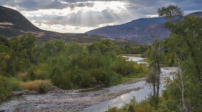
North Fork Gunnison River, near Paonia, Colorado © Jon Mullen Photography
Hubbard Park: Bejeweled in western purple martins (pictured here), Hubbard Park always lends an air of grace and elegance to the party. Typical of the North Fork landscape, Hubbard Park is comprised of large stands of large aspen trees, wide-open meadows and scattered ponds. Here, purple martins share the spotlight with an elite crowd, including elk, moose, black bear, goshawk, osprey, leopard frog and many more. We’re working to harness this star power to protect Hubbard Park in the ongoing Gunnison National Forest plan revision, by encouraging the Forest Service to consider the area as recommended wilderness and ultimately protect the wilderness and wildlife values of this gem.
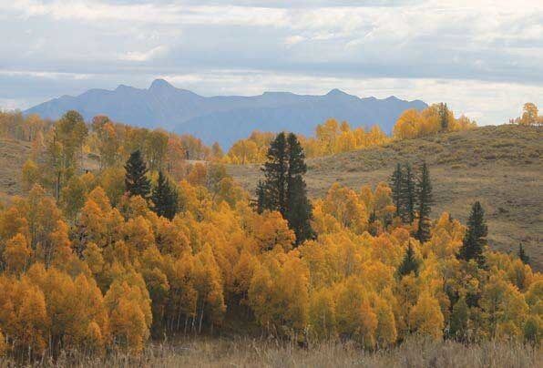
Typical North Fork landscape, Hubbard Park, Gunnison National Forest, Colorado © Bill Day
Thompson Divide is the personality that brings a little bit of something for everyone to the party. This rich, low-elevation landscape is home to dozens of grazing allotments and supports recreation of all types, from award-winning hunting and fishing, to skiing, snowmobiling and mountain biking. It’s also home to prime wildlife habitat for hundreds of species who rely on this largely roadless landscape on both sides of McClure Pass. Lastly, the Divide’s numerous watershed’s provide clean water for towns and robust ranching and agricultural economies in its adjacent communities.
Thompson Divide near McClure Pass, Colorado © Jon Mullen Photography
Grand Hogback: The Grand Hogback knows how to make an entrance. The distinctive ridges of the Hogback divide the Colorado Plateau from the southern Rocky Mountains, arriving on the scene with much fanfare. Like many glamorous landscapes managed by the Bureau of Land Management in our region, the Hogback is threatened by oil and gas leasing and development. We’ll be working to secure protections for the Hogback and other public land A-listers in the upcoming revision to the BLM’s land management plan, and we’ll need your help.
The Grand Hogback divides the Colorado Plateau from the Southern Rocky Mountains, Colorado © Brandon Jones
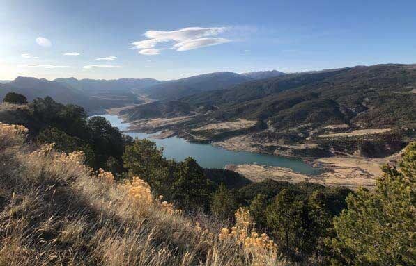
Roan Plateau: The Roan Plateau looks down on everyone at the party, but that’s just because this celebrity landscape towers 3,000 feet above I-70 west of Rifle. The Roan holds a treasure trove of wonders for those who make their way into the entourage, from dramatic waterfalls cascading down the plateau cliffs to streams full of native Colorado cutthroat trout to hanging gardens and abundant fossils. In 2014, we reached a settlement agreement in litigation over the Roan Plateau that resulted in most of the oil and gas leases on top of the plateau being canceled; now we’re working to mitigate impacts to wildlife habitat resulting from ongoing development at the base of the plateau.
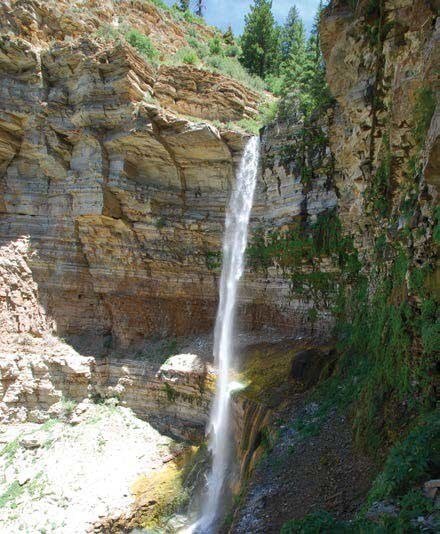
Roan Plateau, west of Rifle, Colorado © Peter Hart
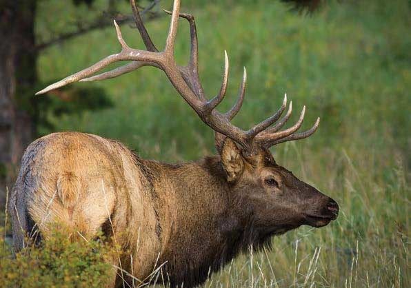
Berlaimont: The inholding outside of Edwards, known as Berlaimont Estates, and its neighboring public lands is the introvert of the party. It’s surrounded by a close group of friends who are working to prevent a 26-foot-wide, paved road from being erected across 4.5 miles of national forest, to access 19 new luxury homes in the backcountry. It’s in the heart of some of the Eagle River Valley’s best remaining elk habitat and critical winter range, where elk have been in steep decline over the last decade due to habitat loss and landscape fragmentation.
Berliamont, an inholding near Edwards, Colorado © Rick Spitzer
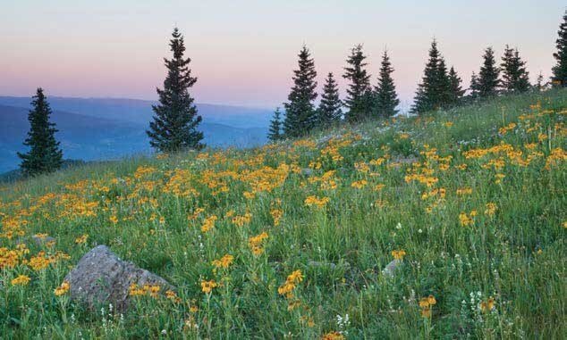
Deep Creek is the drama(tic) queen of the party. Massive limestone cliffs rise thousands of feet above a trail-less creek fed by snowmelt off the Flat Tops Wilderness. The Forest Service and BLM currently manage the creek and surrounding lands as a Wild and Scenic River and now a stakeholder group is working to get permanent protection for the Creek from Congress.
Deep Creek fed by snowmelt from Flat Tops Wilderness, Colorado © Juli Slivka
__________________________________
The Rewilding Institute (TRI) mission is to explore and share tactics and strategies to advance continental-scale conservation and restoration in North America and beyond. We focus on the need for large carnivores and protected wildways for their movement; and we offer a bold, scientifically credible, practically achievable, and hopeful vision for the future of wild Nature and human civilization on planet Earth. Subscribe | Support