
Mapping the Border Wall in Arizona and New Mexico
August 24, 2021
In July 2021, Wildlands Network released the first publicly available map documenting the U.S.-Mexico border wall through New Mexico and Arizona. The map depicts completed sections of border wall as well as other related construction activities and is the most accurate, detailed, and up-to-date documentation of new sections of border wall completed during the Trump Administration.
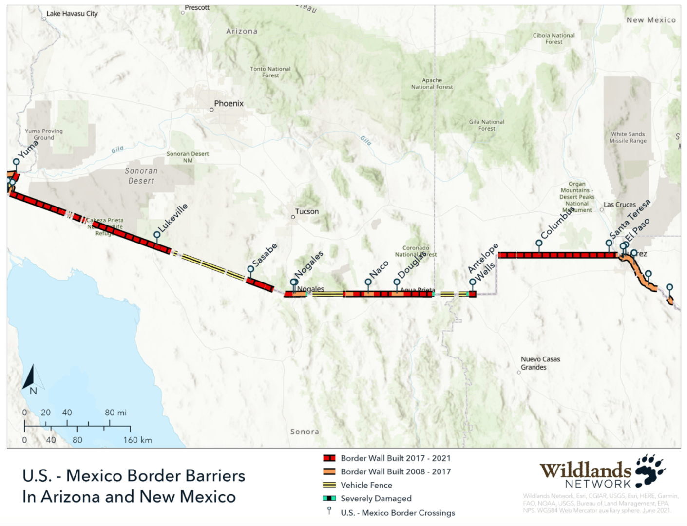
Click for interactive map.
In addition to the map, Wildlands Network has also released a StoryMap that highlights six priority restoration areas in Arizona and New Mexico. In New Mexico, these include sites in the Whitewater Mountains and the Carrizalillo Mountains. The priority restoration areas in Arizona include sites in the Patagonia Mountains, Pajarito Mountains, and San Bernardino National Wildlife Refuge – all of which are in desperate need of immediate restoration.
Nature is intimately connected. When one component is changed or lost it can have enduring consequences for the entire system. This interdependence is part of what makes our natural world so remarkable but also emphasizes the importance of ecosystems remaining intact and unaltered.
It was this understanding that, in 1991, led Michael Soulé, Reed Noss, Jim Estes, and other preeminent scientists along with visionary Wildlands advocate Dave Foreman to establish an organization devoted to the continental-scale conservation of core habitat and migration corridors for wildlife. Known today as Wildlands Network, we share our founders’ mission of reconnecting, restoring and rewilding North America so that life—in all its diversity—can thrive. Our work is founded in science, driven by fieldwork and furthered through strategic policy and partnerships.
With staff based across the United States and in Mexico, Wildlands Network has been at the forefront of continental-scale conservation for 30 years. The core principle of all we do is this: if protected areas are connected with healthy habitats on a continental scale, our treasured native plants and animals will thrive—as will life-supporting ecological processes like carbon storage and pollination, and high water quality. Our work has inspired the establishment of similar organizations across the world, and our commitment to the prosperity of wildlife and wild spaces is emboldened in the face of the challenges of our rapidly developing world. wildlandsnetwork.org