

Indian Burning Myth and Realities
November 27, 2020
By George Wuerthner
Featured Image: Burn mosaic in Gallatin Range, Yellowstone NP (c) George Wuerthner
There has been a spate of articles this year in various newspapers and magazines asserting that if the Forest Service were following burning practices of Indigenous people, the large wildfires we have seen around the West would be tamed.
Here are some examples of articles suggesting Indian burning can save the forest.
- https://www.theguardian.com/us-news/2020/oct/23/karuk-tribe-california-slater-fire-insurance
- https://www.nytimes.com/2020/01/24/us/native-american-controlled-burns-california-wildfires.html
- https://www.vox.com/first-person/21517619/california-wildfires-indigenous-controlled-burns
- https://www.wweek.com/news/2020/10/07/oregons-indigenous-communities-know-how-to-stop-megafires-will-the-state-let-them/?utm_campaign=2020-10-07+WildNews&utm_medium=email&utm_source=Pew
The October 7th, 2020 article “Wildfires have ravaged the Western United States this year, sending firefighting experts to Indigenous communities for guidance”, by Jim Cowan in the New York Times, is typical of articles making erroneous assertions about Native American burning and its influence on large wildfires. Cowan writes:
“Long before California was California, Native Americans used fire to keep the lands where they lived healthy. That meant intentionally burning excess vegetation at regular intervals, during times of the year when the weather would keep blazes smaller and cooler than the destructive wildfires burning today.”
And the Guardian article, like most of the articles cited above, implies that the loss of native burning is contributing to large blazes: “a century of practicing fire suppression over traditional tribal land stewardship, has led to larger, more destructive wildfires.”
The idea that tribal burning impacted the broad landscape is also asserted by some scholars (e.g. Williams, G.W. 2004), but often with scant evidence to back up these claims except for “oral traditions” of Native people.
MAJOR ISSUES
- The claim that Indian burning precludes large fires feeds into the “fuels is the problem” narrative, which is increasingly discredited, as large wildfires in fact are driven by extreme climate weather.
- All large fires are driven by climate and weather conditions which include drought, low humidity, high temperatures, and high winds.
- These conditions have always existed, and large blazes have always occurred despite Indigenous burning. However, they are being exacerbated today by human-caused climate warming.
- Indigenous burning resulted primarily in localized fuel reductions but seldom affected the larger landscape.
- There is historic, scientific, ecological, and evolutionary evidence that challenges the Indian burning narrative.
- Large high severity fires are not “destructive” but essential to many healthy forest ecosystems.
- Implementation of a significant prescribed burning program has many obstacles.
- The way to protect homes is to start from the home outward, not to “treat” forests at the landscape scale.
MYTH OF INDIAN LANDSCAPE MANAGEMENT
As Barrett et al. 2005 noted: “For many years, the importance of fire use by American Indians in altering North American ecosystems was underappreciated or ignored. Now, there seems to be an opposite trend…. It is common now to read or hear statements to the effect that American Indians fired landscapes everywhere and all the time, so there is no such thing as a “natural” ecosystem. A myth of human manipulation everywhere in pre-Columbus America is replacing the equally erroneous myth of a totally pristine wilderness.
We believe that it is time to deflate the rapidly spreading myth that American Indians altered all landscapes by means of fire. In short, we believe that the case for landscape-level fire use by American Indians has been dramatically overstated and overextrapolated.”
Noss, et al. 2014 assert: “Despite ample evidence that lightning fire was a primary ecological driver in the NACP [North American Coastal Plain], the myth persists that most fires before the arrival of Europeans were set by Native Americans. For example, Mann (2005; 361) provides a map that shows essentially the entire pre-Columbian NACP, including the lightning-riddled Gulf Coast and Florida peninsula, as ‘dominated by anthropogenic fire’ or with ‘widespread forest clearing for agriculture’. No evidence is offered to support these claims.”
Most “evidence” for the widespread influence of indigenous burning is based on oral tradition which is notoriously subject to variation of interpretation and misinterpretation.
DID INDIGENOUS BURNING PRECLUDE LARGE BLAZES?
The question is not whether Indian burning occurred, but rather to what extent it influenced the landscape as a whole and precluded the occurrence of large mixed to high severity blazes or what some people term “mega” fires. Is traditional management a panacea for problems associated with large blazes, as implied? Furthermore, we should question the notion that high severity blazes are somehow “unnatural” and ecologically “destructive” (Hutto et al. 2016).
The idea that modern fire suppression has led to unnatural fuel build up is true in some plant communities; but again, fuel build up is not the primary cause of large high severity fires. Most of these blazes are burning in plant communities like lodgepole pine, spruce/fir, juniper, west slope Cascades Douglas fir, and other plant communities that naturally had long intervals between fire events and naturally accumulate fuels. In other words, fuel build up in these plant communities is completely natural.
There is ample evidence that Indian burning had little effect upon the occurrence of large fires on the landscape. Except for some high use areas, Indian management did not significantly alter fuel levels; more importantly, it did not preclude larger blazes across the landscape. Indeed, notwithstanding global influences like climate change, even today with much higher human population, the human footprint and “management” across much of the land is geographically limited.
So-called “mega” fires have occurred for thousands of years, and Indigenous burning did not preclude them.
Plus, the idea that low severity fires dominated western landscapes ignores the fact that numerous species from bluebirds to nuthatches are found in greater numbers among the snag forests that result from large high severity blazes. The second highest biodiversity, after old-growth forests, is found in the snag forests with down wood that results from these blazes. These high severity habitats would not exist if such Indigenous burning were as widespread as advocates suggest.
Indeed, the effectiveness of “fire suppression” can be questioned. For evidence, in the early part of the 20th Century, as much as 50 million acres burned annually in the United States during several drought decades.
See:
- https://www.nifc.gov/fireInfo/fireInfo_stats_totalFires.html
- https://www.nifc.gov/fireInfo/fireInfo_statistics.html
LIVING WITH FIRE
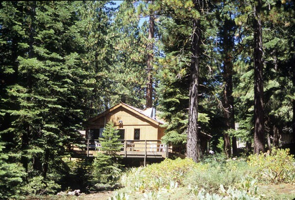
Fire hazard around home by Lake Tahoe, California (c) George Wuerthner
In the past even more than today (with fire crews and insurance), wildfire was a natural force that influenced where people lived. One of the ways tribal people “lived with” fire was to locally reduce fuels so as to safeguard their villages, trading centers, and traditional gathering areas from large dangerous blazes.
This is the model that we should be promoting today—working from the home outward to reduce the flammability of homes and local communities.
Since most tribal people lived in lower elevation landscapes like valley bottoms with grasslands or dry ponderosa pine forests where wildfire was naturally more frequent, Indigenous burning likely favored the continued existence and even expansion of these short-cycle plant communities.
It is important to note that these community types are often a small percentage of the landscape. For instance, dry montane forests (largely ponderosa pine) make up only 4% of western Montana and northern Idaho.
Cultural burning was generally limited in extent but commonly done, for a variety of purposes, such as to create favorable conditions for the growth of specific plant foods that might be favored by fire, and to create fresh new growth of grasses and other plants favored by wildlife that Indians hunted, like deer, elk, or bison. Fires were also used in warfare to burn out enemies that might be hiding in dense brush.
However, the question remains as to whether this cultural burning was sufficient to change fire regimes across the landscape to the point it precluded larger wildfires.
While there is no doubt that Indigenous burning was widely practiced, the idea that cultural burning was a major influence on landscape-scale fire influences is questionable.
There are multiple lines of evidence to suggest that Indian burning was mostly local in nature and did not greatly affect the larger landscape.
FUELS DON’T DRIVE LARGE FIRES
Perhaps the biggest problem with the “Indigenous burning will preclude large blazes” argument is that it feeds into the narrative that “fuels” are driving the large fires we see around the West. To reiterate, large fires are and have always been primarily climate-weather driven events. There is a strong correlation between extensive drought and large landscape fires. Conversely, during periods of wet, cool climate, there are fewer large blazes (Whitlock, C. et al. 2008).
If you have severe drought, low humidity, high temperatures, and most importantly wind, you get large, landscape-level fires. If you do not have these weather/climate conditions, you get fewer ignitions and smaller fires that mostly self-extinguish.
While Indian burning likely did influence fuel loading in some localized areas, it did not change the basic weather/climate ingredients that drive all large blazes (Whitlock, C. et al. 2010).
CLIMATE/WEATHER DRIVES LARGE BLAZES
Most cultural burning, like the prescribed fires set today by state and federal agencies, was practiced in the spring and fall when fire spread was limited by moist fuels, high humidity, cool temperatures, and when winds are calm. High fuel moisture and cool temperatures limit fire spread. In spring or autumn, you will generally not burn very much acreage. Under cool moist conditions typical of spring and fall, most fires simply self-extinguish.
Despite the implied charge in some of the above-cited articles that the Forest Service is ignorant of burning practices, this is the same reason federal and state agencies usually do prescribed burning during the “shoulder” seasons, not during summer, when wildfires tend to grow large.
Most large, landscape-level fires occur during extreme fire weather conditions, which are typically in the summer and early fall months. Again, these inflammatory conditions include drought, low humidity, high temperatures, and most importantly wind.
Why is this important? Because most fires, even natural fires, are small. Unless you have these extreme fire weather conditions, 97-99% of all fires will burn 1-5 acres even if you don’t suppress them. Whether the ignitions are from lightning or humans, if you don’t have the right weather conditions, you will not burn a significant amount of the landscape.
To illustrate, a total of 56,320 fires burned over 9 million acres in the Rocky Mountains between 1980-2003; 98% of these fires (55,220) burned less than 500 acres and accounted for 4% of the area burned. By contrast, only 2% of all fires accounted for 96% the acreage burned. And 0.1% (50) of blazes were responsible for half of the acres charred. (Baker 2009 Fire Ecology in Rocky Mountain Landscapes).
In another example, between 1972 and 1987 Yellowstone National Park managers did not suppress backcountry fires. During this period, there were 235 blazes. Of these 222 charred less than 5 acres each, and most burned less than 1 acre. All 235 blazes self-extinguished.
Then in 1988 more than a million acres burned in Yellowstone. Did fuels suddenly balloon overnight to sustain large high severity blazes? The reason Yellowstone burned in 1988 was because it was the driest year on record since the park was established, with humidity as low as 1-2% and winds exceeding 50 mph.
Thus, it would require setting thousands of these small fires when the climate/weather is not conducive for fire spread to burn any substantial amount of the landscape. So, the idea that Indian burning—which can be characterized as primarily low severity frequent fires—was sufficient in size and scale to affect larger landscapes is questionable just based on the timing of such ignitions.
Native people were wise enough not to purposely set fires in the middle of extreme fire weather. Setting a blaze under conditions with variable high winds and during a drought would be a recipe for disaster because it would lead to uncontrollable fires that would threaten villages and life.
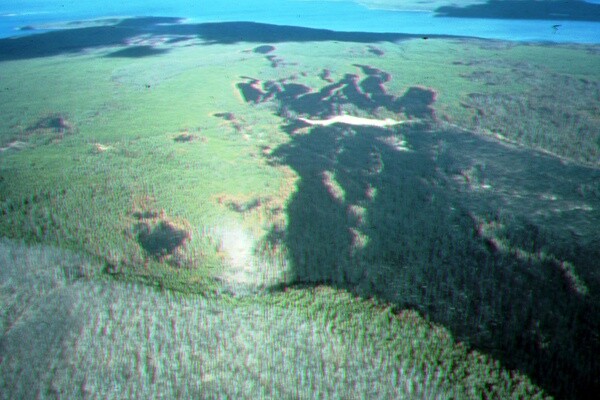
Air view of how winds drove Y’stone fires and spotting. Yellowstone Lake in background. (c) George Wuerthner
ECOLOGICAL EVIDENCE
Most plant communities in the West, and this is even more true in the eastern US, naturally have long to very long fire rotations, of many decades to hundreds of years in length. This includes forests and shrub-lands characterized by aspen, most fir species, mountain hemlock, western hemlock, west-side Douglas-fir, chaparral, sagebrush, juniper-pinyon, lodgepole pine, western white pine, western larch, and various spruce species.
This means wildfire historically did not burn in these communities except at infrequent intervals almost always dictated by climate/weather.
“During extreme weather conditions, the relative importance of fuels diminishes since all stands achieve the threshold required to permit crown fire development. This is important since most of the area burned in subalpine forests has historically occurred during very extreme weather (i.e., drought coupled to high winds). The fire behavior relationships predicted in the models support the concept that forest fire behavior is determined primarily by weather variation among years rather than fuel variation associated with stand age” (Bessie and Johnson 1995).
Many of these species have few adaptations to withstand frequent fires and would simply not exist if tribal burning affected them.
HISTORIC EVIDENCE FOR LARGE BLAZES
Though most fire ecologists concede that native burning likely declined after European American settlement due to native population decline resulting from disease, warfare, and displacement, there is plenty of evidence for large fires before large-scale Euro-American occupation.
For instance, in Oregon’s Willamette Valley most large trees were established after large, high severity fires that occurred long before Euro-American influences on native populations. The 1865 Silverton Fire burned more than a million acres of the western Cascades. The 1853 Yaquina Fire burned nearly a half-million acres. Recent records from Washington estimate that a series of large fires in 1701 may have burned between 3 and 10 million acres in a single summer. To quote from a recent article on fires in Washington state: “1701 is given as the best estimate for the last devastating fire that occurred throughout Western Washington, a fire that burned an estimated 3 million to 10 million acres. At the upper end of that range, the area is roughly equal to 10 Olympic National Parks” (Puget Sound Institute).
Although individual accounts vary, the detail of the observer can provide some hint of the accuracy of early accounts. For instance, David Douglas, (for whom Douglas Fir is named) traveled down the Willamette Valley in 1826 carefully noting the vegetation from the Hudson Bay Post at Fort Vancouver across from present-day Portland. Douglas reported seeing burnt patches but noted that most were small (Knox and Whitlock 2002).
Peter Skene Ogden noted extensive areas of burns in the Blue Mountains of eastern Oregon and attributed it to natives. But there is no way for Ogden to know whether the fires were human ignitions or due to lightning (Whitlock and Knox 2002).
On the other hand, numerous travelers who kept meticulous notes, like Lewis and Clark and John Fremont, seldom mention encountering Indian burning. The absence of contrary evidence is not the same as no evidence; nevertheless, when someone like Lewis and Clark or John Fremont fail to report extensive Indian burning, it does raise a cautionary note about how to interpret historic accounts.
The other consideration is that Douglas, like most people traveling through the landscape, used the Indian trails and natural travel routes, and since human occupation is greatest in such areas, chosen travel routes may provide a biased view of the occurrence of human ignitions. Even today the majority of wildfires occur near roads. Also, since most of these areas were dominated by grasslands and low elevation dry pines where fire is more frequent even today, modern interpretation does not provide support for wider influence of human burning on the landscape.
FIRE STUDY TECHNIQUES GIVE A BETTER LANDSCAPE SCALE PICTURE OF FIRE
Beyond just historic accounts of fires, there is proxy evidence for past fire occurrence. Scientists use various methods to determine the “fire history” of any location. Each method has its advantages and disadvantages (Whitlock et al. 2004).
The most common method for reconstructing fire history is analyzing fire scars, but other methods, including use of charcoal and pollen, give different perspectives.
When a fire burns through an area at low severity (i.e. does not kill many mature trees), it can leave a scar in the surviving trees. The scar eventually heals and is “recorded” in the tree rings. By examining tree rings, one can count the years between fires, and in some cases even determine the season of the burn. This is the most popular method of determining fire histories.
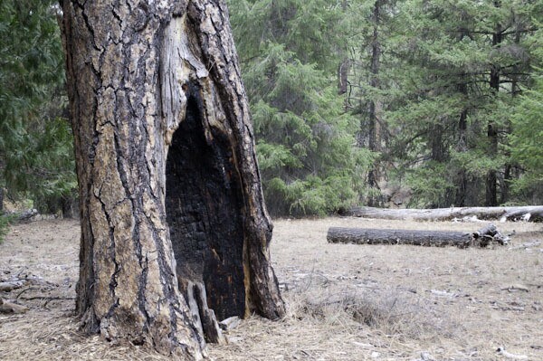
Fire scared ponderosa pine, Metolius River, Deschutes NF, Oregon (c) George Wuerthner
There are, however, some problems with fire scar methods, which some researchers believe result in overestimation of fire frequency and influence (see Baker and Ehle 2001). For more detail on the problems of fire scar historical reconstructions see “Fire Scar Historical Reconstructions: Accurate or Flawed.”
Ecologically speaking, from a landscape perspective, it is the larger fires that significantly influence both vegetative communities and the “fuels” available for future fires.
Numerous studies have looked at Indian burning and its influence on fire regimes. Most work done by fire ecologists who focus on large landscape fires do not find any additive influence from Indigenous burning. Rather climate/weather appears to control periods of significant wildfire activity (Baker W.L. 2002).
In other words, they find evidence for more frequent fires during major droughts and in the immediate area of villages, along major travel corridors, trading centers, and other high use areas; but across the landscape as a whole, they do not find evidence that human ignitions were additive to total landscape acreage charred by wildfire.
The best way, in my view, to document whether human ignitions were an important influence for landscape-scale fires is to use charcoal or pollen studies. But other techniques such as air photo, General Land Office (GLO) surveys, and even historic accounts of early Euro-Americans can also provide insights.
Charcoal studies are a proxy for wildfires that rely on examination of core drillings in lakes and ponds to extract sediments where charcoal from major wildfires are recorded. By examining such cores, researchers can document the larger wildfires in a landscape going back thousands of years.
Pollen from the same core samples also documents the major vegetation present in surrounding lands.
For instance, Vachula et al. (2019) did a study of what is now Yosemite National Park where, historically, large Indigenous communities resided. Their research found a direct correlation between climate and the amount of burning on the landscape.
“We analyzed charcoal preserved in lake sediments from Yosemite National Park and spanning the last 1400 years to reconstruct local and regional area burned. Warm and dry climates promoted burning at both local and regional scales…
Regional area burned peaked during the Medieval Climate Anomaly and declined during the last millennium, as climate became cooler and wetter and Native American burning declined.
Our record indicates that (1) climate changes influenced burning at all spatial scales, (2) Native American influences appear to have been limited to local scales, but (3) high Miwok populations resulted in fire even during periods of climate conditions unfavorable to fires. However, at the regional scale (< 150 km from the lake), fire was generally controlled by the top-down influence of climate.” (Vachula et al. 2019)
Another study found that the mean fire interval in Oregon’s Coast Range was 230 years and the presence of fire-sensitive species like Sitka spruce indicates a lack of frequent fire (Knox and Whitlock 2002).
Regarding Indigenous ignitions in the Willamette Valley, Whitlock notes: “The idea that Native Americans burned from one end of the valley to the other is not supported by our data … Most fires seem to have been fairly localized, and broad changes in fire activity seem to track large-scale variations in climate” (Fire Science 2010).
In a charcoal study of Washington’s Battle Ground Lake, Megan Walsh (Walsh et al. 2008) concluded that fire frequency was highest during the middle Holocene when oak savanna and prairie were widespread near Battle Ground Lake. She suggests: “The vegetation and fire conditions were most likely the result of warmer and drier conditions compared with the present, not from human use of fire” (Fire Science 2010).
To give another example, one can show that Indian burning was frequent in the Yosemite Valley where native people resided much of the year, but no evidence for wide-spread human burning in most of what is now Yosemite Park or the Sierra Nevada Mountains as a whole (Vale 1998).
Hoffman et al. (2016) looked at Indian burning influence in coastal British Columbia and concluded: “At the decadal scale, fires were more likely to occur after positive El Niño-Southern Oscillation and Pacific Decadal Oscillation phases and exhibited 30-year periods of synchrony with the negative phase of the Arctic Oscillation. Fire frequency was significantly inversely correlated with the distance from former Indigenous habitation sites.”
Colombaroil and Gavin (2002) documented that large fires always occurred in the Siskiyou Mountains of northern California and southern Oregon, primarily due to climate/weather, even during the pre-European period. “Fire is a primary mode of natural disturbance in the forests of the Pacific Northwest. Increased fuel loads following fire suppression and the occurrence of several large and severe fires have led to the perception that in many areas there is a greatly increased risk of high-severity fire compared with presettlement forests. To reconstruct the variability of the fire regime in the Siskiyou Mountains, Oregon, we analyzed a 10-m, 2,000-y sediment core for charcoal, pollen, and sedimentological data. The record reveals a highly episodic pattern of fire in which 77% of the 68 charcoal peaks were before Euro-American settlement…”
Odion et al. (2004) (Conservation Biology) studied a 98,814-hectare area burned in 1987 in the California Klamath region, and found that the most fire-suppressed forests in this area (areas that had not burned since at least 1920) burned at significantly lower severity levels, likely due to a reduction in combustible native shrubs as forests mature and canopy cover increases: “The hypothesis that fire severity is greater where previous fire has been long absent was refuted by our study…The amount of high-severity fire in long-unburned closed forests was the lowest of any proportion of the landscape and differed from that in the landscape as a whole (Z = -2.62, n = 66, p = 0.004).”
Early timber surveys also record large high severity fires (Leiberg, J. B. 1903).
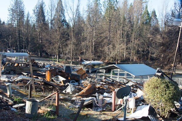
Live trees beyond ruins, Camp Fire Paradise, CA (c) George Wuerthner
Contrary studies that presume to substantiate a major influence of Indian burning tend to focus on major village sites, foraging areas, and other areas of high human use where no doubt Indigenous burning was “additive” to the background fire regime.
Unfortunately, this evidence of increased burning is then extrapolated to the larger landscape where human activities were less frequent. A good example is a study by Klimaszewski-Patterson (2019) who looked at Indian burning in a meadow of the southern Sierra Nevada, and then inferred this represented the fire regime of the southern Sierra Nevada.
This is the same error made by William Cronon in his book Changes in the Land (Cronon 1983) about Indian burning in New England. Cronon’s conclusions were challenged by Parshall and Forester (2002). “The major factor influencing the distribution of fire across New England is climate, which has a direct effect on the physical conditions conducive to fire ignition and spread and an indirect effect on fire through its control on the distribution of vegetation at this spatial scale. We find evidence that other factors exert some control over local fire regimes as well including landforms and their impact on vegetation composition, firebreaks and prevailing winds. Native Americans likely influenced the local occurrence of fire, but their impact on regional fire regimes in New England is not apparent from this or other studies….”
A more recent review of the evidence by David Foster of the Harvard Experimental Forest came to the deduction that Native American burning was localized (Oswald et al. 2020). The researchers conclude: “Our new research, published in the journal Nature Sustainability, tests this human-centric view of the past using interdisciplinary, retrospective science. The data we collected suggest, in New England, this assumption is erroneous….
Our study contradicts the theory that people had significant ecological impacts in southern New England before European arrival. Instead, it reveals that old forests, shaped by climate change and natural processes, prevailed across the region for thousands of years….”
Matlack (2013) wrote: “Prescribed burning is increasingly being used in the deciduous forests of eastern North America. Recent work suggests that historical fire frequency has been overestimated east of the prairie–woodland transition zone, and its introduction could potentially reduce forest herb and shrub diversity…. Thus, it appears that the majority of forests of the eastern United States were little affected by burning before European settlement.”
Russell (1983) also challenges the notion that Indian burning influenced large landscapes: “The historical evidence for the Indians burning the forests of the northeastern United States is reevaluated. Of 35 documents that describe vegetation or Indian life in the 16th or 17th centuries, only half mention any use of fire except for cooking. Only six purportedly first-hand accounts might refer to purposeful, widespread, and frequent use of fire. These six are all consistent with use of fire only locally near camps or villages, or with accidentally escaped fires. It is concluded that the frequent use of fires by the Indians to burn the forests was probably at most a local occurrence. The Indians’ presence in the region and their use of fire for many purposes did, however, increase the frequency of fires above the low levels caused by lightning, and thus had some effect on the vegetation: for example, grasses characterized the ground cover at small, local, frequently burned sites.”
Although in some specific areas of particularly high human populations such as the southern California coastal areas, Indian burning may have expanded natural grasslands at the expense of natural chaparral vegetation (Keeley 2008). However, this must be considered the exception more than the rule given the extremely high human populations and the generally dry Mediterranean climate.
Benix (2002) writing about the southern California chaparral region concluded: “It would be reasonable to summarize the impact of native Californian fire in the following terms: a variety of Native cultures made sophisticated use of fire, both to favor edible species and to facilitate (directly or indirectly) hunting. The scale of fire use was so limited, however, that the bulk of the chaparral as we know it evolved under a natural, lightning-dependent fire regime. Undoubtedly, anthropogenic fire did have some ecological impacts, but those impacts were spatially limited to the immediate surroundings of population centers and to the preexisting (i.e., quasinatural) ecotones. Because of the limited spatial extent of anthropogenic burning, the overall chaparral environment was unchanged by the cessation of native burning, as evidenced by the static nature of the stratigraphic record.”
The conclusion from nearly all of these charcoal/pollen studies is also supported by a 14,000-year study from western Washington which covers the entire time of Indigenous occupation. Given the abundance of food resources (like salmon) and mild climate, western Washington supported some of the densest native populations in western North America. If native burning were a major influence on the landscape, this is where one would expect to document it.
The authors (Walsh et al. 2008) concluded that wildfires were: “mostly large or high-severity fire episodes. The fire history at Battle Ground Lake was apparently driven by climate, directly through the length and severity of the fire season, and indirectly through climate-driven vegetation shifts, which affected available fuel biomass.”
The pollen record is also of importance. If Indigenous burning was so widespread as to influence landscape-scale vegetation, we would expect to find abundance pollen from species favored by frequent, low severity fires. For the most part, except in the immediate area around villages, this evidence does not exist.
Thomas Fire burns across Hwy 101 right to Pacific Ocean, CA (c) George Wuerthner
OTHER EVIDENCE FOR MIXED TO HIGH SEVERITY BLAZES
Along with tree-ring, carbon, and pollen studies, another line of evidence is the use of General Land Office land surveys. These surveys were done often in advance of major settlement—in other words, before there was significant logging, livestock grazing, fire suppression, or any other factor commonly used to “explain” why “fuels” built up during the 20th century.
When doing a GLO survey, notes were made of all vegetation encountered along the line of the survey. This included notations on tree species, size, and condition (e.g. a major patch of burnt timber would be noted). In addition, at every mile of these surveys, a “corner” was located. As part of this corner marking, “bearing trees” were noted, recording the species, size, and distance to the corner.
An advantage of land surveys is that they are linear, random surveys of the vegetation at that point in time. We don’t have to “interpret” the vegetation, density of vegetation or lack thereof, as is done by people using fire scars.
Analysis of these land surveys tends to draw different conclusions about historic vegetation and fire influence than do fire scar studies. They tend to document denser forests and plant species that are favored by larger, high severity blazes as opposed to low severity, frequent fires.
The idea that most wildfires in all plant communities were low severity is inaccurate. Mixed-intensity fire, including patches of high-intensity fire, is natural: Mixed-intensity fire is not limited to true fir and lodgepole pine; mixed-intensity fire, including a significant proportion of high-intensity fire and occasional large high-intensity fire patches hundreds or thousands of acres in size, is also a natural condition in ponderosa-pine/Jeffrey-pine and mixed-conifer forest, and it generally dominated pre-suppression fire regimes historically in these forest types.
For example, using GLO records, Baker (2012) found that in dry mixed-conifer forests of the eastside of the southern Cascades, historic fire was 24% low-intensity, 50% mixed-intensity, and 26% high-intensity.
Similarly, Hessburg et al. (2007) using air photo interpretation came to similar conclusions: “Historical mixed-conifer forests of eastern Oregon Cascades were … dominated by dense, early- and mid-successional forests regenerating from past higher-intensity fire, rather than by open and park-like old-growth forests.”
And these results were found in a wide variety of geographical locations and forest types, including ponderosa pine forests.
Shinneman, D.J. and W.L. Baker (1997) looked at ponderosa pine forests in the Black Hills of South Dakota and concluded that high-intensity fire patches many thousands of acres in size occurred prior to fire suppression and logging.
Sherriff and Veblen (2007) as well as Williams and Baker (2012) both documented high severity blazes were common in the ponderosa pine forest of the Colorado Front Range.
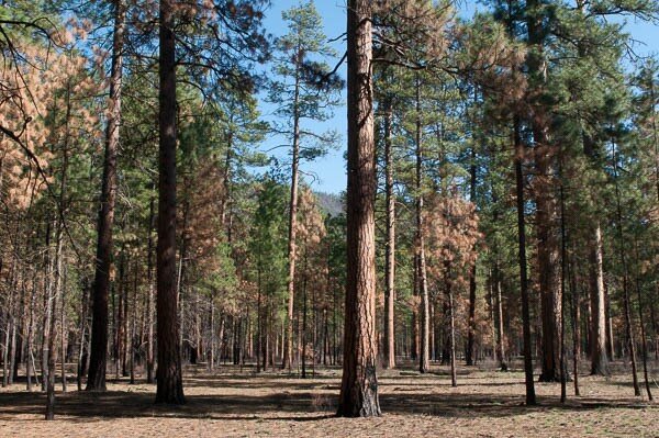
Ponderosa pine prescribed burn, Deschutes NF, Oregon (c) George Wuerthner
ECOLOGICAL AND EVOLUTIONARY EVIDENCE
Another line of evidence that frequent, low severity blazes were not the rule in most plant communities comes from evolutionary studies.
For instance, sagebrush ecosystems once covered 150 million areas of the American West—much of this geography utilized by numerous tribal groups. Because sagebrush was so prevalent, numerous species are sagebrush obligates, including ferruginous hawks, burrowing owls, loggerhead shrikes, sage sparrows, Brewer’s sparrows, sage thrashers, greater sage grouse, long-billed curlews, sagebrush voles, Merriam’s shrews, pygmy rabbits, Washington ground squirrels, black-tailed jackrabbits, sagebrush lizards, striped whipsnakes, and many plant species (Rowland 2011). More than 350 associated plant and animal species are at risk of local or regional extinction due to the decline of sagebrush (Thompson 2007).
Most sagebrush species have no adaptations to fire. Indeed, the fire rotation for sagebrush species varies from 50 to more than 400 years (Baker 2006). If Indian burning were occurring annually or at least every few years, sagebrush would not survive. Therefore, we would not have sagebrush and there certainly would not have been the evolution of species like sage grouse.
More direct evolutionary evidence for the occurrence of large, stand replacement blazes, in spite of Indigenous burning, also exists. Hutto reports numerous bird species that are most abundant in areas that get high severity fires. The black-backed woodpecker is perhaps the best-known of the large-fire obligates (Hutto 2007, Hutto 2008). Among other species that thrive after an intense fire are morel mushrooms, a culinary treat (Fire Science Brief 2009).
PROBLEMS WITH IMPLEMENTATION OF PRESCRIBED BURNING
There is no doubt that there were extensive wildfires in prehistory. It is estimated that wildfire (of all severity) charred between 4 and 12 million acres of California annually.
More specifically, Stephens et al. (2007) estimated that approximately 1.8 million hectares (about 4.5 million acres) burned annually in California prehistorically (pre-1800). Stephens suggested: “Our estimate of prehistoric annual area burned in California is 88% of the total annual wildfire area in the entire US during a decade (1994–2004) characterized as ‘‘extreme’’ regarding wildfires. Skies were likely smoky much of the summer and fall in California during the prehistoric period.”
Whether today we even have fewer human ignitions may also be questioned. Approximately 84% of all ignitions nowadays are human.
Even if prescribed burning could reduce large blazes (which would not be good for forest ecosystem health), multiple problems would result if prescribed burning were to ramp up significantly.
First, we would still have smoke in the summer months, but a significant increase in prescribed burning could generate almost year-round smoke. Furthermore, since agencies usually prescribe burns when fuels are moist, and most smoke is water vapor, on a per-acre-of-fire basis, extensive prescribed burns would mean more smoke which can violate air quality regulations and harm human (and wildlife?) health.
There is also the potential for prescribed burns to escape control. Perhaps the most notable of such incidents was the 2000 Cerro Grande Fire, which began in early May as a prescribed fire at Bandolier National Monument in New Mexico but escaped to become a 19,000 ha wildfire. The Cerro Grande Fire consumed 235 homes (Ribe 2010) and subsequently shut down nearly all federal prescribed burning in the US for several months.
Again, as shown by numerous long-term studies, large blazes have always occurred despite Indigenous burning. As Reinhardt et al. (2008) concluded: “The majority of acreage burned by wildfire in the US occurs in a very few wildfires under extreme conditions (Strauss et al., 1989; Brookings Institution, 2005). Under these extreme conditions suppression efforts are largely ineffective.”
Furthermore, Reinhardt goes on to determine: “Extreme environmental conditions, overwhelmed most fuel treatment effects. . . This included almost all treatment methods including prescribed burning and thinning… Suppression efforts had little benefit from fuel modifications.”
To quote from the scientists’ letter: “Thinning is most often proposed to reduce fire risk and lower fire intensity…However, as the climate changes, most of our fires will occur during extreme fire-weather (high winds and temperatures, low humidity, low vegetation moisture). These fires, like the ones burning in the West this summer, will affect large landscapes, regardless of thinning, and, in some cases, burn hundreds or thousands of acres in just a few days.”
Plus, the likelihood that a natural fire will encounter a prescribed burn during the period when the management fire might be effective at slowing the wildfire is extremely small (Rhodes and Baker 2008).
Prescribed burning can increase flammable materials by favoring regrowth of grasses, shrubs, and other fine fuels. Thus maintenance burning must be done on a regular basis to reduce fuels, and to do this over any significant acreage is problematic. Doing this on a local level, to safeguard homes and communities, may make sense. Doing this at a landscape-scale, such as across whole National Forests, would be economically and ecologically ruinous.
Prescribed burning, even if it were increased by a hundred times, will not preclude large blazes when there is extreme fire weather. Prescribed burning, whether done by Indigenous people or any other group, makes sense only at the local scale. Fuels do not drive large blazes. Climate/weather does. It is time to give up our delusional thinking about managing fires at a landscape-scale and instead focus on protecting homes and communities while letting wider forests do what they evolved to do.
Snags from 88 fires, Cache Creek, Yellowstone NP, Wyoming (c) George Wuerthner
REFERENCES:
Baker and Ehle. 2001. Uncertainty in Fire History and Restoration of Ponderosa Pine Forests in the Western United States USDA Forest Service Proceedings RMRS-P-29. 2003.
Baker, W.L. 2002. Indians and fire in the U.S. Rocky Mountains: the wilderness hypothesis renewed. In Fire, Native Peoples, and the Natural Landscape, ed. T.R. Vale. pp. 41–76. Covelo, CA: Island Press.
Baker, William. 2006. Fire and Restoration of Sagebrush Ecosystems. WILDLIFE SOCIETY BULLETIN 34(1):177–185;
Baker, William. 2009. Fire in Rocky Mountain Landscapes. Island Press.
Baker, W.L. 2012. Implications of spatially extensive historical data from surveys for restoring dry forests of Oregon’s eastern Cascades. Ecosphere 3(3): article 23.
Barrett, Stephen, Thomas W. Swetnam, and William L. Baker. 2005. Indian Fire Use: Deflating the Legend. Fire Management Today, v. 65, no. 3, p. 31-34. https://www.researchgate.net/publication/228116861_Indian_fire_use_deflating_the_legend
Benix, Jacob. 2002. PreEuropean Fire in the California Chaparral. T.R. Vale (ed.) Fire, Native Peoples, and the Natural Landscape. Island Press. Washington DC
Bessie, W.C. and E.A. Johnson. 1995. The Relative Importance of Fuels and Weather on Fire Behavior in Subalpine Forests. Published in Ecology, Vol. 76, No. 3 (Apr., 1995) pp. 747-762. http://www.jstor.org/pss/1939341
Colombaroli, Daniele, and Daniel G. Gavin. 2002. Highly episodic fire and erosion regime over the past 2,000 y in the Siskiyou Mountains, Oregon Proceedings of the National Academy of Sciences Nov 2010, 107 (44) 18909-18914; DOI: 10.1073/pnas.1007692107
Cronon, William. 1983. Changes in the Land: Indians, Colonists, and the Ecology of New England. Hill and Wang.
Fire Science. 2009. Listening to the Message of the Black-backed Woodpecker, a Hot Fire Specialist Fire Science Brief. Issue 39. February 2009. Page 2. www.firescience.gov.
Fire Science. 2010. Fire Science Brief. Issue 98. March 2010. www.firescience.gov
Hessburg, P. F., R. B. Salter, and K. M. James. 2007. Re-examining fire severity relations in pre-management era mixed conifer forests: inferences from landscape patterns of forest structure. Landscape Ecology 22:5-24.
Hoffman, KM; Gavin, DG; Starzomski, BM. 2016. Seven hundred years of human-driven and climate-influenced fire activity in a British Columbia coastal temperate rainforest. R. Soc. open sci. 3: 160608. http://dx.doi.org/10.1098/rsos.160608
Hutto, Richard L. 2007. “Understanding the influence of local and landscape conditions on the occurrence and abundance of Black-backed Woodpeckers in burned forest patches.” Final Report – Joint Fire Science Program, 30 October 2007. http://avianscience.dbs. umt.edu/documents/fi nalreport2007_000.pdf
Hutto, R. L. 2008. The ecological importance of severe wildfires: Some like it hot. Ecological Applications 18:1827–1834. (Black-backed woodpeckers strongly select high-intensity fire areas, and post-fire occupancy is greatly reduced by pre-fire mechanical thinning).
Hutto, R. L., R. E. Keane, R. L. Sherriff, C. T. Rota, L. A. Eby, and V. A. Saab. 2016. Toward a more ecologically informed view of severe forest fires. Ecosphere 7:Article e01255.
Keeley, Jon E. 2002. Native American impacts on fire regimes of California Coastal Ranges. Journal of Biogeography, 29, 3030-320.
Klimaszewski-Patterson, Anna, Peter J. Weisberg, Scott A. Mensing & Robert M. Scheller. 2018. Using Paleolandscape Modeling to Investigate the Impact of Native American–Set Fires on Pre-Columbian Forests in the Southern Sierra Nevada, California, USA, Annals of the American Association of Geographers, 108:6, 1635-1654, DOI: 10.1080/24694452.2018.1470922
Knox, M. A. and C. Whitlock. 2002. Prehistoric Burning in the Pacific Northwest: Human versus Climatic Influences. T.R. Vale (ed.) Fire, Native Peoples, and the Natural Landscape. Island Press. Washington DC
Leiberg, J. B. 1903. Southern part of Cascade Range Forest Reserve. Pages 229–289 in H. D. Langille, F. G. Plummer, A. Dodwell, T. F. Rixon, and J. B. Leiberg, editors. Forest conditions in the Cascade Range Forest Reserve, Oregon. Professional Paper No. 9. U.S. Geological Survey, U.S. Government Printing Office, Washington, D.C., USA.
Matlack, Glenn. 2013. Reassessment of the Use of Fire as a Management Tool in Deciduous Forests of Eastern North America. Conservation Biology 27:916–926. http://onlinelibrary.wiley.com/doi/10.1111/cobi.12121/abstract
Noss, Reed F.; William J. Platt; Bruce A. Sorrie; Alan S. Weakley; D. Bruce Means; Jennifer Costanza; and Robert K. Peet. 2014. How Global Biodiversity Hotspots May Go Unrecognized: Lessons from the North American Coastal Plain. Diversity and Distributions, (Diversity Distrib.) (2015) 21, 236–244 https://doi.org/10.1111/ddi.12278
Odion et al. 2004. Patterns of fire severity and forest conditions in the Western Klamath Mountains, CA. Conservation Biology page 927-936 Vol. 18, No 4.
Oswald, Wyant, David R. Foster, Bryan N. Shuman, Elizabeth S. Chilton. 2020. Conservation implications of limited Native American impacts in pre-contact New England. Nature Sustainability https://www.nature.com/articles/s41893-019-0466-0
Parshall, Tim and David R. Foster. 2002. Fire on the New England Landscape: Regional and Temporal Variation, Cultural and Environmental Controls. Journal of Biogeography, 29, 1305–1317. http://harvardforest.fas.harvard.edu/sites/harvardforest.fas.harvard.edu/files/publications/pdfs/Parshall_JBiogeography_2002.pdf
Reinhardt, Elizabeth D.; Keane, Robert E.; Calkin, David E.; Cohen, Jack D. 2008. Objectives and considerations for wildland fuel treatment in forested ecosystems of the interior western United States. Forest Ecology and Management. 256: 1997-2006.
Rhodes, J. and W. Baker. 2008. Fire Probability, Fuel Treatment Effectiveness and Ecological Tradeoffs in Western U.S. Public Forests The Open Forest Science Journal, 2008, 1, 1-7
Ribe, Thomas. 2010. Inferno by Committee: A History of the Cerro Grande (Los Alamos) Fire, America’s Worst Prescribed Fire Disaster
Rowland, Mary et al. 2011. Sagebrush Ecosystem Conservation and Management: 46–68, 2011 Chapter 2: Sagebrush-Associated Species of Conservation Concern. https://www.fs.fed.us/pnw/pubs/journals/pnw_2011_rowland001.pdf
Russell. Emily. 1983. Indian-set Fires on the Forests of the Northeastern United States. Ecology Vol. 64, No. 1. pp. 78-88. DOI: 10.2307/1937331. https://www.jstor.org/stable/1937331
Sherriff, R. L., and T. T. Veblen. 2007. A spatially explicit reconstruction of historical fire occurrence in the Ponderosa pine zone of the Colorado Front Range. Ecosystems 9:1342- 1347.
Shinneman, D.J. and W.L. Baker. 1997. Non-equilibrium dynamics between catastrophic disturbances and old-growth forests in ponderosa pine landscapes of the Black Hills. Conservation Biology11: 1276-1288.
Stephens, Scott L., Robert Martin, and Nicholas Clinton. 2007. Prehistoric fire area and emissions from California’s forests, woodlands, shrublands, and grasslands. Forest Ecology and Management xxx (2007) xxx–xxx
Thompson, Jonathan. 2007. Sagebrush in western North America habitats and species in Jeopardy. issue ninety-one / march 2007 Pacific Northwest Research Station USDA Forest Service P.O. Box 3890 Portland, Oregon 97208
Vachula et al. 2019. Climate exceeded human management as the dominant control of fire at the regional scale in California’s Sierra Nevada. Environ. Res. Lett. 14 104011
Vale, Thomas. 1998. The Myth of the Humanized Landscape: An Example from Yosemite National Park Natural Areas Journal Vol. 18, No. 3 (July 1998), pp. 231-236 (6 pages) Published By: Natural Areas Association https://www.jstor.org/stable/43911767
Walsh, Megan.K., Cathy Whitlock, Patrick J. Bartlein. 2008. A 14,300-year-long record of fire–vegetation–climate linkages at Battle Ground Lake, southwestern Washington. Quaternary Research 70 (2008) 251–264
Whitlock et al. 2004. Comparison of charcoal and tree-ring records of recent fires in the eastern Klamath Mountains, California, USA. Can. J. For. Res. 34: 2110–2121 (2004)
Whitlock, C., J. Marlon, C. Briles, A. Brunelle, C. Long and P. Bartlein, 2008. Long-term relations among fire, fuel, and climate in the north-western US based on lake-sediment studies. International Journal of Wildland Fire17: 72-83.
Whitlock, C., P.E. Higuera, D.B. McWethy, and C.E. Briles. 2010. Paleoecological perspectives on fire ecology: revisiting the fire-regime concept. The Open Ecology Journal 3: 6-23.
Williams, G.W. 2004. American Indian fire use in the arid West. Fire Management. Today. 64(3): 10–14.
Williams, M.A., W.L. Baker. 2012. Comparison of the higher-severity fire regime in historical (A.D. 1800s) and modern (A.D. 1984-2009) montane forests across 624,156 ha of the Colorado Front Range. Ecosystems 15: 832-847.
George Wuerthner, resident of the US West, is an ecologist, photographer, and wilderness explorer. He has published 38 books on various topics related to environmental and natural history. He has visited over 400 designated wilderness areas and over 200 national park units.
George’s Books: On Amazon
George’s interview on Public Lands Grazing on Rewilding Earth podcast.